![](/images/other/stat-length.png)
Mont Saint Honorat
aris
Gebruiker
![Lengte](/images/other/stat-length.png)
![Max. hoogte](https://static1.geolcdn.com/siteimages/upload/files/1508320355ic_sort_altitude_max_24dp.png)
![Positief hoogteverschil](https://static1.geolcdn.com/siteimages/upload/files/1508320355ic_sort_den_pos_24dp.png)
![Km-Effort](/images/other/stat-length.png)
![Min. hoogte](https://static1.geolcdn.com/siteimages/upload/files/1508320355ic_sort_altitude_min_24dp.png)
![Negatief hoogteverschil](https://static1.geolcdn.com/siteimages/upload/files/1508320355ic_sort_den_neg_24dp.png)
![Boucle](https://static1.geolcdn.com/siteimages/upload/files/16400158638029165_repeat_loop_refresh_sync_direction_icon.png)
![Stappen](https://static1.geolcdn.com/sitytour/trail-icons/101.png)
5h48
Moeilijkheid : Medium
![Scan deze QR-code om de tocht te openen in de SityTrail-applicatie](https://capi.geolives.com/qq0zvz2zws4bq2lad0pu/sitytour/trails/2549342/qr.png?size=200)
Gratisgps-wandelapplicatie
Over ons
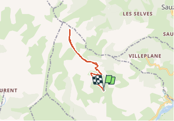
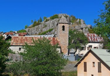
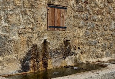
Tocht Stappen van 12,2 km beschikbaar op Provence-Alpes-Côte d'Azur, Alpes-Maritimes, Daluis. Deze tocht wordt voorgesteld door aris.
Beschrijving
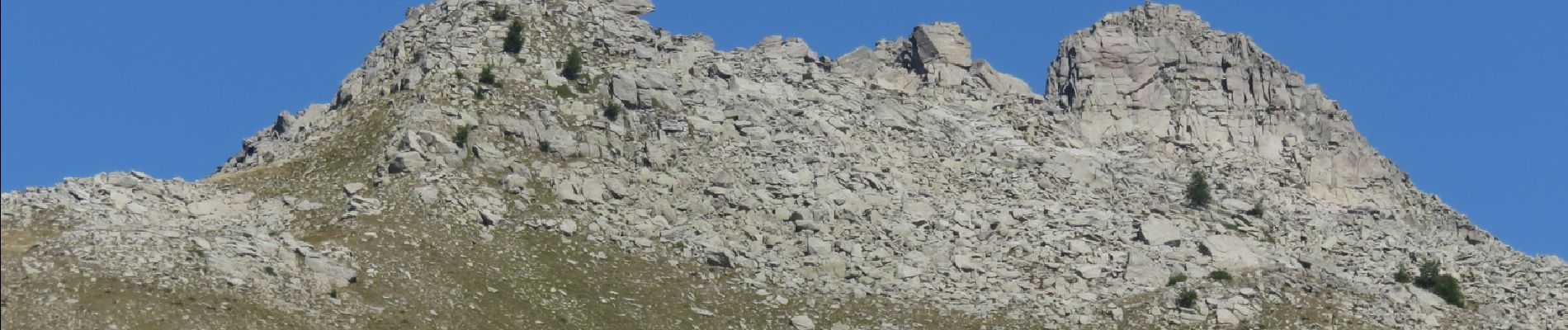
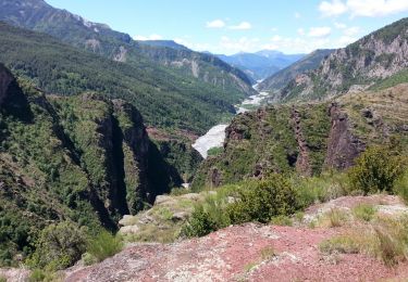
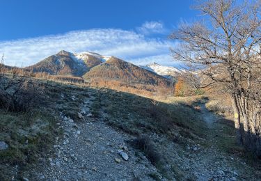
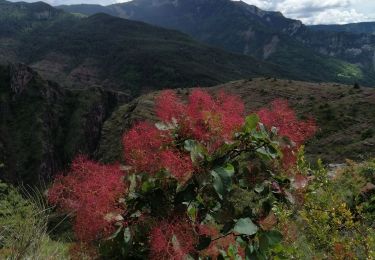
Au départ de la Pinée (Daluis). Sans difficulté jusqu'à la base du sommet (environ 2400m). La suite du parcours se fait en grimpant sur des blocs plus ou moins stables. L'ascension se termine par un gros monticule de cailloux (une sorte de gros cairn de 20m de haut) un peu scabreux et aérien.
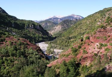
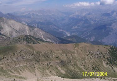
Belles vues sur toutes alpes du Sud, mais le temps trop brumeux et les nuages lointains nous ont empêchés de voir la Corse, le Mt Viso et la Barre des Ecrins.
Plaatsbepaling
Opmerkingen
Wandeltochten in de omgeving
![Tocht Te voet Guillaumes - Gorges de Daluis - Photo](https://media.geolcdn.com/t/375/260/cf6f6166-06c7-4fb4-b3e6-a1ea2ecf5d7a.jpeg&format=jpg&maxdim=2)
![Te voet Te voet](https://static1.geolcdn.com/sitytour/trail-icons/100.png)
Te voet
![](/images/other/stat-length.png)
![](https://static1.geolcdn.com/siteimages/upload/files/16400158638029165_repeat_loop_refresh_sync_direction_icon.png)
![Tocht Te voet Daluis - Mont Saint-Honorat - Photo](https://media.geolcdn.com/t/375/260/fc1ba9a1-932e-4ff5-9aac-8dc781637060.jpeg&format=jpg&maxdim=2)
![Te voet Te voet](https://static1.geolcdn.com/sitytour/trail-icons/100.png)
Te voet
![](/images/other/stat-length.png)
![](https://static1.geolcdn.com/siteimages/upload/files/16400158638029165_repeat_loop_refresh_sync_direction_icon.png)
![Tocht Te voet Sauze - Hameaux de Sauze - Photo](https://media.geolcdn.com/t/375/260/8de1e0fb-d754-4ba0-84e6-05cab893c487.jpeg&format=jpg&maxdim=2)
![Te voet Te voet](https://static1.geolcdn.com/sitytour/trail-icons/100.png)
Te voet
![](/images/other/stat-length.png)
![](https://static1.geolcdn.com/siteimages/upload/files/16400158638029165_repeat_loop_refresh_sync_direction_icon.png)
![Tocht Stappen Daluis - Daluis - Point Sublime - 4 km 150m - 2016 06 17 - Photo](https://media.geolcdn.com/t/375/260/ext.jpg?maxdim=2&url=https%3A%2F%2Fservices.sitytrail.com%2FGeolivesWS%2FDownloadMedia.ashx%3FTrailID%3D597790%26Media%3Dfix__20160617120004.jpg)
![Stappen Stappen](https://static1.geolcdn.com/sitytour/trail-icons/101.png)
Stappen
![](/images/other/stat-length.png)
![](https://static1.geolcdn.com/siteimages/upload/files/16400158638029165_repeat_loop_refresh_sync_direction_icon.png)
![Tocht Stappen Daluis - Gorges de Daluis - Photo](https://media.geolcdn.com/t/375/260/ext.jpg?maxdim=2&url=https%3A%2F%2Fstatic1.geolcdn.com%2Fsiteimages%2Fupload%2Ffiles%2F1553511878bg_sport_marche.png)
![Stappen Stappen](https://static1.geolcdn.com/sitytour/trail-icons/101.png)
Stappen
![](/images/other/stat-length.png)
![](https://static1.geolcdn.com/siteimages/upload/files/16400158638029165_repeat_loop_refresh_sync_direction_icon.png)
![Tocht Stappen Sauze - Mont St Honorât - Photo](https://media.geolcdn.com/t/375/260/60060653-5e59-4e6b-ba0a-f1f4b45ca880.jpg&format=jpg&maxdim=2)
![Stappen Stappen](https://static1.geolcdn.com/sitytour/trail-icons/101.png)
Stappen
![](/images/other/stat-length.png)
![](https://static1.geolcdn.com/siteimages/upload/files/16400158638029165_repeat_loop_refresh_sync_direction_icon.png)
![Tocht Stappen Daluis - Gorges de Daluis - Photo](https://media.geolcdn.com/t/375/260/617cb6d2-42fa-4d55-b1a3-65b3424d4778.jpg&format=jpg&maxdim=2)
![Stappen Stappen](https://static1.geolcdn.com/sitytour/trail-icons/101.png)
Stappen
![](/images/other/stat-length.png)
![](https://static1.geolcdn.com/siteimages/upload/files/16400158638029165_repeat_loop_refresh_sync_direction_icon.png)
![Tocht Stappen Saint-Léger - Tete de Pibossan Col de Roua depuis ST Leger - Photo](https://media.geolcdn.com/t/375/260/9aee2a88-acc3-4522-8a50-f8a6868f4421.jpg&format=jpg&maxdim=2)
![Stappen Stappen](https://static1.geolcdn.com/sitytour/trail-icons/101.png)
Stappen
![](/images/other/stat-length.png)
![](https://static1.geolcdn.com/siteimages/upload/files/16400158638029165_repeat_loop_refresh_sync_direction_icon.png)
![Tocht Stappen Daluis - Gorges du Daluis - Photo](https://media.geolcdn.com/t/375/260/38db2acd-ddab-438c-8fd8-215a6512b64e.jpg&format=jpg&maxdim=2)
![Stappen Stappen](https://static1.geolcdn.com/sitytour/trail-icons/101.png)
Stappen
![](/images/other/stat-length.png)
![](https://static1.geolcdn.com/siteimages/upload/files/16400158638029165_repeat_loop_refresh_sync_direction_icon.png)