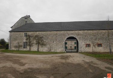
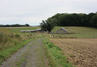
Tocht Stappen Tinlot - TINLOT - Promenade du Rougeaud - Photo

TINLOT - Promenade du Rougeaud

 tourcondroz
tourcondroz

Gebruiker

© OpenStreetMap contributors
Lengte
Lengte
11,3 km
Max. hoogte
Max. hoogte
292 m
Positief hoogteverschil
151 m
Km-Effort
Km-Effort  
13,3 km
Min. hoogte
Min. hoogte
233 m
Negatief hoogteverschil
152 m
Boucle
Boucle
Ja
Markering
Markering
Datum van aanmaak :
2019-04-01 13:27:36.154
Laatste wijziging :
2019-04-01 13:27:36.24

(2 Bericht)

Stappen
Stappen
2h54
Moeilijkheid : Medium

Scan deze QR-code om de tocht te openen in de SityTrail-applicatie

Gratisgps-wandelapplicatie

Logo SityTrail SityTrail

IGN / Geografische instituten

SityTrail uit de App Store downloaden SityTrail uit Google Play downloaden

Logo SityTrail SityTrail World

De wereld gaat voor u open

SityTrail uit de App Store downloaden SityTrail uit Google Play downloaden SityTrail op Huawei AppGallery downloaden

Over ons

Tocht Stappen van 11,3 km beschikbaar op Wallonië, Luik, Tinlot. Deze tocht wordt voorgesteld door tourcondroz.

Beschrijving

Début 19e, le Rougeaud était le pire ennemi du D’Zy. Il commettait de nombreux vols. Un jour, il vida même les étangs du baron de Fraiture pour y voler les carpes et tua un marchand de bestiaux pour lui dérober sa bourse. Il était le fiancé de la Grande Gatte  une ivrogne invétérée.
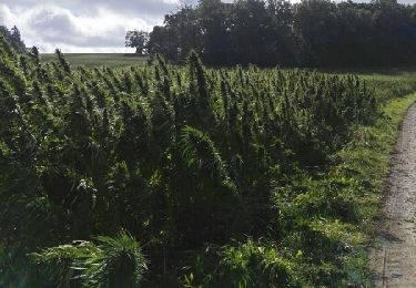
Lors de la promenade, on ne peut éviter le bois de Fraiture, merveille de la nature. Il est également possible de voir le Chemin de Favence et d’y contempler les bois imposants donnant un aspect ardennais à la nature environnante.

Hoogteprofiel

POI's

POI Tinlot - Bois de Fraiture - Photo
Syndicat d'Initiative "Entre Eaux & Châteaux"
POI Nandrin - Chemin de Favence - Photo
Syndicat d'Initiative "Entre Eaux & Châteaux"
POI Tinlot - Eglise Saint-Remacle - Photo
Syndicat d'Initiative "Entre Eaux & Châteaux"
POI Tinlot - Camping - Photo
Syndicat d'Initiative "Entre Eaux & Châteaux"
TINLOT 

Plaatsbepaling

Land:
Belgium
Regio :
Wallonië
Departement/Provincie :
Luik
Gemeente :
Tinlot
Locatie:
Fraiture
Vertrek:(Dec)
Vertrek:(UTM)
671274 ; 5594311 (31U) N.

Opmerkingen

Gelieve in te loggen om een commentaar of een beoordeling achter te laten


Promenade sympa à faire à pieds ou à vélo. pas de grosses difficultés. Il y a tout intérêt à le faire avec une carte ou un GPS, le balisage (rectangle noir ou bleu marine) est parfois discret, voir absent. Il manque quelques balises dans des carrefours importants. Actuellement un pont dans le Bois de Soheit est en réfection. La traversée est actuellement très difficile mais ce sera reglé après la fin de cet ouvrage.


Wandeltochten in de omgeving

Tocht Stappen Anthisnes - RB-Lg-18_Tavier - Photo
Stappen
PRO

Stappen

Zeer moeilijk
(10)
Anthisnes, Wallonië, Luik, Belgium
22 km | 28 km-effort
6h 19min
Ja
Tocht Stappen Ouffet - Warzée - Photo
Stappen
Jacques Guisse

Stappen

Gemakkelijk
(1)
Ouffet, Wallonië, Luik, Belgium
10,3 km | 12,4 km-effort
2h 28min
Ja
Tocht Stappen Ouffet - ouffet fermes ac + - Photo
Stappen
colsonandre

Stappen

Medium
(2)
Ouffet, Wallonië, Luik, Belgium
8,6 km | 10,7 km-effort
2h 41min
Ja
Tocht Stappen Nandrin - Villers le temple  .  st jean sart  .  clemaude  - Photo
Stappen
GUIDE
stef789

Stappen

Heel gemakkelijk
(1)
Nandrin, Wallonië, Luik, Belgium
7,9 km | 10,4 km-effort
2h 12min
Ja
Tocht Mountainbike Anthisnes - première rando anthisne tavier - Photo
Mountainbike
Amby

Mountainbike

Medium
(1)
Anthisnes, Wallonië, Luik, Belgium
10,2 km | 13,4 km-effort
1h 8min
Ja
Tocht Stappen Nandrin - promenade de la rochette : villers le temple - grand fond d'oxhe - villers le temple - Photo
Stappen
GUIDE
stef789

Stappen

Medium
(1)
Nandrin, Wallonië, Luik, Belgium
10 km | 13,3 km-effort
2h 47min
Ja
Tocht Te voet Ouffet - 2. Balade des Loups - Photo
Te voet
GUIDE+

Te voet

Gemakkelijk
Ouffet, Wallonië, Luik, Belgium
11,6 km | 13,8 km-effort
3h 7min
Ja
Tocht Te voet Anthisnes - AS06 Boucle des Sarts - Photo
Te voet
GUIDE+

Te voet

Gemakkelijk
Anthisnes, Wallonië, Luik, Belgium
10,9 km | 13,6 km-effort
3h 4min
Ja
Tocht Stappen Nandrin - Balade des bois de Yernée - Photo
Stappen
floflo61

Stappen

Gemakkelijk
(1)
Nandrin, Wallonië, Luik, Belgium
9,1 km | 11,8 km-effort
2h 9min
Ja


Sluiten
Mijn abonnementen