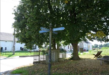
Tocht Elektrische fiets Étalle - Tour 20200905 - Photo
 yvesh489
yvesh489

Gebruiker

© OpenStreetMap contributors
Lengte
Lengte
40 km
Max. hoogte
Max. hoogte
511 m
Positief hoogteverschil
667 m
Km-Effort
Km-Effort  
48 km
Min. hoogte
Min. hoogte
332 m
Negatief hoogteverschil
558 m
Boucle
Boucle
Neen
Datum van aanmaak :
2020-09-05 14:21:35.189
Laatste wijziging :
2020-09-05 16:32:57.029

(0 Bericht)

Elektrische fiets
Elektrische fiets
2h11
Moeilijkheid : Heel gemakkelijk

Scan deze QR-code om de tocht te openen in de SityTrail-applicatie

Gratisgps-wandelapplicatie

Logo SityTrail SityTrail

IGN / Geografische instituten

SityTrail uit de App Store downloaden SityTrail uit Google Play downloaden

Logo SityTrail SityTrail World

De wereld gaat voor u open

SityTrail uit de App Store downloaden SityTrail uit Google Play downloaden SityTrail op Huawei AppGallery downloaden

Over ons

Tocht Elektrische fiets van 40 km beschikbaar op Wallonië, Luxemburg, Étalle. Deze tocht wordt voorgesteld door yvesh489.

Hoogteprofiel

Plaatsbepaling

Land:
Belgium
Regio :
Wallonië
Departement/Provincie :
Luxemburg
Gemeente :
Étalle
Locatie:
Sainte-Marie
Vertrek:(UTM)
684940 ; 5505191 (31U) N.

Wandeltochten in de omgeving

Tocht Stappen Étalle - Sentier des mardelles - Photo
Stappen
pielem

Stappen

Gemakkelijk
(1)
Étalle, Wallonië, Luxemburg, Belgium
3,7 km | 4,2 km-effort
1h 0min
Ja
Tocht Stappen Tintigny - À l’ombre de la forêt gaumaise  - Photo
Stappen
Vagabond gaumardennais

Stappen

Gemakkelijk
(4)
Tintigny, Wallonië, Luxemburg, Belgium
14,6 km | 17 km-effort
2h 49min
Ja
Tocht Stappen Tintigny - La Rando du Bian: Autour de Lahage  - Photo
Stappen
bian69

Stappen

Gemakkelijk
(1)
Tintigny, Wallonië, Luxemburg, Belgium
18,8 km | 22 km-effort
3h 58min
Ja
Tocht Mountainbike Étalle - O2bikers_26_etalle - Photo
Mountainbike
GUIDE+

Mountainbike

Heel gemakkelijk
(1)
Étalle, Wallonië, Luxemburg, Belgium
22 km | 27 km-effort
3h 0min
Ja
Tocht Stappen Étalle - cyruse - Photo
Stappen
Klepper

Stappen

Heel gemakkelijk
(1)
Étalle, Wallonië, Luxemburg, Belgium
41 km | 47 km-effort
1h 18min
Neen
Tocht Stappen Virton - Buzenol - Circuit Natura 2000, des sites qui valent le détour - Lx17 - Photo
Stappen
GUIDE+

Stappen

Medium
(1)
Virton, Wallonië, Luxemburg, Belgium
13,5 km | 16,7 km-effort
2h 0min
Ja
Tocht Stappen Étalle - GAUME Boucle vers la vallee de la Rougeau - Photo
Stappen
julucasi

Stappen

Gemakkelijk
(3)
Étalle, Wallonië, Luxemburg, Belgium
5,6 km | 7,1 km-effort
1h 32min
Ja
Tocht Te voet Tintigny - Promenade Tintigny-Han - Photo
Te voet
GUIDE+

Te voet

Gemakkelijk
Tintigny, Wallonië, Luxemburg, Belgium
4,4 km | 5 km-effort
1h 7min
Ja
Tocht Te voet Étalle - La Stabuloise - Photo
Te voet
GUIDE+

Te voet

Gemakkelijk
Étalle, Wallonië, Luxemburg, Belgium
13,5 km | 15,5 km-effort
3h 30min
Ja


Sluiten
Mijn abonnementen