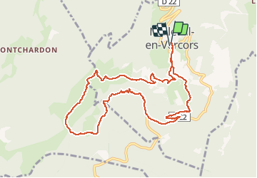
![](/images/other/stat-length.png)
![Tocht Stappen Malleval-en-Vercors - lunette des Coulmes - Photo](https://media.geolcdn.com/t/1900/400/ext.pjpeg?maxdim=2&url=https%3A%2F%2Fstatic1.geolcdn.com%2Fsiteimages%2Fupload%2Ffiles%2F1553511878bg_sport_marche.png)
lunette des Coulmes
cmarit
Gebruiker
![Lengte](/images/other/stat-length.png)
![Max. hoogte](https://static1.geolcdn.com/siteimages/upload/files/1508320355ic_sort_altitude_max_24dp.png)
![Positief hoogteverschil](https://static1.geolcdn.com/siteimages/upload/files/1508320355ic_sort_den_pos_24dp.png)
![Km-Effort](/images/other/stat-length.png)
![Min. hoogte](https://static1.geolcdn.com/siteimages/upload/files/1508320355ic_sort_altitude_min_24dp.png)
![Negatief hoogteverschil](https://static1.geolcdn.com/siteimages/upload/files/1508320355ic_sort_den_neg_24dp.png)
![Boucle](https://static1.geolcdn.com/siteimages/upload/files/16400158638029165_repeat_loop_refresh_sync_direction_icon.png)
![Stappen](https://static1.geolcdn.com/sitytour/trail-icons/101.png)
3h40
Moeilijkheid : Medium
![Scan deze QR-code om de tocht te openen in de SityTrail-applicatie](https://capi.geolives.com/qq0zvz2zws4bq2lad0pu/sitytour/trails/2530392/qr.png?size=200)
Gratisgps-wandelapplicatie
Over ons
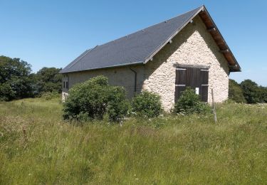
Tocht Stappen van 11,2 km beschikbaar op Auvergne-Rhône-Alpes, Isère, Malleval-en-Vercors. Deze tocht wordt voorgesteld door cmarit.
Beschrijving
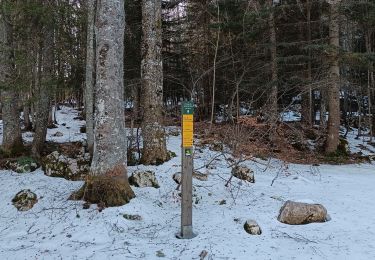
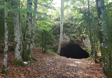
En allant à la Lunette, on a fait un peu de hors piste mais pour le plaisir de s'orienter.
Pour la descente j'ai encore fait un refus sur la combe coquette. La prochaine fois, il faudra chercher le chemin dès le Pas de Pré Coquet, il semble que ça arrive là (vu par Rémy). Au lieu de ça, on a emprunté un chemin bien marqué sur la carte mais pas mal oublié sur le terrain.
Tout le monde était content quand même!
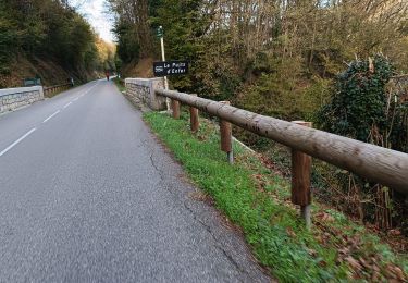
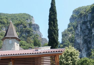
Ce qui a fait le plus peur à certains, c'est la route des gorges du Nan, très étroite!...
Plaatsbepaling
Opmerkingen
Wandeltochten in de omgeving
![Tocht Stappen Cognin-les-Gorges - gerlette abs - Photo](https://media.geolcdn.com/t/375/260/c8110e9f-bd5d-4d92-bba6-1a7936beeb04.jpg&format=jpg&maxdim=2)
![Stappen Stappen](https://static1.geolcdn.com/sitytour/trail-icons/101.png)
Stappen
![](/images/other/stat-length.png)
![](https://static1.geolcdn.com/siteimages/upload/files/16400158638029165_repeat_loop_refresh_sync_direction_icon.png)
![Tocht Stappen Malleval-en-Vercors - pas du Follet en boucle - Photo](https://media.geolcdn.com/t/375/260/ext.jpg?maxdim=2&url=https%3A%2F%2Fstatic1.geolcdn.com%2Fsiteimages%2Fupload%2Ffiles%2F1553511878bg_sport_marche.png)
![Stappen Stappen](https://static1.geolcdn.com/sitytour/trail-icons/101.png)
Stappen
![](/images/other/stat-length.png)
![](https://static1.geolcdn.com/siteimages/upload/files/16400158638029165_repeat_loop_refresh_sync_direction_icon.png)
![Tocht Wegfiets Beaulieu - Beaulieu - Cognin par la pisciculture - Photo](https://media.geolcdn.com/t/375/260/35ef182e-2ae6-4c48-a6bb-babdec0fa24b.jpg&format=jpg&maxdim=2)
![Wegfiets Wegfiets](https://static1.geolcdn.com/sitytour/trail-icons/201.png)
Wegfiets
![](/images/other/stat-length.png)
![](https://static1.geolcdn.com/siteimages/upload/files/16400158638029165_repeat_loop_refresh_sync_direction_icon.png)
![Tocht Mountainbike Beaulieu - Fond de Beaulieu- Treillins - Cognin , balade en vélo - Photo](https://media.geolcdn.com/t/375/260/25a5486a-ec56-4bc3-8edc-1f81e2cba7ba.jpg&format=jpg&maxdim=2)
![Mountainbike Mountainbike](https://static1.geolcdn.com/sitytour/trail-icons/202.png)
Mountainbike
![](/images/other/stat-length.png)
![](https://static1.geolcdn.com/siteimages/upload/files/16400158638029165_repeat_loop_refresh_sync_direction_icon.png)
![Tocht Stappen Malleval-en-Vercors - Patente - Photo](https://media.geolcdn.com/t/375/260/60b129ee-9863-458f-8d0b-886077adfedf.jpg&format=jpg&maxdim=2)
![Stappen Stappen](https://static1.geolcdn.com/sitytour/trail-icons/101.png)
Stappen
![](/images/other/stat-length.png)
![](https://static1.geolcdn.com/siteimages/upload/files/16400158638029165_repeat_loop_refresh_sync_direction_icon.png)
![Tocht Stappen Saint-Gervais - Les Écouges - Pas de Pierre Taillée - Photo](https://media.geolcdn.com/t/375/260/c1514613-b24f-48ec-aa78-bb7bfa66a6b4.jpg&format=jpg&maxdim=2)
![Stappen Stappen](https://static1.geolcdn.com/sitytour/trail-icons/101.png)
Stappen
![](/images/other/stat-length.png)
![](https://static1.geolcdn.com/siteimages/upload/files/16400158638029165_repeat_loop_refresh_sync_direction_icon.png)
![Tocht Stappen Cognin-les-Gorges - Cognin-les-Gorges - Gorges du Nan - Malleval-en-Vercors - Photo](https://media.geolcdn.com/t/375/260/ade7945e-a7c5-44bc-b392-a4cb822d8799.jpg&format=jpg&maxdim=2)
![Stappen Stappen](https://static1.geolcdn.com/sitytour/trail-icons/101.png)
Stappen
![](/images/other/stat-length.png)
![](https://static1.geolcdn.com/siteimages/upload/files/16400158638029165_repeat_loop_refresh_sync_direction_icon.png)
![Tocht Stappen Saint-Pierre-de-Chérennes - Les Coulmes - La Lunette - Photo](https://media.geolcdn.com/t/375/260/3a4910c5-13ba-451d-9478-dccf34306295.jpg&format=jpg&maxdim=2)
![Stappen Stappen](https://static1.geolcdn.com/sitytour/trail-icons/101.png)
Stappen
![](/images/other/stat-length.png)
![](https://static1.geolcdn.com/siteimages/upload/files/16400158638029165_repeat_loop_refresh_sync_direction_icon.png)
![Tocht Stappen Presles - Coulmes - La Fontaine de Pétouze par la grotte des Boeufs - Photo](https://media.geolcdn.com/t/375/260/fe4f0ce9-4c0f-4a57-8bf8-01fb087e941a.jpg&format=jpg&maxdim=2)
![Stappen Stappen](https://static1.geolcdn.com/sitytour/trail-icons/101.png)
Stappen
![](/images/other/stat-length.png)
![](https://static1.geolcdn.com/siteimages/upload/files/16400158638029165_repeat_loop_refresh_sync_direction_icon.png)