


 - Photo 21")
 - Photo 22")
 - Photo 23")
 - Photo 24")
 - Photo 25")
 - Photo 26")
 - Photo 27")
 - Photo 28")
 - Photo 29")
 - Photo 30")
 - Photo 31")
 - Photo 32")
 - Photo 33")
 - Photo 34")
 - Photo 35")
 - Photo 36")
 - Photo 37")
 - Photo 38")
 - Photo 39")
 - Photo 40")
 - Photo 41")
 - Photo 42")

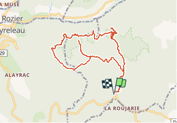
10,1 km | 18,8 km-effort

Gebruiker


Gratisgps-wandelapplicatie
 SityTrail
IGN / Geografische instituten
SityTrail World
De wereld gaat voor u open
Tocht Stappen van 12 km beschikbaar op Occitanië, Aveyron, Veyreau. Deze tocht wordt voorgesteld door PiloudeBamako.
Randonnée téléchargée sur Visorando et effectuée sans problème ni changement. Enregistrée ici pour les photos.
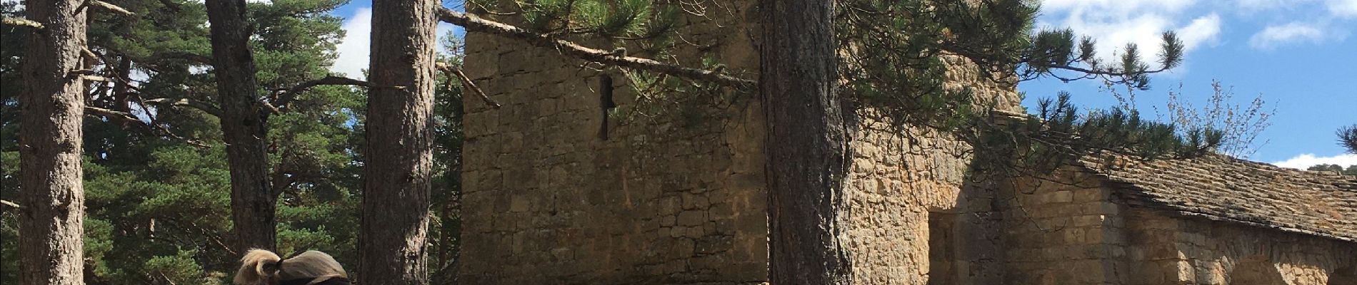
Prieuré Saint-Jean-des-Balmes - Cirque de Madasse
Ermitage Saint Michel (accès aux ruines de l'ermitage par une grande échelle et passages acrobatiques au sommet, mais rien n'oblige à monter...)
Le point sublime (panorama grandiose sur les gorges du Tarn)
Le champignon préhistorique (étrange rocher gigantesque)
La Bartasserie.
Pas de difficulté majeure sauf pour l'accès à l'ermitage St Michel que l'on évitera si sujet au vertige.
 - Photo 1")
 - Photo 2")
 - Photo 3")
 - Photo 4")
 - Photo 5")
 - Photo 6")
 - Photo 7")
 - Photo 8")
 - Photo 9")
 - Photo 10")
 - Photo 11")
 - Photo 12")
 - Photo 13")
 - Photo 14")
 - Photo 15")
 - Photo 16")
 - Photo 17")
 - Photo 18")
 - Photo 19")
 - Photo 20")
42 fotos in totaal. Klik op een foto om ze allemaal in de galerij weer te geven.

Stappen

Stappen

Stappen

Stappen

Stappen

Stappen

Stappen

Stappen
Stappen