![](/images/other/stat-length.png)
![Tocht Noords wandelen Orlu - Orlu, col de l'Osque, Porteille d'Orgeix, Orgeix - Photo](https://media.geolcdn.com/t/1900/400/bb96309c-1ffe-4fdf-ba7a-51865c84fc15.jpg&format=pjpeg&maxdim=2)
Orlu, col de l'Osque, Porteille d'Orgeix, Orgeix
octo
Gebruiker
![Lengte](/images/other/stat-length.png)
Lengte
13,9 km
![Max. hoogte](https://static1.geolcdn.com/siteimages/upload/files/1508320355ic_sort_altitude_max_24dp.png)
Max. hoogte
1435 m
![Positief hoogteverschil](https://static1.geolcdn.com/siteimages/upload/files/1508320355ic_sort_den_pos_24dp.png)
Positief hoogteverschil
637 m
![Km-Effort](/images/other/stat-length.png)
Km-Effort
22 km
![Min. hoogte](https://static1.geolcdn.com/siteimages/upload/files/1508320355ic_sort_altitude_min_24dp.png)
Min. hoogte
821 m
![Negatief hoogteverschil](https://static1.geolcdn.com/siteimages/upload/files/1508320355ic_sort_den_neg_24dp.png)
Negatief hoogteverschil
637 m
![Boucle](https://static1.geolcdn.com/siteimages/upload/files/16400158638029165_repeat_loop_refresh_sync_direction_icon.png)
Boucle
Ja
Datum van aanmaak :
2020-08-26 06:11:34.861
Laatste wijziging :
2020-08-26 14:54:38.227
![Noords wandelen](https://static1.geolcdn.com/sitytour/trail-icons/102.png)
3h21
Moeilijkheid : Heel gemakkelijk
![Scan deze QR-code om de tocht te openen in de SityTrail-applicatie](https://capi.geolives.com/qq0zvz2zws4bq2lad0pu/sitytour/trails/2528226/qr.png?size=200)
Gratisgps-wandelapplicatie
Over ons
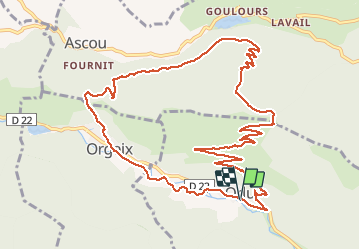
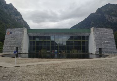
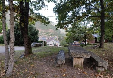
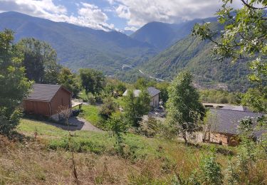
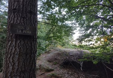
Tocht Noords wandelen van 13,9 km beschikbaar op Occitanië, Ariège, Orlu. Deze tocht wordt voorgesteld door octo.
Beschrijving
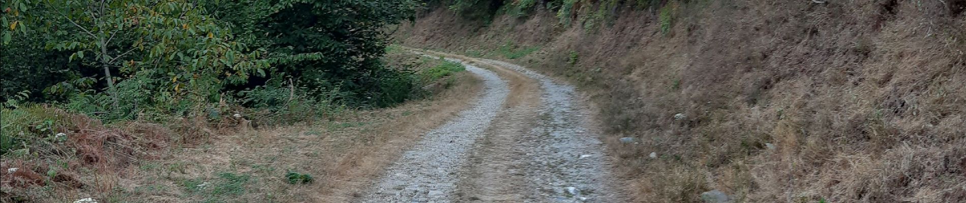
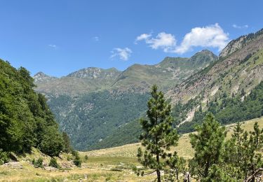
depuis le départ vous prenez un chemin routier forestier, pas de difficulté particulière, retour par le porteille d'Orgeix et puis suivre le ruisseau l'Oriege par sa rive gauche
Plaatsbepaling
Land:
France
Regio :
Occitanië
Departement/Provincie :
Ariège
Gemeente :
Orlu
Locatie:
Unknown
Vertrek:(Dec)
Vertrek:(UTM)
409048 ; 4728222 (31T) N.
Opmerkingen
Wandeltochten in de omgeving
![Tocht Stappen Orgeix - aiguelongue - Photo](https://media.geolcdn.com/t/375/260/ext.jpg?maxdim=2&url=https%3A%2F%2Fservices.sitytrail.com%2FGeolivesWS%2FDownloadMedia.ashx%3FTrailID%3D643989%26Media%3Dfix__20161010104856.jpg)
![Stappen Stappen](https://static1.geolcdn.com/sitytour/trail-icons/101.png)
aiguelongue
Stappen
Gemakkelijk
(2)
Orgeix,
Occitanië,
Ariège,
France
![](/images/other/stat-length.png)
9 km | 17,9 km-effort
3h 37min
![](https://static1.geolcdn.com/siteimages/upload/files/16400158638029165_repeat_loop_refresh_sync_direction_icon.png)
Ja
![Tocht Stappen Sorgeat - Chemin des Bonhommes - Sorgeat Merens - Photo](https://media.geolcdn.com/t/375/260/ext.jpg?maxdim=2&url=https%3A%2F%2Fservices.sitytrail.com%2FGeolivesWS%2FDownloadMedia.ashx%3FTrailID%3D108179%26Media%3D769_1.jpg)
![Stappen Stappen](https://static1.geolcdn.com/sitytour/trail-icons/101.png)
Chemin des Bonhommes - Sorgeat Merens
Stappen
Zeer moeilijk
(1)
Sorgeat,
Occitanië,
Ariège,
France
![](/images/other/stat-length.png)
21 km | 36 km-effort
8h 0min
![](https://static1.geolcdn.com/siteimages/upload/files/16400158638029165_repeat_loop_refresh_sync_direction_icon.png)
Neen
![Tocht Mountainbike Orlu - Orlu Parking Aygue Longue - Photo](https://media.geolcdn.com/t/375/260/29d37a56-8c65-404d-a626-5d8cec80cb8d.jpg&format=jpg&maxdim=2)
![Mountainbike Mountainbike](https://static1.geolcdn.com/sitytour/trail-icons/202.png)
Orlu Parking Aygue Longue
Mountainbike
Medium
Orlu,
Occitanië,
Ariège,
France
![](/images/other/stat-length.png)
16,1 km | 24 km-effort
2h 51min
![](https://static1.geolcdn.com/siteimages/upload/files/16400158638029165_repeat_loop_refresh_sync_direction_icon.png)
Ja
![Tocht Stappen Ax-les-Thermes - Lac de Campauleil - Orgeix - Photo](https://media.geolcdn.com/t/375/260/ext.jpg?maxdim=2&url=https%3A%2F%2Fstatic1.geolcdn.com%2Fsiteimages%2Fupload%2Ffiles%2F1553511878bg_sport_marche.png)
![Stappen Stappen](https://static1.geolcdn.com/sitytour/trail-icons/101.png)
Lac de Campauleil - Orgeix
Stappen
Heel gemakkelijk
(1)
Ax-les-Thermes,
Occitanië,
Ariège,
France
![](/images/other/stat-length.png)
8,6 km | 11,2 km-effort
3h 3min
![](https://static1.geolcdn.com/siteimages/upload/files/16400158638029165_repeat_loop_refresh_sync_direction_icon.png)
Ja
![Tocht Stappen Orlu - Le Fanguil - Photo](https://media.geolcdn.com/t/375/260/c3accd76-1509-4827-a01c-0e33052ccaa5.jpg&format=jpg&maxdim=2)
![Stappen Stappen](https://static1.geolcdn.com/sitytour/trail-icons/101.png)
![Tocht Stappen Ax-les-Thermes - balade bleue au dessus d'Ax - Photo](https://media.geolcdn.com/t/375/260/1d43ecd2-3cc0-4fbb-b33b-15c49f564005.jpg&format=jpg&maxdim=2)
![Stappen Stappen](https://static1.geolcdn.com/sitytour/trail-icons/101.png)
balade bleue au dessus d'Ax
Stappen
Gemakkelijk
Ax-les-Thermes,
Occitanië,
Ariège,
France
![](/images/other/stat-length.png)
3,8 km | 6,1 km-effort
1h 22min
![](https://static1.geolcdn.com/siteimages/upload/files/16400158638029165_repeat_loop_refresh_sync_direction_icon.png)
Ja
![Tocht Stappen Ax-les-Thermes - Orgeix _ Ignaux - Photo](https://media.geolcdn.com/t/375/260/e43b3995-af8e-4435-939e-d3db1e3b3da2.jpg&format=jpg&maxdim=2)
![Stappen Stappen](https://static1.geolcdn.com/sitytour/trail-icons/101.png)
Orgeix _ Ignaux
Stappen
Medium
Ax-les-Thermes,
Occitanië,
Ariège,
France
![](/images/other/stat-length.png)
12,8 km | 19,1 km-effort
4h 12min
![](https://static1.geolcdn.com/siteimages/upload/files/16400158638029165_repeat_loop_refresh_sync_direction_icon.png)
Ja
![Tocht Stappen Orlu - Le roc de la péra - Photo](https://media.geolcdn.com/t/375/260/73155c20-8e48-42b7-9201-111106b56065.jpg&format=jpg&maxdim=2)
![Stappen Stappen](https://static1.geolcdn.com/sitytour/trail-icons/101.png)
Le roc de la péra
Stappen
Medium
(1)
Orlu,
Occitanië,
Ariège,
France
![](/images/other/stat-length.png)
9,3 km | 15 km-effort
2h 52min
![](https://static1.geolcdn.com/siteimages/upload/files/16400158638029165_repeat_loop_refresh_sync_direction_icon.png)
Ja
![Tocht Stappen Orlu - Orlu promenade des marmottes - Photo](https://media.geolcdn.com/t/375/260/5b2a5531-e3cc-44c5-8612-d73d9e8195ce.jpg&format=jpg&maxdim=2)
![Stappen Stappen](https://static1.geolcdn.com/sitytour/trail-icons/101.png)
Orlu promenade des marmottes
Stappen
Heel gemakkelijk
Orlu,
Occitanië,
Ariège,
France
![](/images/other/stat-length.png)
10,9 km | 15,5 km-effort
4h 3min
![](https://static1.geolcdn.com/siteimages/upload/files/16400158638029165_repeat_loop_refresh_sync_direction_icon.png)
Ja