

MONTANER-De La Rouquère à Saint Lézer-Trace faite le 19 /08/2020 - M1

mitch1952
Gebruiker

Lengte
10,1 km

Max. hoogte
342 m

Positief hoogteverschil
187 m

Km-Effort
12,6 km

Min. hoogte
248 m

Negatief hoogteverschil
187 m
Boucle
Ja
Datum van aanmaak :
2020-08-19 06:58:28.045
Laatste wijziging :
2022-06-07 10:27:24.218
3h00
Moeilijkheid : Medium

Gratisgps-wandelapplicatie
Over ons
Tocht Stappen van 10,1 km beschikbaar op Nieuw-Aquitanië, Pyrénées-Atlantiques, Montaner. Deze tocht wordt voorgesteld door mitch1952.
Beschrijving
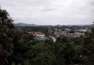
Rando à faire de préférence en été pour son parcours essentiellement en forêt.
A voir l'Oppidum, la table d'orientation et l'église
Plaatsbepaling
Land:
France
Regio :
Nieuw-Aquitanië
Departement/Provincie :
Pyrénées-Atlantiques
Gemeente :
Montaner
Locatie:
Unknown
Vertrek:(Dec)
Vertrek:(UTM)
257179 ; 4805327 (31T) N.
Opmerkingen
Wandeltochten in de omgeving
MONTANER La Milouloise M2 82 ans le 5/02/2020


Te voet
Gemakkelijk
Montaner,
Nieuw-Aquitanië,
Pyrénées-Atlantiques,
France

7 km | 8,7 km-effort
Onbekend
Ja
MONTANER 85 Ans de JC


Stappen
Medium
Montaner,
Nieuw-Aquitanië,
Pyrénées-Atlantiques,
France

6,7 km | 8,9 km-effort
1h 50min
Ja
RS Montaner 2021


Stappen
Gemakkelijk
Montaner,
Nieuw-Aquitanië,
Pyrénées-Atlantiques,
France

4,4 km | 5,8 km-effort
1h 23min
Ja
Pontiac RS


Stappen
Heel gemakkelijk
Pontiacq-Viellepinte,
Nieuw-Aquitanië,
Pyrénées-Atlantiques,
France

4,2 km | 4,6 km-effort
1h 53min
Ja

Les coteaux de Saint-Lézer


Mountainbike
Gemakkelijk
Saint-Lézer,
Occitanië,
Hautes-Pyrénées,
France

11,9 km | 14,5 km-effort
1h 0min
Ja

Les coteaux de Saint-Lézer


Stappen
Medium
Saint-Lézer,
Occitanië,
Hautes-Pyrénées,
France

11,9 km | 14,5 km-effort
3h 0min
Ja
Variante GR 101


Te voet
Gemakkelijk
Talazac,
Occitanië,
Hautes-Pyrénées,
France

8,9 km | 11 km-effort
2h 30min
Neen

SityTrail - Les coteaux de Saint-Lézer


Te voet
Gemakkelijk
Saint-Lézer,
Occitanië,
Hautes-Pyrénées,
France

10,1 km | 12,4 km-effort
2h 49min
Ja

TarasteeixMN2bis


Noords wandelen
Heel gemakkelijk
Tarasteix,
Occitanië,
Hautes-Pyrénées,
France

8,2 km | 10,5 km-effort
2h 38min
Ja


 SityTrail


