Tocht Auto Λουρδάτα - Grèce - Photo
 GOHIER
GOHIER

Gebruiker

© OpenStreetMap contributors
Lengte
Lengte
256 km
Max. hoogte
Max. hoogte
1041 m
Positief hoogteverschil
8362 m
Km-Effort
Km-Effort  
368 km
Min. hoogte
Min. hoogte
-4 m
Negatief hoogteverschil
8468 m
Boucle
Boucle
Neen
Datum van aanmaak :
2020-08-08 08:23:28.0
Laatste wijziging :
2020-08-14 12:23:58.33

(0 Bericht)

Auto
Auto
17h59
Moeilijkheid : Onbekend

Scan deze QR-code om de tocht te openen in de SityTrail-applicatie

Gratisgps-wandelapplicatie

Logo SityTrail SityTrail

IGN / Geografische instituten

SityTrail uit de App Store downloaden SityTrail uit Google Play downloaden

Logo SityTrail SityTrail World

De wereld gaat voor u open

SityTrail uit de App Store downloaden SityTrail uit Google Play downloaden SityTrail op Huawei AppGallery downloaden

Over ons

Tocht Auto van 256 km beschikbaar op Peloponnesos, West-Griekenland en Ionische Eilanden, Περιφερειακή Ενότητα Κεφαλληνίας. Deze tocht wordt voorgesteld door GOHIER.

Hoogteprofiel

Plaatsbepaling

Land:
Greece
Regio :
Peloponnesos, West-Griekenland en Ionische Eilanden
Departement/Provincie :
Περιφερειακή Ενότητα Κεφαλληνίας
Gemeente :
Λουρδάτα
Locatie:
Unknown
Vertrek:(Dec)
Vertrek:(UTM)
467335 ; 4218934 (34S) N.

Wandeltochten in de omgeving

Tocht Auto  - Grèce - Photo
Auto
GOHIER

Auto

, Peloponnesos, West-Griekenland en Ionische Eilanden, Περιφερειακή Ενότητα Κεφαλληνίας, Greece
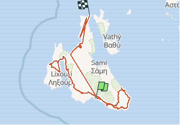
256 km | 368 km-effort
17h 59min
Neen
Tocht Auto  - Sommet Aenos 1600 m d’altitude.  - Photo
Auto
GOHIER

Auto

, Peloponnesos, West-Griekenland en Ionische Eilanden, Περιφερειακή Ενότητα Κεφαλληνίας, Greece
108 km | 145 km-effort
4h 19min
Neen


Sluiten
Mijn abonnementen