


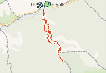

7,2 km | 15,3 km-effort


Gebruiker


Gratisgps-wandelapplicatie
 SityTrail
IGN / Geografische instituten
SityTrail World
De wereld gaat voor u open
Tocht Stappen van 9,2 km beschikbaar op Occitanië, Pyrénées-Orientales, Thuès-Entre-Valls. Deze tocht wordt voorgesteld door fab0202.
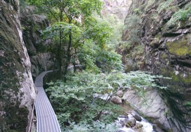
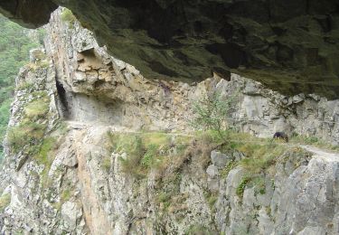
belle randonnée avec de superbes points de vue. Commencer par la montée du côté corniche. passage avec main courante sur la corniche et ensuite jusqu au pont de pierre, passage par des passerelles et pont de singe. La faire de bonne heure pour éviter le monde

Stappen

Stappen

Stappen

Stappen
Stappen

Stappen
Stappen
Stappen
Te voet