![](/images/other/stat-length.png)
![Tocht Fiets Deinze - Het mooiste van de Oost-Vlaamse Leie - Photo](https://media.geolcdn.com/t/1900/400/ext.pjpeg?maxdim=2&url=https%3A%2F%2Fstatic1.geolcdn.com%2Fsiteimages%2Fupload%2Ffiles%2F1524743154velo.jpg)
Het mooiste van de Oost-Vlaamse Leie
zorro
Gebruiker
![Lengte](/images/other/stat-length.png)
![Max. hoogte](https://static1.geolcdn.com/siteimages/upload/files/1508320355ic_sort_altitude_max_24dp.png)
![Positief hoogteverschil](https://static1.geolcdn.com/siteimages/upload/files/1508320355ic_sort_den_pos_24dp.png)
![Km-Effort](/images/other/stat-length.png)
![Min. hoogte](https://static1.geolcdn.com/siteimages/upload/files/1508320355ic_sort_altitude_min_24dp.png)
![Negatief hoogteverschil](https://static1.geolcdn.com/siteimages/upload/files/1508320355ic_sort_den_neg_24dp.png)
![Boucle](https://static1.geolcdn.com/siteimages/upload/files/16400158638029165_repeat_loop_refresh_sync_direction_icon.png)
![Fiets](https://static1.geolcdn.com/sitytour/trail-icons/200.png)
1h33
Moeilijkheid : Medium
![Scan deze QR-code om de tocht te openen in de SityTrail-applicatie](https://capi.geolives.com/qq0zvz2zws4bq2lad0pu/sitytour/trails/250806/qr.png?size=200)
Gratisgps-wandelapplicatie
Over ons
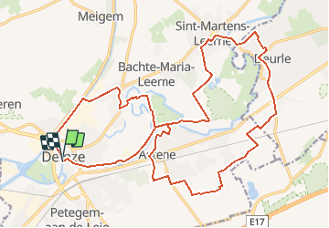
Tocht Fiets van 24 km beschikbaar op Vlaanderen, Oost-Vlaanderen, Deinze. Deze tocht wordt voorgesteld door zorro.
Beschrijving
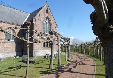
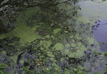
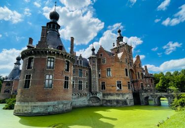
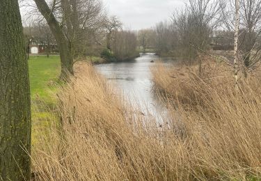
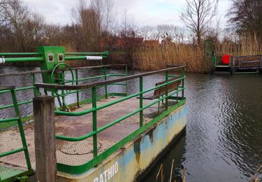
De Leie is op z'n mooist tussen Deinze en Afsnee. Het bochtig traject slingert zich door het landschap met bossen en weiden. Deze fietsroute is zeer gevarieerd: je fietst een stuk langs de Leie, door de natuur en Deurle waar kunstenaars inspiratie vonden door die romantische Leie. Je rijdt in prachtige dreven met grote villa's naar St.-Martens LatemWe rijden terug naar Deinze langs een rustiger traject via Astene en Astene-Sas.
Plaatsbepaling
Opmerkingen
Wandeltochten in de omgeving
![Tocht Te voet Zulte - Roger Raveelroute - Photo](https://media.geolcdn.com/t/375/260/65215fcc-3c39-4b2f-8a5e-53236c2ada3d.jpeg&format=jpg&maxdim=2)
![Te voet Te voet](https://static1.geolcdn.com/sitytour/trail-icons/100.png)
Te voet
![](/images/other/stat-length.png)
![](https://static1.geolcdn.com/siteimages/upload/files/16400158638029165_repeat_loop_refresh_sync_direction_icon.png)
![Tocht Te voet Deinze - Vlasrotersroute - Lus 3 - Photo](https://media.geolcdn.com/t/375/260/5f809ab3-3463-4e66-9d8b-48be8026772a.jpeg&format=jpg&maxdim=2)
![Te voet Te voet](https://static1.geolcdn.com/sitytour/trail-icons/100.png)
Te voet
![](/images/other/stat-length.png)
![](https://static1.geolcdn.com/siteimages/upload/files/16400158638029165_repeat_loop_refresh_sync_direction_icon.png)
![Tocht Te voet Deinze - Ooidonkroute - Photo](https://media.geolcdn.com/t/375/260/a989dc90-b267-4c71-9207-1c5a32844e07.jpeg&format=jpg&maxdim=2)
![Te voet Te voet](https://static1.geolcdn.com/sitytour/trail-icons/100.png)
Te voet
![](/images/other/stat-length.png)
![](https://static1.geolcdn.com/siteimages/upload/files/16400158638029165_repeat_loop_refresh_sync_direction_icon.png)
![Tocht Te voet Zulte - Vlasrotersroute - Lus 1 - Photo](https://media.geolcdn.com/t/375/260/f3a30667-494e-4299-845d-44168b5304fd.jpeg&format=jpg&maxdim=2)
![Te voet Te voet](https://static1.geolcdn.com/sitytour/trail-icons/100.png)
Te voet
![](/images/other/stat-length.png)
![](https://static1.geolcdn.com/siteimages/upload/files/16400158638029165_repeat_loop_refresh_sync_direction_icon.png)
![Tocht Stappen Zulte - Roger_Raveelwandelroute - Photo](https://media.geolcdn.com/t/375/260/ext.jpg?maxdim=2&url=https%3A%2F%2Fstatic1.geolcdn.com%2Fsiteimages%2Fupload%2Ffiles%2F1553511878bg_sport_marche.png)
![Stappen Stappen](https://static1.geolcdn.com/sitytour/trail-icons/101.png)
Stappen
![](/images/other/stat-length.png)
![](https://static1.geolcdn.com/siteimages/upload/files/16400158638029165_repeat_loop_refresh_sync_direction_icon.png)
![Tocht Stappen Deinze - 19 km autour de Deinze et Machelen - Photo](https://media.geolcdn.com/t/375/260/f6f6d5b4-ad07-4d56-9b6b-e63ccbbcdac3.jpg&format=jpg&maxdim=2)
![Stappen Stappen](https://static1.geolcdn.com/sitytour/trail-icons/101.png)
Stappen
![](/images/other/stat-length.png)
![](https://static1.geolcdn.com/siteimages/upload/files/16400158638029165_repeat_loop_refresh_sync_direction_icon.png)
![Tocht Stappen Deinze - Le château d’Ooidonk à Deinze - Photo](https://media.geolcdn.com/t/375/260/d255fdad-ee32-44cd-b7de-2c94d8b7f7ee.jpeg&format=jpg&maxdim=2)
![Stappen Stappen](https://static1.geolcdn.com/sitytour/trail-icons/101.png)
Stappen
![](/images/other/stat-length.png)
![](https://static1.geolcdn.com/siteimages/upload/files/16400158638029165_repeat_loop_refresh_sync_direction_icon.png)
![Tocht Stappen Deinze - Filliers Deinze - Photo](https://media.geolcdn.com/t/375/260/e61df0b9-73c6-4e71-8315-6346762c2e63.jpg&format=jpg&maxdim=2)
![Stappen Stappen](https://static1.geolcdn.com/sitytour/trail-icons/101.png)
Stappen
![](/images/other/stat-length.png)
![](https://static1.geolcdn.com/siteimages/upload/files/16400158638029165_repeat_loop_refresh_sync_direction_icon.png)
![Tocht Stappen Deinze - Randonnée des Filliers à Deinze - Photo](https://media.geolcdn.com/t/375/260/63489dac-74b1-4b82-bcac-292bc60f01cd.jpg&format=jpg&maxdim=2)
![Stappen Stappen](https://static1.geolcdn.com/sitytour/trail-icons/101.png)
Stappen
![](/images/other/stat-length.png)
![](https://static1.geolcdn.com/siteimages/upload/files/16400158638029165_repeat_loop_refresh_sync_direction_icon.png)