Tocht Stappen Banyuls-sur-Mer - puig de sallfort depuis coll de vallauria - Photo

puig de sallfort depuis coll de vallauria

 stef789
stef789

Gebruiker

© OpenStreetMap contributors
Lengte
Lengte
11,4 km
Max. hoogte
Max. hoogte
966 m
Positief hoogteverschil
637 m
Km-Effort
Km-Effort  
19,9 km
Min. hoogte
Min. hoogte
393 m
Negatief hoogteverschil
638 m
Boucle
Boucle
Ja
Datum van aanmaak :
2020-08-08 11:59:14.367
Laatste wijziging :
2020-08-08 19:21:30.719

(0 Bericht)

Stappen
Stappen
5h07
Moeilijkheid : Medium

Scan deze QR-code om de tocht te openen in de SityTrail-applicatie

Gratisgps-wandelapplicatie

Logo SityTrail SityTrail

IGN / Geografische instituten

SityTrail uit de App Store downloaden SityTrail uit Google Play downloaden

Logo SityTrail SityTrail World

De wereld gaat voor u open

SityTrail uit de App Store downloaden SityTrail uit Google Play downloaden SityTrail op Huawei AppGallery downloaden

Over ons

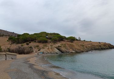
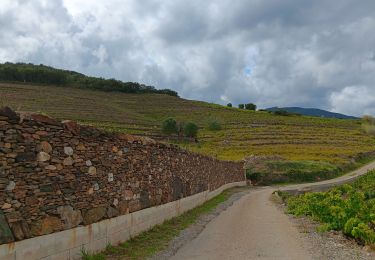
Tocht Stappen van 11,4 km beschikbaar op Occitanië, Pyrénées-Orientales, Banyuls-sur-Mer. Deze tocht wordt voorgesteld door stef789.

Beschrijving

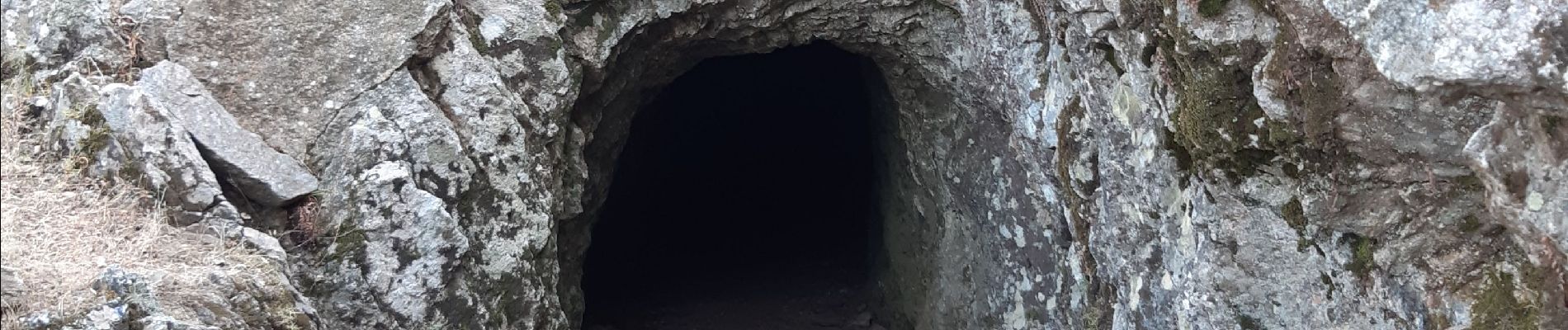
montee raide tres pénible sous canicule de 36° sans vent... -  retour : la descente depuis le pic est au début hors chemin -  appréciez le passage dans le tunnel

Hoogteprofiel

Foto's

Plaatsbepaling

Land:
France
Regio :
Occitanië
Departement/Provincie :
Pyrénées-Orientales
Gemeente :
Banyuls-sur-Mer
Locatie:
Unknown
Vertrek:(UTM)
505717 ; 4703436 (31T) N.

Wandeltochten in de omgeving

Tocht Stappen Port-Vendres - Le sentier des douaniers (Port-Vendres) - Photo
Stappen
tracegps

Stappen

Medium
(5)
Port-Vendres, Occitanië, Pyrénées-Orientales, France
14,5 km | 19,1 km-effort
4h 0min
Ja
Tocht Stappen Argelès-sur-Mer - 66 ARGELES SUR MER - mas Christine, promenade dans les Albères, par les pistes,sentiers, entre les chênes lièges - Photo
Stappen
jeff66

Stappen

Medium
(2)
Argelès-sur-Mer, Occitanië, Pyrénées-Orientales, France
7,4 km | 9,8 km-effort
1h 28min
Ja
Tocht Stappen Collioure - 66 COLLIOURE - les balcons de Madeloc - circuit de la tour et des fortifications  - Photo
Stappen
jeff66

Stappen

Moeilijk
(1)
Collioure, Occitanië, Pyrénées-Orientales, France
9,3 km | 14,9 km-effort
2h 4min
Ja
Tocht Stappen Port-Vendres - PORT-VENDRES 66 - Sentier littoral jusqu'à BANYULS-SUR-MER - retour par l'arrière pays et le vignoble - Photo
Stappen
jeff66

Stappen

Medium
(2)
Port-Vendres, Occitanië, Pyrénées-Orientales, France
10,1 km | 14 km-effort
2h 21min
Ja
Tocht Stappen Collioure - COLLIOURE 66 - Ermitage ND de consolation - tour MADELOC - Photo
Stappen
jeff66

Stappen

Moeilijk
(4)
Collioure, Occitanië, Pyrénées-Orientales, France
14,7 km | 23 km-effort
3h 41min
Ja
Tocht Stappen Banyuls-sur-Mer - Littoral Banyuls-Cerbere - Photo
Stappen
perittel

Stappen

Medium
(1)
Banyuls-sur-Mer, Occitanië, Pyrénées-Orientales, France
13,6 km | 18,8 km-effort
4h 33min
Ja
Tocht Stappen Port-Vendres - port vendres - Photo
Stappen
perittel

Stappen

Heel gemakkelijk
(1)
Port-Vendres, Occitanië, Pyrénées-Orientales, France
10,9 km | 14,8 km-effort
3h 42min
Ja
Tocht Te voet Collioure - La Tour Massane par le Chemin de l'Eau - Photo
Te voet
PRO

Te voet

Medium
Collioure, Occitanië, Pyrénées-Orientales, France
15,5 km | 27 km-effort
6h 5min
Ja
Tocht Stappen Banyuls-sur-Mer - Banyuls Cerbère - Littoral retour bus - 10km 4h 320m déniv. - Photo
Stappen
jopost

Stappen

Moeilijk
(1)
Banyuls-sur-Mer, Occitanië, Pyrénées-Orientales, France
10 km | 14,3 km-effort
4h 12min
Neen


Sluiten
Mijn abonnementen