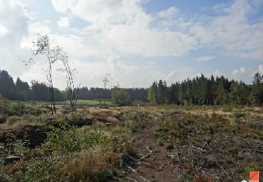
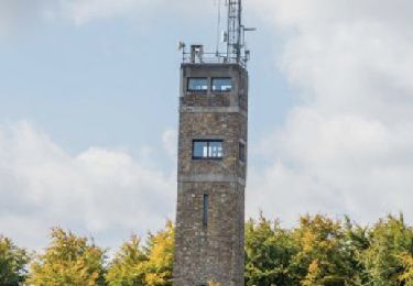
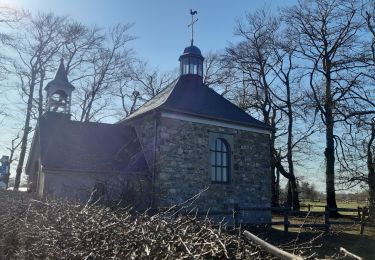
Tocht Te voet Waimes - #200801 - Mont Rigi(recalculated) - Photo

#200801 - Mont Rigi(recalculated)

 Randos Ouvertes
Randos Ouvertes

Gebruiker

© OpenStreetMap contributors
Lengte
Lengte
7 km
Max. hoogte
Max. hoogte
679 m
Positief hoogteverschil
96 m
Km-Effort
Km-Effort  
8,3 km
Min. hoogte
Min. hoogte
610 m
Negatief hoogteverschil
95 m
Boucle
Boucle
Ja
Datum van aanmaak :
2020-07-30 10:25:51.194
Laatste wijziging :
2020-11-11 17:00:15.762

(0 Bericht)

Te voet
Te voet
2h00
Moeilijkheid : Heel gemakkelijk

Scan deze QR-code om de tocht te openen in de SityTrail-applicatie

Gratisgps-wandelapplicatie

Logo SityTrail SityTrail

IGN / Geografische instituten

SityTrail uit de App Store downloaden SityTrail uit Google Play downloaden

Logo SityTrail SityTrail World

De wereld gaat voor u open

SityTrail uit de App Store downloaden SityTrail uit Google Play downloaden SityTrail op Huawei AppGallery downloaden

Over ons

Tocht Te voet van 7 km beschikbaar op Wallonië, Luik, Waimes. Deze tocht wordt voorgesteld door Randos Ouvertes.

Beschrijving

projet en cours

Hoogteprofiel

POI's

POI Malmedy - Heuvel - Photo
Randos Ouvertes
MALMEDY 
POI Malmedy - Hoge Venen - Photo
Randos Ouvertes
MALMEDY 
POI Malmedy - Fagne Polleur - Photo
Randos Ouvertes
MALMEDY 
POI Malmedy - Fagne de la Poleûr - Photo
Randos Ouvertes
POI Malmedy - Knuppelpaadjes - Photo
Randos Ouvertes
POI Malmedy - Polleurvenn - Photo
Randos Ouvertes
MALMEDY 
POI Malmedy - Fagne de Polleur - Photo
Randos Ouvertes
POI Malmedy - Wegwijzer - Photo
Randos Ouvertes
MALMEDY 
POI Waimes - Station météo - Photo
Randos Ouvertes
POI Waimes - Station scientifique des Hautes-Fagnes - Photo
Randos Ouvertes
POI Waimes - Mont Rigi - Photo
Randos Ouvertes
WAIMES 
POI Waimes - Lehrpfad Poleur-venn (4 Km) - Photo
Randos Ouvertes
POI Waimes - Ski Mont Rigi - Photo
Randos Ouvertes
POI Waimes - Opération Stösser - Photo
Randos Ouvertes
POI Waimes - Tourist Info Le Haut Pays Des Fagnes - Signal De Botrange - Photo
Randos Ouvertes

Plaatsbepaling

Land:
Belgium
Regio :
Wallonië
Departement/Provincie :
Luik
Gemeente :
Waimes
Locatie:
Robertville
Vertrek:(Dec)
Vertrek:(UTM)
292584 ; 5599478 (32U) N.

Wandeltochten in de omgeving

Tocht Stappen Waimes - RB-Lg-32_Botrange_via-racc-2 - Photo
Stappen
PRO

Stappen

(6)
Waimes, Wallonië, Luik, Belgium
16,7 km | 22 km-effort
5h 4min
Ja
Tocht Stappen Waimes - RB-Lg-32_Botrange_via-racc-1 - Photo
Stappen
PRO

Stappen

(7)
Waimes, Wallonië, Luik, Belgium
12,3 km | 15,7 km-effort
3h 34min
Ja
Tocht Stappen Waimes - RB-Lg-32_Botrange - Photo
Stappen
PRO

Stappen

(7)
Waimes, Wallonië, Luik, Belgium
19,6 km | 26 km-effort
5h 51min
Ja
Tocht Stappen Malmedy - RB-Lg-31_Malmedy - Photo
Stappen
PRO

Stappen

(6)
Malmedy, Wallonië, Luik, Belgium
16,9 km | 23 km-effort
5h 9min
Ja
Tocht Stappen Waimes - Sourbrodt - Circuit Natura 2000, des sites qui valent le détour - Lg11 - Photo
Stappen
GUIDE+

Stappen

Gemakkelijk
(8)
Waimes, Wallonië, Luik, Belgium
7,3 km | 8,3 km-effort
1h 50min
Ja
Tocht Stappen Waimes - Balade Peak Myrtille avec extension - restaurée - Photo
Stappen
PRO

Stappen

Medium
(38)
Waimes, Wallonië, Luik, Belgium
4,9 km | 6 km-effort
1h 22min
Ja
Tocht Stappen Waimes - Balade Peak Myrtille - restaurée - Photo
Stappen
PRO

Stappen

Gemakkelijk
(16)
Waimes, Wallonië, Luik, Belgium
2,7 km | 3,3 km-effort
45min
Ja
Tocht Stappen Waimes - Wandering Peak Beer IPA (new) - Photo
Stappen
PRO

Stappen

Medium
(30)
Waimes, Wallonië, Luik, Belgium
9,7 km | 12 km-effort
2h 43min
Ja
Tocht Stappen Waimes - baraque Michel . botrange  . baraque michel - Photo
Stappen
GUIDE
stef789

Stappen

Heel gemakkelijk
(2)
Waimes, Wallonië, Luik, Belgium
8,9 km | 10,5 km-effort
3h 2min
Ja


Sluiten
Mijn abonnementen