![](/images/other/stat-length.png)
![Tocht Mountainbike Jougne - Belcoster Poyette - Photo](https://media.geolcdn.com/t/1900/400/ext.pjpeg?maxdim=2&url=https%3A%2F%2Fstatic1.geolcdn.com%2Fsiteimages%2Fupload%2Ffiles%2F1524743154velo.jpg)
Belcoster Poyette
Michel Vermot
Gebruiker
![Lengte](/images/other/stat-length.png)
Lengte
19,2 km
![Max. hoogte](https://static1.geolcdn.com/siteimages/upload/files/1508320355ic_sort_altitude_max_24dp.png)
Max. hoogte
1396 m
![Positief hoogteverschil](https://static1.geolcdn.com/siteimages/upload/files/1508320355ic_sort_den_pos_24dp.png)
Positief hoogteverschil
632 m
![Km-Effort](/images/other/stat-length.png)
Km-Effort
28 km
![Min. hoogte](https://static1.geolcdn.com/siteimages/upload/files/1508320355ic_sort_altitude_min_24dp.png)
Min. hoogte
870 m
![Negatief hoogteverschil](https://static1.geolcdn.com/siteimages/upload/files/1508320355ic_sort_den_neg_24dp.png)
Negatief hoogteverschil
634 m
![Boucle](https://static1.geolcdn.com/siteimages/upload/files/16400158638029165_repeat_loop_refresh_sync_direction_icon.png)
Boucle
Ja
Datum van aanmaak :
2020-07-30 08:13:41.466
Laatste wijziging :
2020-07-30 10:14:22.505
![Mountainbike](https://static1.geolcdn.com/sitytour/trail-icons/202.png)
1h33
Moeilijkheid : Medium
![Scan deze QR-code om de tocht te openen in de SityTrail-applicatie](https://capi.geolives.com/qq0zvz2zws4bq2lad0pu/sitytour/trails/2495581/qr.png?size=200)
Gratisgps-wandelapplicatie
Over ons
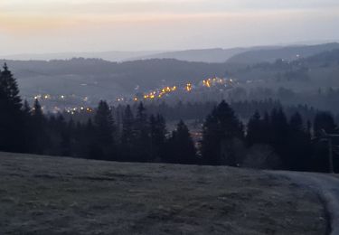
Tocht Mountainbike van 19,2 km beschikbaar op Bourgondië-Franche-Comté, Doubs, Jougne. Deze tocht wordt voorgesteld door Michel Vermot.
Beschrijving
Petit tour sympa depuis les Echampès (commune de Jougne) jusqu'au pied du Suchet. Beaux point de vue sur la chaîne des Alpes
Plaatsbepaling
Land:
France
Regio :
Bourgondië-Franche-Comté
Departement/Provincie :
Doubs
Gemeente :
Jougne
Locatie:
Unknown
Vertrek:(Dec)
Vertrek:(UTM)
300436 ; 5179226 (32T) N.
Opmerkingen
Wandeltochten in de omgeving
![Tocht Mountainbike Vallorbe - Le Suchet - Photo](https://media.geolcdn.com/t/375/260/ext.jpg?maxdim=2&url=https%3A%2F%2Fstatic1.geolcdn.com%2Fsiteimages%2Fupload%2Ffiles%2F1524743154velo.jpg)
![Mountainbike Mountainbike](https://static1.geolcdn.com/sitytour/trail-icons/202.png)
Le Suchet
Mountainbike
Heel gemakkelijk
(1)
Vallorbe,
Waadland,
District du Jura-Nord vaudois,
Switzerland
![](/images/other/stat-length.png)
35 km | 53 km-effort
14h 41min
![](https://static1.geolcdn.com/siteimages/upload/files/16400158638029165_repeat_loop_refresh_sync_direction_icon.png)
Ja
![Tocht Te voet Vallorbe - Mont d'Orzeires - Le Pont Gare - Photo](https://media.geolcdn.com/t/375/260/7e9156be-5722-477c-ab77-407a4f623ffb.jpeg&format=jpg&maxdim=2)
![Te voet Te voet](https://static1.geolcdn.com/sitytour/trail-icons/100.png)
Mont d'Orzeires - Le Pont Gare
Te voet
Gemakkelijk
Vallorbe,
Waadland,
District du Jura-Nord vaudois,
Switzerland
![](/images/other/stat-length.png)
3,2 km | 4,4 km-effort
59min
![](https://static1.geolcdn.com/siteimages/upload/files/16400158638029165_repeat_loop_refresh_sync_direction_icon.png)
Neen
![Tocht Te voet Ballaigues - Ballaigues-Vallorbe - Photo](https://media.geolcdn.com/t/375/260/94e39ae2-cd96-4289-ab6b-b58b7f70c35d.jpeg&format=jpg&maxdim=2)
![Te voet Te voet](https://static1.geolcdn.com/sitytour/trail-icons/100.png)
Ballaigues-Vallorbe
Te voet
Gemakkelijk
Ballaigues,
Waadland,
District du Jura-Nord vaudois,
Switzerland
![](/images/other/stat-length.png)
5,1 km | 6,3 km-effort
1h 25min
![](https://static1.geolcdn.com/siteimages/upload/files/16400158638029165_repeat_loop_refresh_sync_direction_icon.png)
Neen
![Tocht Stappen Jougne - Aiguilles de Baulmes - Suisse - Photo](https://media.geolcdn.com/t/375/260/ext.jpg?maxdim=2&url=https%3A%2F%2Fstatic1.geolcdn.com%2Fsiteimages%2Fupload%2Ffiles%2F1553511878bg_sport_marche.png)
![Stappen Stappen](https://static1.geolcdn.com/sitytour/trail-icons/101.png)
Aiguilles de Baulmes - Suisse
Stappen
Moeilijk
(1)
Jougne,
Bourgondië-Franche-Comté,
Doubs,
France
![](/images/other/stat-length.png)
16,4 km | 26 km-effort
5h 33min
![](https://static1.geolcdn.com/siteimages/upload/files/16400158638029165_repeat_loop_refresh_sync_direction_icon.png)
Ja
![Tocht Stappen Métabief - GTJ Metabief - Pontarlier - Photo](https://media.geolcdn.com/t/375/260/ext.jpg?maxdim=2&url=https%3A%2F%2Fstatic1.geolcdn.com%2Fsiteimages%2Fupload%2Ffiles%2F1553511878bg_sport_marche.png)
![Stappen Stappen](https://static1.geolcdn.com/sitytour/trail-icons/101.png)
GTJ Metabief - Pontarlier
Stappen
Medium
(1)
Métabief,
Bourgondië-Franche-Comté,
Doubs,
France
![](/images/other/stat-length.png)
25 km | 35 km-effort
7h 17min
![](https://static1.geolcdn.com/siteimages/upload/files/16400158638029165_repeat_loop_refresh_sync_direction_icon.png)
Neen
![Tocht Stappen Métabief - Le mont d 0r - Photo](https://media.geolcdn.com/t/375/260/dfbdcbfb-f5e1-43ae-8768-86e7f8471cb6.jpg&format=jpg&maxdim=2)
![Stappen Stappen](https://static1.geolcdn.com/sitytour/trail-icons/101.png)
Le mont d 0r
Stappen
Medium
Métabief,
Bourgondië-Franche-Comté,
Doubs,
France
![](/images/other/stat-length.png)
18,5 km | 25 km-effort
4h 38min
![](https://static1.geolcdn.com/siteimages/upload/files/16400158638029165_repeat_loop_refresh_sync_direction_icon.png)
Neen
![Tocht Sneeuwschoenen Métabief - Les hauteurs de Metabief - Photo](https://media.geolcdn.com/t/375/260/33f04111-8af2-4c09-927f-ba23e9559149.jpg&format=jpg&maxdim=2)
![Sneeuwschoenen Sneeuwschoenen](https://static1.geolcdn.com/sitytour/trail-icons/504.png)
Les hauteurs de Metabief
Sneeuwschoenen
Medium
(1)
Métabief,
Bourgondië-Franche-Comté,
Doubs,
France
![](/images/other/stat-length.png)
15,5 km | 23 km-effort
3h 51min
![](https://static1.geolcdn.com/siteimages/upload/files/16400158638029165_repeat_loop_refresh_sync_direction_icon.png)
Ja
![Tocht Stappen Jougne - La Jougnena - Photo](https://media.geolcdn.com/t/375/260/ext.jpg?maxdim=2&url=https%3A%2F%2Fstatic1.geolcdn.com%2Fsiteimages%2Fupload%2Ffiles%2F1553511878bg_sport_marche.png)
![Stappen Stappen](https://static1.geolcdn.com/sitytour/trail-icons/101.png)
La Jougnena
Stappen
Zeer moeilijk
(1)
Jougne,
Bourgondië-Franche-Comté,
Doubs,
France
![](/images/other/stat-length.png)
17,7 km | 24 km-effort
5h 32min
![](https://static1.geolcdn.com/siteimages/upload/files/16400158638029165_repeat_loop_refresh_sync_direction_icon.png)
Ja
![Tocht Stappen Jougne - La poyette - Photo](https://media.geolcdn.com/t/375/260/7455827d-3f9e-4079-9524-3e53ae00a5a5.jpg&format=jpg&maxdim=2)
![Stappen Stappen](https://static1.geolcdn.com/sitytour/trail-icons/101.png)
La poyette
Stappen
Medium
Jougne,
Bourgondië-Franche-Comté,
Doubs,
France
![](/images/other/stat-length.png)
11,8 km | 17,9 km-effort
4h 7min
![](https://static1.geolcdn.com/siteimages/upload/files/16400158638029165_repeat_loop_refresh_sync_direction_icon.png)
Ja