


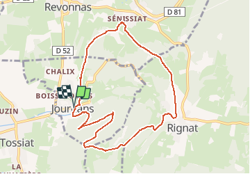

11,2 km | 15,5 km-effort


Gebruiker


Gratisgps-wandelapplicatie
 SityTrail
IGN / Geografische instituten
SityTrail World
De wereld gaat voor u open
Tocht Stappen van 9,3 km beschikbaar op Auvergne-Rhône-Alpes, Ain, Journans. Deze tocht wordt voorgesteld door Didier & Florette.
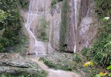
Ne pas manquer la source de la Reyssouze au départ.
Attention, 2 clôtures de pâturage à franchir pour accéder à la descente de la combe du Sorbier.
Stappen

Mountainbike
Mountainbike

Stappen
Mountainbike
Mountainbike
Stappen
Stappen
Stappen