Tocht Paard Forest-l'Abbaye - exp_[visibles].gpx - Photo
 liebniz
liebniz

Gebruiker

© OpenStreetMap contributors
Lengte
Lengte
21 km
Max. hoogte
Max. hoogte
90 m
Positief hoogteverschil
208 m
Km-Effort
Km-Effort  
23 km
Min. hoogte
Min. hoogte
31 m
Negatief hoogteverschil
206 m
Boucle
Boucle
Ja
Datum van aanmaak :
2020-07-19 06:22:28.733
Laatste wijziging :
2020-07-19 06:35:19.659

(0 Bericht)

Paard
Paard
--
Moeilijkheid : Heel gemakkelijk

Scan deze QR-code om de tocht te openen in de SityTrail-applicatie

Gratisgps-wandelapplicatie

Logo SityTrail SityTrail

IGN / Geografische instituten

SityTrail uit de App Store downloaden SityTrail uit Google Play downloaden

Logo SityTrail SityTrail World

De wereld gaat voor u open

SityTrail uit de App Store downloaden SityTrail uit Google Play downloaden SityTrail op Huawei AppGallery downloaden

Over ons

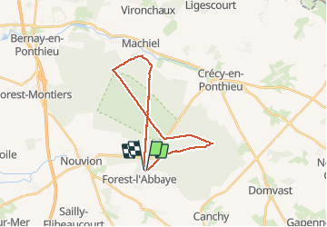
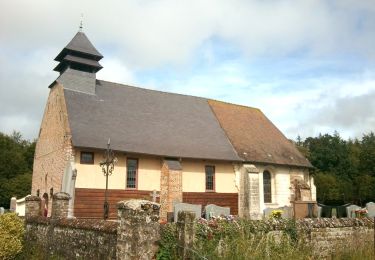
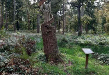
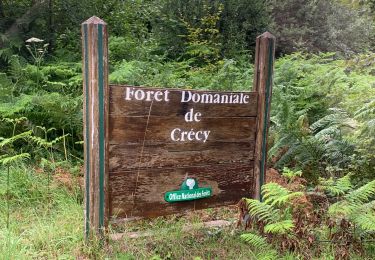
Tocht Paard van 21 km beschikbaar op Hauts-de-France, Somme, Forest-l'Abbaye. Deze tocht wordt voorgesteld door liebniz.

Beschrijving

grp_trc:[visibles]

Hoogteprofiel

Plaatsbepaling

Land:
France
Regio :
Hauts-de-France
Departement/Provincie :
Somme
Gemeente :
Forest-l'Abbaye
Locatie:
Unknown
Vertrek:(UTM)
416357 ; 5562417 (31U) N.

Wandeltochten in de omgeving

Tocht Fiets Crécy-en-Ponthieu - Les Vieux Chênes - Crécy en Ponthieu - Photo
Fiets
tracegps

Fiets

Moeilijk
(1)
Crécy-en-Ponthieu, Hauts-de-France, Somme, France
49 km | 54 km-effort
3h 0min
Ja
Tocht Mountainbike Forest-l'Abbaye - Forest-l'Abbaye Cyclisme - Photo
Mountainbike

Mountainbike

Gemakkelijk
Forest-l'Abbaye, Hauts-de-France, Somme, France
9,4 km | 10,6 km-effort
43min
Ja
Tocht Stappen Forest-l'Abbaye - Forest l’Abbaye  - Photo
Stappen
jpblimond

Stappen

Medium
Forest-l'Abbaye, Hauts-de-France, Somme, France
18,5 km | 21 km-effort
4h 22min
Ja
Tocht Stappen Forest-l'Abbaye - À la découverte d'arbres remarquables en Forêt de Crécy - Photo
Stappen

Stappen

Medium
Forest-l'Abbaye, Hauts-de-France, Somme, France
7,9 km | 8,8 km-effort
1h 59min
Ja
Tocht Stappen Crécy-en-Ponthieu - Forêt de Crécy  - Photo
Stappen
uyl1

Stappen

Medium
Crécy-en-Ponthieu, Hauts-de-France, Somme, France
6,3 km | 7 km-effort
2h 21min
Ja
Tocht Te voet Forest-l'Abbaye - Le Hallot - Photo
Te voet
PRO

Te voet

Gemakkelijk
Forest-l'Abbaye, Hauts-de-France, Somme, France
4,3 km | 4,9 km-effort
1h 6min
Ja
Tocht Stappen Crécy-en-Ponthieu - LP80_Crecy Ponthieu_Scultures bois - Photo
Stappen
GR77LP

Stappen

Heel gemakkelijk
Crécy-en-Ponthieu, Hauts-de-France, Somme, France
4,2 km | 4,7 km-effort
1h 41min
Neen
Tocht Mountainbike Crécy-en-Ponthieu - activity_5258602101 - Photo
Mountainbike

Mountainbike

Heel gemakkelijk
Crécy-en-Ponthieu, Hauts-de-France, Somme, France
12,6 km | 14,1 km-effort
40min
Ja
Tocht Stappen Forest-l'Abbaye - LP80_FOREST-L'ABBAYE_7.9Km - Photo
Stappen

Stappen

Medium
Forest-l'Abbaye, Hauts-de-France, Somme, France
7,9 km | 8,8 km-effort
1h 56min
Ja


Sluiten
Mijn abonnementen