


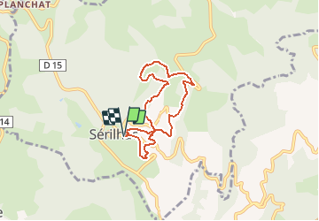

37 km | 50 km-effort


Gebruiker


Gratisgps-wandelapplicatie
 SityTrail
IGN / Geografische instituten
SityTrail World
De wereld gaat voor u open
Tocht Stappen van 6,2 km beschikbaar op Nieuw-Aquitanië, Corrèze, Sérilhac. Deze tocht wordt voorgesteld door Gpoujade.
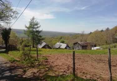
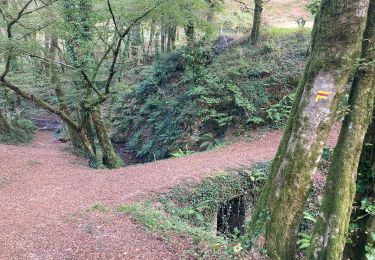
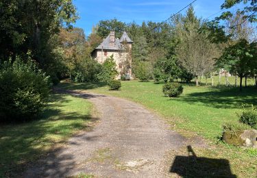
Belle rando , avec des points de vues un peu partout, pour la découverte d'une partie de la commune de Sérilhac .

Mountainbike
Mountainbike
Mountainbike
Mountainbike
Mountainbike
Mountainbike
Stappen
Stappen

Stappen