![](/images/other/stat-length.png)
![Tocht Sneeuwschoenen Cerniébaud - Cerniébaud - Combe Simon - Photo](https://media.geolcdn.com/t/1900/400/ext.pjpeg?maxdim=2&url=https%3A%2F%2Fservices.sitytrail.com%2FGeolivesWS%2FDownloadMedia.ashx%3FTrailID%3D247460%26Media%3Dfix__20140205114610.jpg)
Cerniébaud - Combe Simon
albert39
Gebruiker
![Lengte](/images/other/stat-length.png)
Lengte
8,7 km
![Max. hoogte](https://static1.geolcdn.com/siteimages/upload/files/1508320355ic_sort_altitude_max_24dp.png)
Max. hoogte
1112 m
![Positief hoogteverschil](https://static1.geolcdn.com/siteimages/upload/files/1508320355ic_sort_den_pos_24dp.png)
Positief hoogteverschil
228 m
![Km-Effort](/images/other/stat-length.png)
Km-Effort
11,7 km
![Min. hoogte](https://static1.geolcdn.com/siteimages/upload/files/1508320355ic_sort_altitude_min_24dp.png)
Min. hoogte
966 m
![Negatief hoogteverschil](https://static1.geolcdn.com/siteimages/upload/files/1508320355ic_sort_den_neg_24dp.png)
Negatief hoogteverschil
227 m
![Boucle](https://static1.geolcdn.com/siteimages/upload/files/16400158638029165_repeat_loop_refresh_sync_direction_icon.png)
Boucle
Ja
Datum van aanmaak :
2014-12-10 00:00:00.0
Laatste wijziging :
2014-12-10 00:00:00.0
![Sneeuwschoenen](https://static1.geolcdn.com/sitytour/trail-icons/504.png)
2h52
Moeilijkheid : Medium
![Scan deze QR-code om de tocht te openen in de SityTrail-applicatie](https://capi.geolives.com/qq0zvz2zws4bq2lad0pu/sitytour/trails/247460/qr.png?size=200)
Gratisgps-wandelapplicatie
Over ons
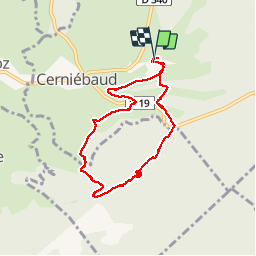
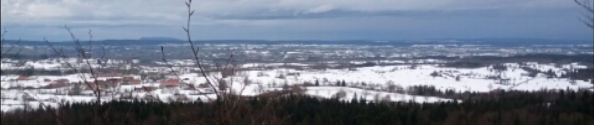
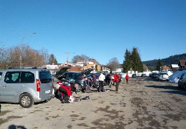
Tocht Sneeuwschoenen van 8,7 km beschikbaar op Bourgondië-Franche-Comté, Jura, Cerniébaud. Deze tocht wordt voorgesteld door albert39.
Beschrijving
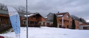
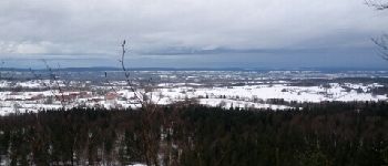
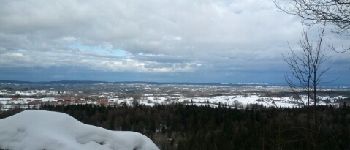
Départ Chalet de la Haute-Joux, circuit N°7 : Le Pélerin, D:7,6km, Dénivelé:220m, La combe des eaux, Forêt du Prince, Belvédère du Mouflon (1110m), casse-coûte au Gîte salle hors sac.
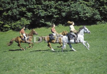
Plaatsbepaling
Land:
France
Regio :
Bourgondië-Franche-Comté
Departement/Provincie :
Jura
Gemeente :
Cerniébaud
Locatie:
Unknown
Vertrek:(Dec)
Vertrek:(UTM)
279795 ; 5179715 (32T) N.
Opmerkingen
Wandeltochten in de omgeving
![Tocht Paard Longcochon - Haut Jura - Longcochon - Cerniébaud - Photo](https://media.geolcdn.com/t/375/260/ext.jpg?maxdim=2&url=https%3A%2F%2Fservices.sitytrail.com%2FGeolivesWS%2FDownloadMedia.ashx%3FTrailID%3D109529%26Media%3D4106_1.jpg)
![Paard Paard](https://static1.geolcdn.com/sitytour/trail-icons/300.png)
Haut Jura - Longcochon - Cerniébaud
Paard
Moeilijk
(1)
Longcochon,
Bourgondië-Franche-Comté,
Jura,
France
![](/images/other/stat-length.png)
22 km | 29 km-effort
3h 0min
![](https://static1.geolcdn.com/siteimages/upload/files/16400158638029165_repeat_loop_refresh_sync_direction_icon.png)
Neen
![Tocht Te voet Mouthe - Les Roches - Photo](https://media.geolcdn.com/t/375/260/8948c562-be23-41e6-9f5c-24fd893182ae.jpeg&format=jpg&maxdim=2)
![Te voet Te voet](https://static1.geolcdn.com/sitytour/trail-icons/100.png)
Les Roches
Te voet
Gemakkelijk
Mouthe,
Bourgondië-Franche-Comté,
Doubs,
France
![](/images/other/stat-length.png)
4,2 km | 6,1 km-effort
1h 23min
![](https://static1.geolcdn.com/siteimages/upload/files/16400158638029165_repeat_loop_refresh_sync_direction_icon.png)
Ja
![Tocht Stappen Fraroz - Cerniébaud 24 sept 2020 CAF - Photo](https://media.geolcdn.com/t/375/260/b6bd267a-1d25-46b2-b9f4-3f005d8f0356.jpg&format=jpg&maxdim=2)
![Stappen Stappen](https://static1.geolcdn.com/sitytour/trail-icons/101.png)
Cerniébaud 24 sept 2020 CAF
Stappen
Moeilijk
Fraroz,
Bourgondië-Franche-Comté,
Jura,
France
![](/images/other/stat-length.png)
21 km | 29 km-effort
6h 9min
![](https://static1.geolcdn.com/siteimages/upload/files/16400158638029165_repeat_loop_refresh_sync_direction_icon.png)
Ja
![Tocht Sneeuwschoenen Cerniébaud - Chalet Haute Joux - Photo](https://media.geolcdn.com/t/375/260/ext.jpg?maxdim=2&url=https%3A%2F%2Fservices.sitytrail.com%2FGeolivesWS%2FDownloadMedia.ashx%3FTrailID%3D388078%26Media%3Dfix__20150219162418.jpg)
![Sneeuwschoenen Sneeuwschoenen](https://static1.geolcdn.com/sitytour/trail-icons/504.png)
Chalet Haute Joux
Sneeuwschoenen
Medium
Cerniébaud,
Bourgondië-Franche-Comté,
Jura,
France
![](/images/other/stat-length.png)
20 km | 25 km-effort
5h 42min
![](https://static1.geolcdn.com/siteimages/upload/files/16400158638029165_repeat_loop_refresh_sync_direction_icon.png)
Ja
![Tocht Sneeuwschoenen Cerniébaud - vendredi jura - Photo](https://media.geolcdn.com/t/375/260/0aacb4a7-ee6b-4656-8d55-ee29049e0792.jpg&format=jpg&maxdim=2)
![Sneeuwschoenen Sneeuwschoenen](https://static1.geolcdn.com/sitytour/trail-icons/504.png)
vendredi jura
Sneeuwschoenen
Medium
Cerniébaud,
Bourgondië-Franche-Comté,
Jura,
France
![](/images/other/stat-length.png)
11,4 km | 15,6 km-effort
3h 43min
![](https://static1.geolcdn.com/siteimages/upload/files/16400158638029165_repeat_loop_refresh_sync_direction_icon.png)
Neen
![Tocht Sneeuwschoenen Fraroz - rando raquette haut joux - Photo](https://media.geolcdn.com/t/375/260/8c60f75a-96d8-437f-9f10-9526a0d25b80.jpg&format=jpg&maxdim=2)
![Sneeuwschoenen Sneeuwschoenen](https://static1.geolcdn.com/sitytour/trail-icons/504.png)
rando raquette haut joux
Sneeuwschoenen
Medium
Fraroz,
Bourgondië-Franche-Comté,
Jura,
France
![](/images/other/stat-length.png)
9,9 km | 12,6 km-effort
3h 8min
![](https://static1.geolcdn.com/siteimages/upload/files/16400158638029165_repeat_loop_refresh_sync_direction_icon.png)
Neen
![Tocht Stappen Arsure-Arsurette - GTJ Etape 14 : Arsure-Arsurette Foncine le Haut - Photo](https://media.geolcdn.com/t/375/260/8c0dda21-3cfb-4cb9-a6d9-501aa5806865.jpg&format=jpg&maxdim=2)
![Stappen Stappen](https://static1.geolcdn.com/sitytour/trail-icons/101.png)
GTJ Etape 14 : Arsure-Arsurette Foncine le Haut
Stappen
Medium
Arsure-Arsurette,
Bourgondië-Franche-Comté,
Jura,
France
![](/images/other/stat-length.png)
15,8 km | 22 km-effort
5h 13min
![](https://static1.geolcdn.com/siteimages/upload/files/16400158638029165_repeat_loop_refresh_sync_direction_icon.png)
Neen
![Tocht Stappen Mouthe - Petite Chaux - Photo](https://media.geolcdn.com/t/375/260/07f031f0-a585-4e3e-9dc6-d5a83338a57e.jpg&format=jpg&maxdim=2)
![Stappen Stappen](https://static1.geolcdn.com/sitytour/trail-icons/101.png)
Petite Chaux
Stappen
Heel gemakkelijk
Mouthe,
Bourgondië-Franche-Comté,
Doubs,
France
![](/images/other/stat-length.png)
19,7 km | 26 km-effort
5h 31min
![](https://static1.geolcdn.com/siteimages/upload/files/16400158638029165_repeat_loop_refresh_sync_direction_icon.png)
Neen
![Tocht Paard Cerniébaud - Haut Jura - Cerniébaud - Chapelle des Bois - Photo](https://media.geolcdn.com/t/375/260/ext.jpg?maxdim=2&url=https%3A%2F%2Fservices.sitytrail.com%2FGeolivesWS%2FDownloadMedia.ashx%3FTrailID%3D109550%26Media%3D4128_1.jpg)
![Paard Paard](https://static1.geolcdn.com/sitytour/trail-icons/300.png)
Haut Jura - Cerniébaud - Chapelle des Bois
Paard
Moeilijk
(1)
Cerniébaud,
Bourgondië-Franche-Comté,
Jura,
France
![](/images/other/stat-length.png)
34 km | 47 km-effort
5h 0min
![](https://static1.geolcdn.com/siteimages/upload/files/16400158638029165_repeat_loop_refresh_sync_direction_icon.png)
Neen