![](/images/other/stat-length.png)
![Tocht Stappen Cerdon - Cerdon : La cascade de Fouges (18 km - D. 823 m) - Photo](https://media.geolcdn.com/t/1900/400/be00382b-1477-4d53-bf4f-55ec6d8fd5ca.jpg&format=pjpeg&maxdim=2)
Cerdon : La cascade de Fouges (18 km - D. 823 m)
Thomasdanielle
Gebruiker
![Lengte](/images/other/stat-length.png)
![Max. hoogte](https://static1.geolcdn.com/siteimages/upload/files/1508320355ic_sort_altitude_max_24dp.png)
![Positief hoogteverschil](https://static1.geolcdn.com/siteimages/upload/files/1508320355ic_sort_den_pos_24dp.png)
![Km-Effort](/images/other/stat-length.png)
![Min. hoogte](https://static1.geolcdn.com/siteimages/upload/files/1508320355ic_sort_altitude_min_24dp.png)
![Negatief hoogteverschil](https://static1.geolcdn.com/siteimages/upload/files/1508320355ic_sort_den_neg_24dp.png)
![Boucle](https://static1.geolcdn.com/siteimages/upload/files/16400158638029165_repeat_loop_refresh_sync_direction_icon.png)
![Stappen](https://static1.geolcdn.com/sitytour/trail-icons/101.png)
6h36
Moeilijkheid : Zeer moeilijk
![Scan deze QR-code om de tocht te openen in de SityTrail-applicatie](https://capi.geolives.com/qq0zvz2zws4bq2lad0pu/sitytour/trails/2473817/qr.png?size=200)
Gratisgps-wandelapplicatie
Over ons
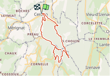
Tocht Stappen van 17,9 km beschikbaar op Auvergne-Rhône-Alpes, Ain, Cerdon. Deze tocht wordt voorgesteld door Thomasdanielle.
Beschrijving
D/A stationner au centre village prêt de la poste
Départ : Emprunter la rue du Maquis D11B que l'on quitte pour un sentier qui rejoint la D1084, traverser et prendre le chemin à travers les vignes jusqu'au col du Crêt du jour.
Puis suivre le GPS et la carte.
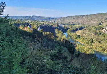
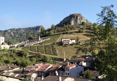
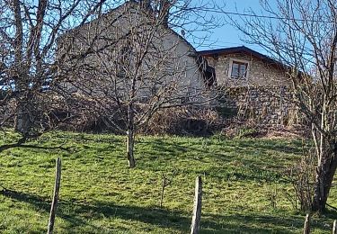
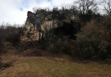
A voir :
- Gouffre de la Fouges (cascade)
- Le Gué de Malpasset
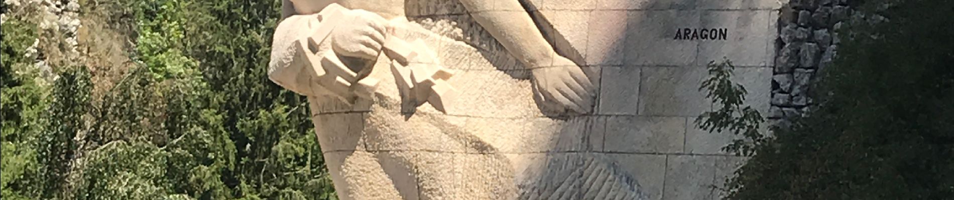
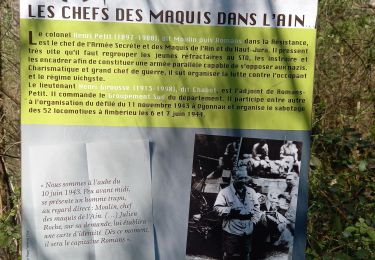
- Le monument aux morts du Maquis
Plaatsbepaling
Opmerkingen
Wandeltochten in de omgeving
![Tocht Stappen Poncin - leymiat merignai breigne - Photo](https://media.geolcdn.com/t/375/260/ext.jpg?maxdim=2&url=https%3A%2F%2Fstatic1.geolcdn.com%2Fsiteimages%2Fupload%2Ffiles%2F1553511878bg_sport_marche.png)
![Stappen Stappen](https://static1.geolcdn.com/sitytour/trail-icons/101.png)
Stappen
![](/images/other/stat-length.png)
![](https://static1.geolcdn.com/siteimages/upload/files/16400158638029165_repeat_loop_refresh_sync_direction_icon.png)
![Tocht Stappen Izenave - l'avocat les eolienes - Photo](https://media.geolcdn.com/t/375/260/061ed967-df56-4e4d-9584-2df596d455cb.jpg&format=jpg&maxdim=2)
![Stappen Stappen](https://static1.geolcdn.com/sitytour/trail-icons/101.png)
Stappen
![](/images/other/stat-length.png)
![](https://static1.geolcdn.com/siteimages/upload/files/16400158638029165_repeat_loop_refresh_sync_direction_icon.png)
![Tocht Stappen Challes-la-Montagne - challes la montagne barrage lallement la cueille sameriat - Photo](https://media.geolcdn.com/t/375/260/3cb2918d-30ca-499e-bf94-e7bdff3fa3f8.jpg&format=jpg&maxdim=2)
![Stappen Stappen](https://static1.geolcdn.com/sitytour/trail-icons/101.png)
Stappen
![](/images/other/stat-length.png)
![](https://static1.geolcdn.com/siteimages/upload/files/16400158638029165_repeat_loop_refresh_sync_direction_icon.png)
![Tocht Te voet Vieu-d'Izenave - les pentes de l'Avocat - Photo](https://media.geolcdn.com/t/375/260/ext.jpg?maxdim=2&url=https%3A%2F%2Fstatic1.geolcdn.com%2Fsiteimages%2Fupload%2Ffiles%2F1545311037marcheuse_200dpi.jpg)
![Te voet Te voet](https://static1.geolcdn.com/sitytour/trail-icons/100.png)
Te voet
![](/images/other/stat-length.png)
![](https://static1.geolcdn.com/siteimages/upload/files/16400158638029165_repeat_loop_refresh_sync_direction_icon.png)
![Tocht Stappen Cerdon - 01_CERDON_CASCADE_FOUGE_18 km_780m - Photo](https://media.geolcdn.com/t/375/260/026a26c5-b2f7-4ada-8315-1f30b324ac8e.jpg&format=jpg&maxdim=2)
![Stappen Stappen](https://static1.geolcdn.com/sitytour/trail-icons/101.png)
Stappen
![](/images/other/stat-length.png)
![](https://static1.geolcdn.com/siteimages/upload/files/16400158638029165_repeat_loop_refresh_sync_direction_icon.png)
![Tocht Stappen Poncin - les bords de l ain depart povin - Photo](https://media.geolcdn.com/t/375/260/1cf13da9-1f19-47d9-8ce3-5d16a77dd449.jpg&format=jpg&maxdim=2)
![Stappen Stappen](https://static1.geolcdn.com/sitytour/trail-icons/101.png)
Stappen
![](/images/other/stat-length.png)
![](https://static1.geolcdn.com/siteimages/upload/files/16400158638029165_repeat_loop_refresh_sync_direction_icon.png)
![Tocht Stappen Jujurieux - 01-Jujurieux-Neuville-restau-18-7km-440m-fev22 - Photo](https://media.geolcdn.com/t/375/260/51235138-d6dc-494f-9a52-96125c4e0560.jpg&format=jpg&maxdim=2)
![Stappen Stappen](https://static1.geolcdn.com/sitytour/trail-icons/101.png)
Stappen
![](/images/other/stat-length.png)
![](https://static1.geolcdn.com/siteimages/upload/files/16400158638029165_repeat_loop_refresh_sync_direction_icon.png)
![Tocht Stappen Cerdon - Le cerdon parr le drapeau - Photo](https://media.geolcdn.com/t/375/260/36e91cd3-f8b8-4408-8ac1-7b7204422aa9.jpg&format=jpg&maxdim=2)
![Stappen Stappen](https://static1.geolcdn.com/sitytour/trail-icons/101.png)
Stappen
![](/images/other/stat-length.png)
![](https://static1.geolcdn.com/siteimages/upload/files/16400158638029165_repeat_loop_refresh_sync_direction_icon.png)
![Tocht Wegfiets Poncin - Circuit l'Ain à vélo n° 22 - Et au milieu coule une rivière... - Photo](https://media.geolcdn.com/t/375/260/ext.jpg?maxdim=2&url=http%3A%2F%2Fwww.circuits-de-france.com%2Fimage%2Fphoto%2F7774_33600_0_fr.jpg)
![Wegfiets Wegfiets](https://static1.geolcdn.com/sitytour/trail-icons/201.png)
Wegfiets
![](/images/other/stat-length.png)
![](https://static1.geolcdn.com/siteimages/upload/files/16400158638029165_repeat_loop_refresh_sync_direction_icon.png)