![](/images/other/stat-length.png)
![Tocht Stappen Sainte-Croix-du-Mont - Circuit Ste. Croix du mont / Verdelais / St. Maixant - Photo](https://media.geolcdn.com/t/1900/400/aad8da9f-fe2d-4390-8a4e-2ffa2a94545a.jpg&format=pjpeg&maxdim=2)
Circuit Ste. Croix du mont / Verdelais / St. Maixant
bedous
Gebruiker
![Lengte](/images/other/stat-length.png)
![Max. hoogte](https://static1.geolcdn.com/siteimages/upload/files/1508320355ic_sort_altitude_max_24dp.png)
![Positief hoogteverschil](https://static1.geolcdn.com/siteimages/upload/files/1508320355ic_sort_den_pos_24dp.png)
![Km-Effort](/images/other/stat-length.png)
![Min. hoogte](https://static1.geolcdn.com/siteimages/upload/files/1508320355ic_sort_altitude_min_24dp.png)
![Negatief hoogteverschil](https://static1.geolcdn.com/siteimages/upload/files/1508320355ic_sort_den_neg_24dp.png)
![Boucle](https://static1.geolcdn.com/siteimages/upload/files/16400158638029165_repeat_loop_refresh_sync_direction_icon.png)
![Stappen](https://static1.geolcdn.com/sitytour/trail-icons/101.png)
5h06
Moeilijkheid : Medium
![Scan deze QR-code om de tocht te openen in de SityTrail-applicatie](https://capi.geolives.com/qq0zvz2zws4bq2lad0pu/sitytour/trails/2460087/qr.png?size=200)
Gratisgps-wandelapplicatie
Over ons
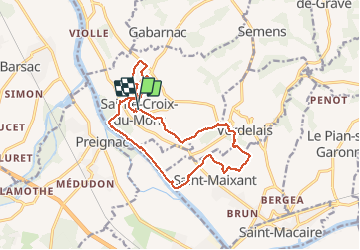
Tocht Stappen van 16,2 km beschikbaar op Nieuw-Aquitanië, Gironde, Sainte-Croix-du-Mont. Deze tocht wordt voorgesteld door bedous.
Beschrijving
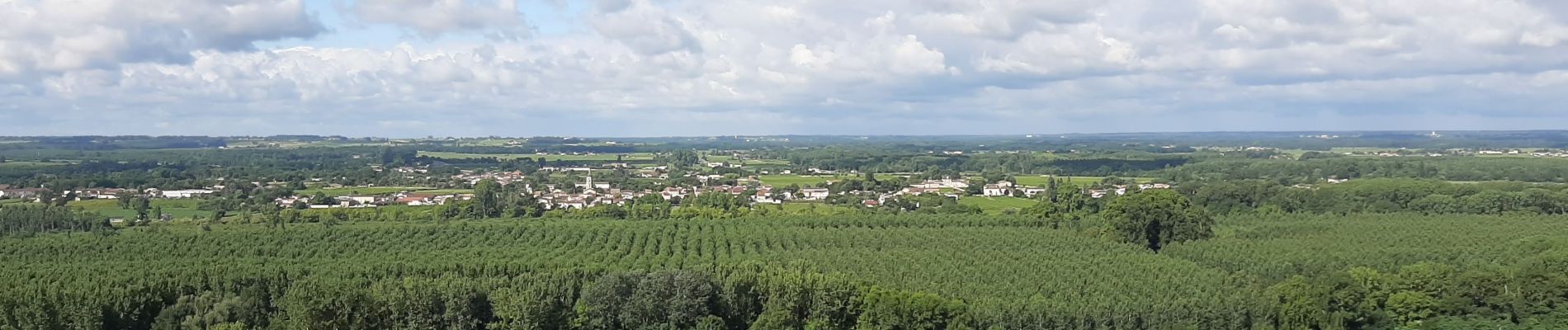
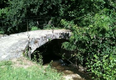
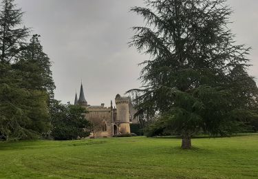
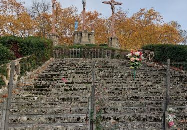
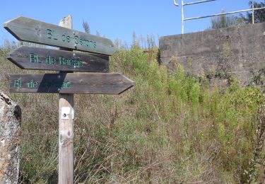
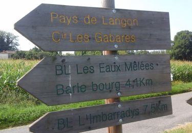
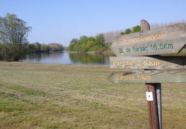
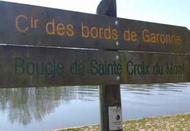
Randonnée en bord de Garonne et sur les "hauteurs" avec des vues magnifiques, au travers des vignes et multiples chateaux, de petits chemins ....., mais un grandiose calvaire et un chemin de croix constitué de multiples chapelles dans un bois descendant du calvaire au Verdelais.
En bord de Garonne des carrelets et souvent des lieux si agréables et à respecter ! A Ste. Croix du mont voir le banc d'huitres fossilisées depuis 22 millions d'années.......etc.... Randonnée à effectuer en dégustant les vins sans abus.
Plaatsbepaling
Opmerkingen
Wandeltochten in de omgeving
![Tocht Stappen Verdelais - Verdelais boucle n1 1h30 7km - Photo](https://media.geolcdn.com/t/375/260/ext.jpg?maxdim=2&url=https%3A%2F%2Fservices.sitytrail.com%2FGeolivesWS%2FDownloadMedia.ashx%3FTrailID%3D40628%26Media%3Dimage8.jpg)
![Stappen Stappen](https://static1.geolcdn.com/sitytour/trail-icons/101.png)
Stappen
![](/images/other/stat-length.png)
![](https://static1.geolcdn.com/siteimages/upload/files/16400158638029165_repeat_loop_refresh_sync_direction_icon.png)
![Tocht Stappen Loupiac - Loupiac. Les coteaux. - Photo](https://media.geolcdn.com/t/375/260/f2129390-37e4-44db-941f-7256aa8ef486.jpg&format=jpg&maxdim=2)
![Stappen Stappen](https://static1.geolcdn.com/sitytour/trail-icons/101.png)
Stappen
![](/images/other/stat-length.png)
![](https://static1.geolcdn.com/siteimages/upload/files/16400158638029165_repeat_loop_refresh_sync_direction_icon.png)
![Tocht Stappen Verdelais - Verdelais - Photo](https://media.geolcdn.com/t/375/260/ac506b0f-5859-4b40-94f2-5df41beb3f87.jpg&format=jpg&maxdim=2)
![Stappen Stappen](https://static1.geolcdn.com/sitytour/trail-icons/101.png)
Stappen
![](/images/other/stat-length.png)
![](https://static1.geolcdn.com/siteimages/upload/files/16400158638029165_repeat_loop_refresh_sync_direction_icon.png)
![Tocht Te voet Cérons - Boucle locale de Cérons - Photo](https://media.geolcdn.com/t/375/260/0cb637ee-2c72-4b29-98b2-63dc8718bd3c.jpeg&format=jpg&maxdim=2)
![Te voet Te voet](https://static1.geolcdn.com/sitytour/trail-icons/100.png)
Te voet
![](/images/other/stat-length.png)
![](https://static1.geolcdn.com/siteimages/upload/files/16400158638029165_repeat_loop_refresh_sync_direction_icon.png)
![Tocht Te voet Langon - Les Gabares : circuit départemental - Photo](https://media.geolcdn.com/t/375/260/d1c9893c-3e2a-436e-a388-d134a1bf0ef0.jpeg&format=jpg&maxdim=2)
![Te voet Te voet](https://static1.geolcdn.com/sitytour/trail-icons/100.png)
Te voet
![](/images/other/stat-length.png)
![](https://static1.geolcdn.com/siteimages/upload/files/16400158638029165_repeat_loop_refresh_sync_direction_icon.png)
![Tocht Te voet Loupiac - Monprimblanc et Loupiac : boucle locale - Photo](https://media.geolcdn.com/t/375/260/252b1336-069e-4cad-9573-2b7af99298fc.jpeg&format=jpg&maxdim=2)
![Te voet Te voet](https://static1.geolcdn.com/sitytour/trail-icons/100.png)
Te voet
![](/images/other/stat-length.png)
![](https://static1.geolcdn.com/siteimages/upload/files/16400158638029165_repeat_loop_refresh_sync_direction_icon.png)
![Tocht Te voet Barsac - Boucle locale de Barsac - Photo](https://media.geolcdn.com/t/375/260/aa6a797b-3dd2-4ea5-8850-cf566be6458d.jpeg&format=jpg&maxdim=2)
![Te voet Te voet](https://static1.geolcdn.com/sitytour/trail-icons/100.png)
Te voet
![](/images/other/stat-length.png)
![](https://static1.geolcdn.com/siteimages/upload/files/16400158638029165_repeat_loop_refresh_sync_direction_icon.png)
![Tocht Te voet Verdelais - Boucle locale de Verdelais - Photo](https://media.geolcdn.com/t/375/260/1483325e-e526-4e1b-bde7-bab75ad5ace7.jpeg&format=jpg&maxdim=2)
![Te voet Te voet](https://static1.geolcdn.com/sitytour/trail-icons/100.png)
Te voet
![](/images/other/stat-length.png)
![](https://static1.geolcdn.com/siteimages/upload/files/16400158638029165_repeat_loop_refresh_sync_direction_icon.png)
![Tocht Te voet Saint-Maixant - Saint-Maixant : boucle locale - Photo](https://media.geolcdn.com/t/375/260/10cbbc93-cab1-482e-b4e6-d201754cfc58.jpeg&format=jpg&maxdim=2)
![Te voet Te voet](https://static1.geolcdn.com/sitytour/trail-icons/100.png)
Te voet
![](/images/other/stat-length.png)
![](https://static1.geolcdn.com/siteimages/upload/files/16400158638029165_repeat_loop_refresh_sync_direction_icon.png)