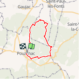
![](/images/other/stat-length.png)
![Tocht Stappen Pouzilhac - POUZILHAC - LE SENTIER BOTANIQUE - 11.3 Km - 3h00 - Dénivelé 228 m - Photo](https://media.geolcdn.com/t/1900/400/ext.pjpeg?maxdim=2&url=https%3A%2F%2Fstatic1.geolcdn.com%2Fsiteimages%2Fupload%2Ffiles%2F1553511878bg_sport_marche.png)
POUZILHAC - LE SENTIER BOTANIQUE - 11.3 Km - 3h00 - Dénivelé 228 m
dansmabulle
Gebruiker
![Lengte](/images/other/stat-length.png)
![Max. hoogte](https://static1.geolcdn.com/siteimages/upload/files/1508320355ic_sort_altitude_max_24dp.png)
![Positief hoogteverschil](https://static1.geolcdn.com/siteimages/upload/files/1508320355ic_sort_den_pos_24dp.png)
![Km-Effort](/images/other/stat-length.png)
![Min. hoogte](https://static1.geolcdn.com/siteimages/upload/files/1508320355ic_sort_altitude_min_24dp.png)
![Negatief hoogteverschil](https://static1.geolcdn.com/siteimages/upload/files/1508320355ic_sort_den_neg_24dp.png)
![Boucle](https://static1.geolcdn.com/siteimages/upload/files/16400158638029165_repeat_loop_refresh_sync_direction_icon.png)
![Stappen](https://static1.geolcdn.com/sitytour/trail-icons/101.png)
3h03
Moeilijkheid : Medium
![Scan deze QR-code om de tocht te openen in de SityTrail-applicatie](https://capi.geolives.com/qq0zvz2zws4bq2lad0pu/sitytour/trails/244577/qr.png?size=200)
Gratisgps-wandelapplicatie
Over ons
Tocht Stappen van 11,3 km beschikbaar op Occitanië, Gard, Pouzilhac. Deze tocht wordt voorgesteld door dansmabulle.
Beschrijving
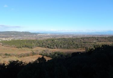
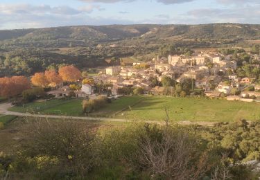
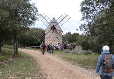
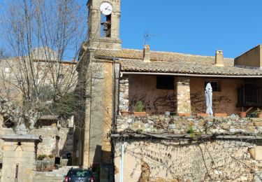
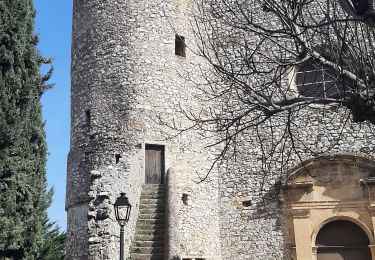
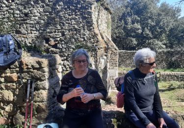
Sentier botanique de Gaujac et la forêt de Pouzilhac au programme du circuit, avec la possibilité de faire le tour complet du sentier botanique (20mn de plus). Très belles vues sur la vallée du Rhône. Du centre sportif de Pouzilhac, partir au nord par un bon chemin qui devient un sentier et domine le paysage. Descendre au sentier botanique puis quitter la combe à campagne Athon. Admirer le paysage tout le long de la montée, puis à travers bois en suivant le balisage jaune, retourner au parking. Bonne rando.
Plaatsbepaling
Opmerkingen
Wandeltochten in de omgeving
![Tocht Stappen Pouzilhac - Le sentier botanique - Pouzilhac - Photo](https://media.geolcdn.com/t/375/260/ext.jpg?maxdim=2&url=https%3A%2F%2Fservices.sitytrail.com%2FGeolivesWS%2FDownloadMedia.ashx%3FTrailID%3D317463%26Media%3D16695_6.jpg)
![Stappen Stappen](https://static1.geolcdn.com/sitytour/trail-icons/101.png)
Stappen
![](/images/other/stat-length.png)
![](https://static1.geolcdn.com/siteimages/upload/files/16400158638029165_repeat_loop_refresh_sync_direction_icon.png)
![Tocht Stappen Valliguières - Valliguières - St Pierre - Solidarité - Photo](https://media.geolcdn.com/t/375/260/34c7644f-964a-475b-8438-72b62b10d114.jpg&format=jpg&maxdim=2)
![Stappen Stappen](https://static1.geolcdn.com/sitytour/trail-icons/101.png)
Stappen
![](/images/other/stat-length.png)
![](https://static1.geolcdn.com/siteimages/upload/files/16400158638029165_repeat_loop_refresh_sync_direction_icon.png)
![Tocht Stappen Valliguières - Valliguières - Etang - St Pierre - Photo](https://media.geolcdn.com/t/375/260/34c7644f-964a-475b-8438-72b62b10d114.jpg&format=jpg&maxdim=2)
![Stappen Stappen](https://static1.geolcdn.com/sitytour/trail-icons/101.png)
Stappen
![](/images/other/stat-length.png)
![](https://static1.geolcdn.com/siteimages/upload/files/16400158638029165_repeat_loop_refresh_sync_direction_icon.png)
![Stappen Stappen](https://static1.geolcdn.com/sitytour/trail-icons/101.png)
Stappen
![](/images/other/stat-length.png)
![](https://static1.geolcdn.com/siteimages/upload/files/16400158638029165_repeat_loop_refresh_sync_direction_icon.png)
![Tocht Stappen La Capelle-et-Masmolène - La Capelle-et-Masmolène - Photo](https://media.geolcdn.com/t/375/260/f4bee39f-4c39-4cab-8a93-6bf86aad1227.jpg&format=jpg&maxdim=2)
![Stappen Stappen](https://static1.geolcdn.com/sitytour/trail-icons/101.png)
Stappen
![](/images/other/stat-length.png)
![](https://static1.geolcdn.com/siteimages/upload/files/16400158638029165_repeat_loop_refresh_sync_direction_icon.png)
![Tocht Stappen La Capelle-et-Masmolène - la Capelle Masmolène - Photo](https://media.geolcdn.com/t/375/260/bef0fd11-cf52-40d2-a314-8a457cce1486.jpg&format=jpg&maxdim=2)
![Stappen Stappen](https://static1.geolcdn.com/sitytour/trail-icons/101.png)
Stappen
![](/images/other/stat-length.png)
![](https://static1.geolcdn.com/siteimages/upload/files/16400158638029165_repeat_loop_refresh_sync_direction_icon.png)
![Tocht Stappen Saint-Victor-la-Coste - Saint victor la coste 300323 - Photo](https://media.geolcdn.com/t/375/260/b12b695c-7275-4742-bf11-008804646dd6.jpg&format=jpg&maxdim=2)
![Stappen Stappen](https://static1.geolcdn.com/sitytour/trail-icons/101.png)
Stappen
![](/images/other/stat-length.png)
![](https://static1.geolcdn.com/siteimages/upload/files/16400158638029165_repeat_loop_refresh_sync_direction_icon.png)
![Tocht Stappen Gaujac - Gaujac 160323 - Photo](https://media.geolcdn.com/t/375/260/439ce872-f270-4bfe-a0e1-c0bcc7ef5229.jpg&format=jpg&maxdim=2)
![Stappen Stappen](https://static1.geolcdn.com/sitytour/trail-icons/101.png)
![Tocht Stappen Saint-Victor-la-Coste - St Victor la Coste Goule de Navet - Photo](https://media.geolcdn.com/t/375/260/4895cb47-8177-4f48-bef5-74ca2af99397.jpg&format=jpg&maxdim=2)
![Stappen Stappen](https://static1.geolcdn.com/sitytour/trail-icons/101.png)
Stappen
![](/images/other/stat-length.png)
![](https://static1.geolcdn.com/siteimages/upload/files/16400158638029165_repeat_loop_refresh_sync_direction_icon.png)