![](/images/other/stat-length.png)
![Tocht Stappen Deluz - Deluz, chapelle d'Aigremont - croix de Souvance - Photo](https://media.geolcdn.com/t/1900/400/f6f22e16-0e84-400c-b95d-a7229feab287.jpg&format=pjpeg&maxdim=2)
Deluz, chapelle d'Aigremont - croix de Souvance
eltonnermou
Gebruiker
![Lengte](/images/other/stat-length.png)
![Max. hoogte](https://static1.geolcdn.com/siteimages/upload/files/1508320355ic_sort_altitude_max_24dp.png)
![Positief hoogteverschil](https://static1.geolcdn.com/siteimages/upload/files/1508320355ic_sort_den_pos_24dp.png)
![Km-Effort](/images/other/stat-length.png)
![Min. hoogte](https://static1.geolcdn.com/siteimages/upload/files/1508320355ic_sort_altitude_min_24dp.png)
![Negatief hoogteverschil](https://static1.geolcdn.com/siteimages/upload/files/1508320355ic_sort_den_neg_24dp.png)
![Boucle](https://static1.geolcdn.com/siteimages/upload/files/16400158638029165_repeat_loop_refresh_sync_direction_icon.png)
![Stappen](https://static1.geolcdn.com/sitytour/trail-icons/101.png)
3h28
Moeilijkheid : Medium
![Scan deze QR-code om de tocht te openen in de SityTrail-applicatie](https://capi.geolives.com/qq0zvz2zws4bq2lad0pu/sitytour/trails/2437418/qr.png?size=200)
Gratisgps-wandelapplicatie
Over ons
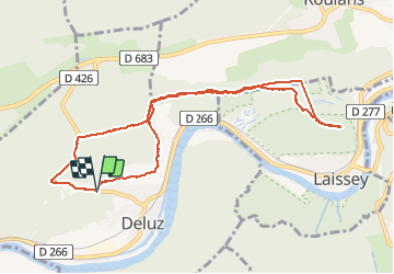
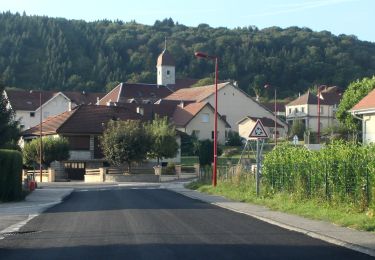
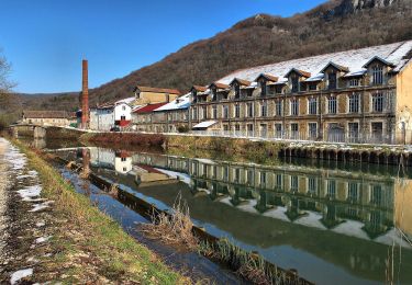
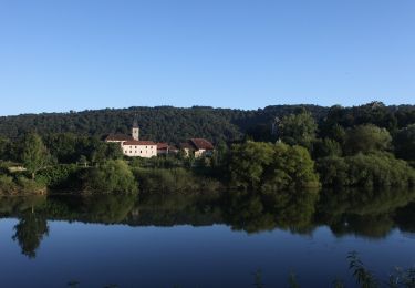
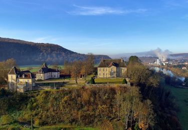
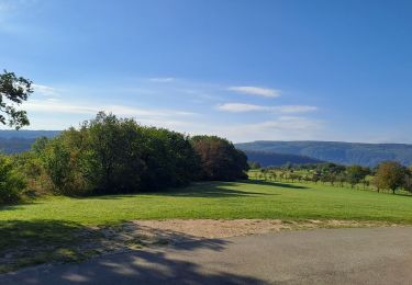
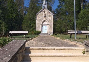
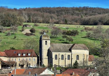
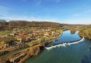
Tocht Stappen van 9,8 km beschikbaar op Bourgondië-Franche-Comté, Doubs, Deluz. Deze tocht wordt voorgesteld door eltonnermou.
Beschrijving
randonnée en groupe ; la distance est 10,2km (oubli de relancer l'enregistrement).
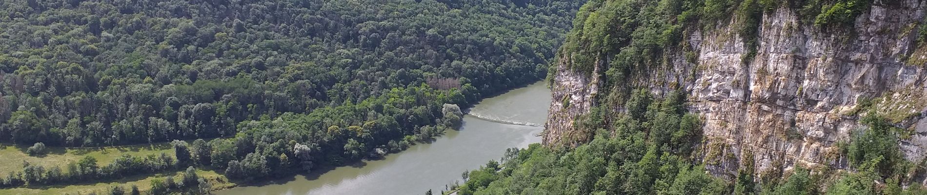
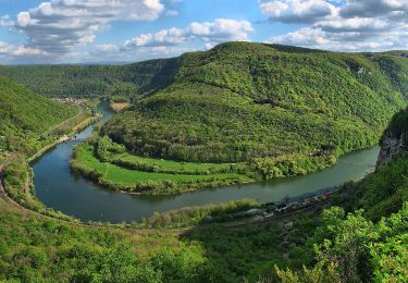
belle randonnée avec passages plus difficiles, bâtons fortement conseillés, en sous bois sur une très grande partie ; des belvédères offrant des points de vue magnifiques. Vous risquez de surprendre des chevreuils, et profitez des plantes et de la nature.
Plaatsbepaling
Opmerkingen
Wandeltochten in de omgeving
![Tocht Te voet Nancray - Sentier du Tour des Landes - Photo](https://media.geolcdn.com/t/375/260/dca2d2cb-2448-41ff-970e-c18701afcb22.jpeg&format=jpg&maxdim=2)
![Te voet Te voet](https://static1.geolcdn.com/sitytour/trail-icons/100.png)
Te voet
![](/images/other/stat-length.png)
![](https://static1.geolcdn.com/siteimages/upload/files/16400158638029165_repeat_loop_refresh_sync_direction_icon.png)
![Tocht Te voet Deluz - Sentier du Château Loriot - Photo](https://media.geolcdn.com/t/375/260/a6c0a960-bcfb-4e05-ab1e-cb250b6d6d40.jpeg&format=jpg&maxdim=2)
![Te voet Te voet](https://static1.geolcdn.com/sitytour/trail-icons/100.png)
Te voet
![](/images/other/stat-length.png)
![](https://static1.geolcdn.com/siteimages/upload/files/16400158638029165_repeat_loop_refresh_sync_direction_icon.png)
![Tocht Te voet Deluz - Sentier du Patrimoine - Photo](https://media.geolcdn.com/t/375/260/3858c5b3-abf9-4504-8767-bbab2b7352b8.jpeg&format=jpg&maxdim=2)
![Te voet Te voet](https://static1.geolcdn.com/sitytour/trail-icons/100.png)
Te voet
![](/images/other/stat-length.png)
![](https://static1.geolcdn.com/siteimages/upload/files/16400158638029165_repeat_loop_refresh_sync_direction_icon.png)
![Tocht Te voet Vaire - Sentier des Sources 2 - Photo](https://media.geolcdn.com/t/375/260/0ecedb62-3c33-4251-8982-81e9743d8322.jpeg&format=jpg&maxdim=2)
![Te voet Te voet](https://static1.geolcdn.com/sitytour/trail-icons/100.png)
Te voet
![](/images/other/stat-length.png)
![](https://static1.geolcdn.com/siteimages/upload/files/16400158638029165_repeat_loop_refresh_sync_direction_icon.png)
![Tocht Te voet Vaire - Sentier des Sources 1 - Photo](https://media.geolcdn.com/t/375/260/3b895425-3268-42d6-8ef6-757959f26627.jpeg&format=jpg&maxdim=2)
![Te voet Te voet](https://static1.geolcdn.com/sitytour/trail-icons/100.png)
Te voet
![](/images/other/stat-length.png)
![](https://static1.geolcdn.com/siteimages/upload/files/16400158638029165_repeat_loop_refresh_sync_direction_icon.png)
![Tocht Stappen Amagney - Amagney Ferme de Rufille Marchaux Amagney - Photo](https://media.geolcdn.com/t/375/260/ffd6ac8b-8fb9-4275-8d55-80b04a29e6ed.jpg&format=jpg&maxdim=2)
![Stappen Stappen](https://static1.geolcdn.com/sitytour/trail-icons/101.png)
Stappen
![](/images/other/stat-length.png)
![](https://static1.geolcdn.com/siteimages/upload/files/16400158638029165_repeat_loop_refresh_sync_direction_icon.png)
![Tocht Stappen Vaire - vaire le petit - Photo](https://media.geolcdn.com/t/375/260/8f23000f-8031-4a3e-b8c7-010445a2b43b.jpg&format=jpg&maxdim=2)
![Stappen Stappen](https://static1.geolcdn.com/sitytour/trail-icons/101.png)
Stappen
![](/images/other/stat-length.png)
![](https://static1.geolcdn.com/siteimages/upload/files/16400158638029165_repeat_loop_refresh_sync_direction_icon.png)
![Tocht Te voet Amagney - Sentier d'Amagney - Photo](https://media.geolcdn.com/t/375/260/383202e7-4796-4fc8-ba0a-67e6402f0540.jpeg&format=jpg&maxdim=2)
![Te voet Te voet](https://static1.geolcdn.com/sitytour/trail-icons/100.png)
Te voet
![](/images/other/stat-length.png)
![](https://static1.geolcdn.com/siteimages/upload/files/16400158638029165_repeat_loop_refresh_sync_direction_icon.png)
![Tocht Te voet Champlive - Sentier des Crêtes - Photo](https://media.geolcdn.com/t/375/260/7c732505-4f0b-4f56-a014-1317e06c73a8.jpeg&format=jpg&maxdim=2)
![Te voet Te voet](https://static1.geolcdn.com/sitytour/trail-icons/100.png)
Te voet
![](/images/other/stat-length.png)
![](https://static1.geolcdn.com/siteimages/upload/files/16400158638029165_repeat_loop_refresh_sync_direction_icon.png)