


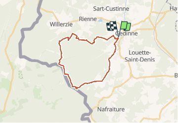

22 km | 28 km-effort


Gebruiker GUIDE


Gratisgps-wandelapplicatie
 SityTrail
IGN / Geografische instituten
SityTrail World
De wereld gaat voor u open
Tocht Stappen van 24 km beschikbaar op Wallonië, Namen, Gedinne. Deze tocht wordt voorgesteld door rvapeldo.
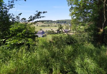
Tour classique dans le massif de la Croix Scaille, au départ du parking du camping du même nom, situé en fait à côté de Gedinne. Possibilité de grimper dans la tour du Millénaire. Repas ou verre possible au resto/taverne du camping.


Stappen

Stappen

Stappen
Stappen
Stappen
Stappen

Te voet

Te voet