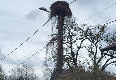
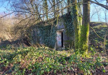
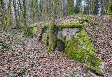
Tocht Andere activiteiten Argiésans - Urcerey - Photo
 alexbnmr
alexbnmr

Gebruiker

© OpenStreetMap contributors
Lengte
Lengte
13,8 km
Max. hoogte
Max. hoogte
460 m
Positief hoogteverschil
217 m
Km-Effort
Km-Effort  
16,6 km
Min. hoogte
Min. hoogte
365 m
Negatief hoogteverschil
196 m
Boucle
Boucle
Neen
Datum van aanmaak :
2014-12-10 00:00:00.0
Laatste wijziging :
2014-12-10 00:00:00.0

(0 Bericht)

Andere activiteiten
Andere activiteiten
1h44
Moeilijkheid : Onbekend

Scan deze QR-code om de tocht te openen in de SityTrail-applicatie

Gratisgps-wandelapplicatie

Logo SityTrail SityTrail

IGN / Geografische instituten

SityTrail uit de App Store downloaden SityTrail uit Google Play downloaden

Logo SityTrail SityTrail World

De wereld gaat voor u open

SityTrail uit de App Store downloaden SityTrail uit Google Play downloaden SityTrail op Huawei AppGallery downloaden

Over ons

Tocht Andere activiteiten van 13,8 km beschikbaar op Bourgondië-Franche-Comté, Territoire-de-Belfort, Argiésans. Deze tocht wordt voorgesteld door alexbnmr.

Hoogteprofiel

POI's

POI Argiésans - Point 1 - Photo
alexbnmr
ARGIÉSANS 
POI Urcerey - Point 2 - Photo
alexbnmr
URCEREY 
POI Urcerey - Point 3 - Photo
alexbnmr
URCEREY 
POI Urcerey - Point 4 - Photo
alexbnmr
URCEREY 
POI Urcerey - Point 5 - Photo
alexbnmr
URCEREY 
POI Urcerey - Point 6 - Photo
alexbnmr
URCEREY 
POI Urcerey - Point 7 - Photo
alexbnmr
URCEREY 
POI Urcerey - Point 8 - Photo
alexbnmr
URCEREY 
POI Urcerey - Point 9 - Photo
alexbnmr
URCEREY 
POI Urcerey - Point 10 - Photo
alexbnmr
URCEREY 
POI Urcerey - Point 11 - Photo
alexbnmr
URCEREY 
POI Urcerey - Point 12 - Photo
alexbnmr
URCEREY 
POI Urcerey - Point 13 - Photo
alexbnmr
URCEREY 
POI Urcerey - Point 14 - Photo
alexbnmr
URCEREY 
POI Urcerey - Point 15 - Photo
alexbnmr
URCEREY 
POI Urcerey - Point 16 - Photo
alexbnmr
URCEREY 
POI Urcerey - Point 17 - Photo
alexbnmr
URCEREY 
POI Urcerey - Point 18 - Photo
alexbnmr
URCEREY 
POI Urcerey - Point 19 - Photo
alexbnmr
URCEREY 
POI Urcerey - Point 20 - Photo
alexbnmr
URCEREY 
POI Urcerey - Point 21 - Photo
alexbnmr
URCEREY 
POI Urcerey - Point 22 - Photo
alexbnmr
URCEREY 
POI Urcerey - Point 23 - Photo
alexbnmr
URCEREY 
POI Urcerey - Point 24 - Photo
alexbnmr
URCEREY 
POI Urcerey - Point 25 - Photo
alexbnmr
URCEREY 
POI Urcerey - Point 26 - Photo
alexbnmr
URCEREY 
POI Urcerey - Point 27 - Photo
alexbnmr
URCEREY 
POI Urcerey - Point 28 - Photo
alexbnmr
URCEREY 
POI Urcerey - Point 29 - Photo
alexbnmr
URCEREY 
POI Urcerey - Point 30 - Photo
alexbnmr
URCEREY 
POI Urcerey - Point 31 - Photo
alexbnmr
URCEREY 
POI Urcerey - Point 32 - Photo
alexbnmr
URCEREY 
POI Urcerey - Point 33 - Photo
alexbnmr
URCEREY 
POI Urcerey - Point 34 - Photo
alexbnmr
URCEREY 
POI Urcerey - Point 35 - Photo
alexbnmr
URCEREY 
POI Urcerey - Point 36 - Photo
alexbnmr
URCEREY 
POI Urcerey - Point 37 - Photo
alexbnmr
URCEREY 
POI Urcerey - Point 38 - Photo
alexbnmr
URCEREY 
POI Urcerey - Point 39 - Photo
alexbnmr
URCEREY 
POI Argiésans - Point 40 - Photo
alexbnmr
ARGIÉSANS 
POI Urcerey - Point 41 - Photo
alexbnmr
URCEREY 
POI Urcerey - Point 42 - Photo
alexbnmr
URCEREY 
POI Urcerey - Point 43 - Photo
alexbnmr
URCEREY 
POI Urcerey - Point 44 - Photo
alexbnmr
URCEREY 
POI Urcerey - Point 45 - Photo
alexbnmr
URCEREY 
POI Urcerey - Point 46 - Photo
alexbnmr
URCEREY 
POI Urcerey - Point 47 - Photo
alexbnmr
URCEREY 
POI Urcerey - Point 48 - Photo
alexbnmr
URCEREY 
POI Urcerey - Point 49 - Photo
alexbnmr
URCEREY 
POI Urcerey - Point 50 - Photo
alexbnmr
URCEREY 

Plaatsbepaling

Land:
France
Regio :
Bourgondië-Franche-Comté
Departement/Provincie :
Territoire-de-Belfort
Gemeente :
Argiésans
Locatie:
Unknown
Vertrek:(Dec)
Vertrek:(UTM)
335662 ; 5274912 (32T) N.

Wandeltochten in de omgeving

Tocht Stappen Héricourt - La Pierre Plate - Héricourt - Photo
Stappen
tracegps

Stappen

Moeilijk
(3)
Héricourt, Bourgondië-Franche-Comté, Haute-Saône, France
12 km | 16,4 km-effort
3h 10min
Ja
Tocht Mountainbike Andelnans - Tour d'Essert - Photo
Mountainbike
qlqin

Mountainbike

Gemakkelijk
(2)
Andelnans, Bourgondië-Franche-Comté, Territoire-de-Belfort, France
29 km | 36 km-effort
2h 12min
Ja
Tocht Stappen Belfort - Offemont - La ballade des Champs Cerisiers - Photo
Stappen
bmorel@orange.fr

Stappen

Gemakkelijk
(1)
Belfort, Bourgondië-Franche-Comté, Territoire-de-Belfort, France
8,8 km | 10,8 km-effort
Onbekend
Ja
Tocht Elektrische fiets Essert - VTT - Essert - Salbert - Vétrigne - Miotte - Citadelle Belfort - Essert - Photo
Elektrische fiets
Bart2015

Elektrische fiets

Moeilijk
Essert, Bourgondië-Franche-Comté, Territoire-de-Belfort, France
42 km | 55 km-effort
4h 55min
Ja
Tocht Elektrische fiets Châlonvillars - VTT - Châlonvillars - Etobon - Ronchamp - Plancher-Bas - Malsaucy - Photo
Elektrische fiets
Bart2015

Elektrische fiets

Moeilijk
Châlonvillars, Bourgondië-Franche-Comté, Haute-Saône, France
71 km | 90 km-effort
5h 50min
Ja
Tocht Stappen Banvillars - Banvillars - forts du Hauts Bois et du Bois d'Oye - Photo
Stappen
Bart2015

Stappen

Zeer moeilijk
Banvillars, Bourgondië-Franche-Comté, Territoire-de-Belfort, France
16,3 km | 21 km-effort
4h 40min
Ja
Tocht Stappen Mandrevillars - Echenans et son fort - Photo
Stappen
Bart2015

Stappen

Zeer moeilijk
Mandrevillars, Bourgondië-Franche-Comté, Haute-Saône, France
14,8 km | 19,6 km-effort
4h 27min
Ja
Tocht Stappen Sevenans - Randonnée des forts depuis Sévenans - Photo
Stappen
Bart2015

Stappen

Zeer moeilijk
Sevenans, Bourgondië-Franche-Comté, Territoire-de-Belfort, France
19,9 km | 24 km-effort
5h 26min
Ja
Tocht Stappen Châlonvillars - Châlonvillars - Fort du Salbert - Evette-Salbert - Photo
Stappen
Bart2015

Stappen

Moeilijk
(1)
Châlonvillars, Bourgondië-Franche-Comté, Haute-Saône, France
11 km | 15,8 km-effort
3h 36min
Ja


Sluiten
Mijn abonnementen