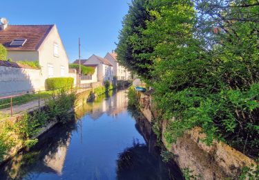
Tocht Stappen Crécy-la-Chapelle - Les coteaux du Grand Morin - Photo
 Bntg
Bntg

Gebruiker

© OpenStreetMap contributors
Lengte
Lengte
11,8 km
Max. hoogte
Max. hoogte
132 m
Positief hoogteverschil
189 m
Km-Effort
Km-Effort  
14,3 km
Min. hoogte
Min. hoogte
47 m
Negatief hoogteverschil
189 m
Boucle
Boucle
Ja
Datum van aanmaak :
2020-06-04 20:39:20.893
Laatste wijziging :
2020-07-28 01:14:06.962

(0 Bericht)

Stappen
Stappen
3h06
Moeilijkheid : Medium

Scan deze QR-code om de tocht te openen in de SityTrail-applicatie

Gratisgps-wandelapplicatie

Logo SityTrail SityTrail

IGN / Geografische instituten

SityTrail uit de App Store downloaden SityTrail uit Google Play downloaden

Logo SityTrail SityTrail World

De wereld gaat voor u open

SityTrail uit de App Store downloaden SityTrail uit Google Play downloaden SityTrail op Huawei AppGallery downloaden

Over ons

Tocht Stappen van 11,8 km beschikbaar op Île-de-France, Seine-et-Marne, Crécy-la-Chapelle. Deze tocht wordt voorgesteld door Bntg.

Beschrijving

Une randonnée à recommander avec aussi bien des sous-bois, des communes agréables, des chemins à travers champs, des cours d’eau et bien sûr Le Grand-Morin.
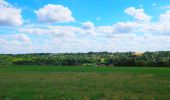
Nous l’avons faite fin juillet et toutes les cultures céréalières n’étant pas encore rentrées, le coup d’œil et les couleurs étaient magnifiques. Qu’en sera-t-il à d’autres saisons ?
De même, tous les chemins son praticables par temps sec mais je pense que certains passages sont à éviter juste après la saison des pluies (notamment le dernier quart).

Hoogteprofiel

Foto's

Plaatsbepaling

Land:
France
Regio :
Île-de-France
Departement/Provincie :
Seine-et-Marne
Gemeente :
Crécy-la-Chapelle
Locatie:
Unknown
Vertrek:(Dec)
Vertrek:(UTM)
491400 ; 5412260 (31U) N.

Wandeltochten in de omgeving

Tocht Stappen Crécy-la-Chapelle - Boucle 28 km autour de Crecy la Chapelle - Guérard - Voulangis - Tigeaux - Photo
Stappen
GUIDE
chessyca

Stappen

Medium
Crécy-la-Chapelle, Île-de-France, Seine-et-Marne, France
28 km | 35 km-effort
5h 46min
Ja
Tocht Stappen Crécy-la-Chapelle - Crécy la Chapelle Parcours normal - Photo
Stappen
CC.RIDER

Stappen

Gemakkelijk
(1)
Crécy-la-Chapelle, Île-de-France, Seine-et-Marne, France
16,1 km | 19,5 km-effort
4h 18min
Ja
Tocht Stappen Crécy-la-Chapelle - Crécy la chapelle - Photo
Stappen
CC.RIDER

Stappen

Gemakkelijk
(2)
Crécy-la-Chapelle, Île-de-France, Seine-et-Marne, France
19,7 km | 24 km-effort
5h 12min
Ja
Tocht Stappen Crécy-la-Chapelle - Crécy la Chapelle - Photo
Stappen
jctinchebray

Stappen

Medium
(1)
Crécy-la-Chapelle, Île-de-France, Seine-et-Marne, France
16,4 km | 20 km-effort
4h 23min
Ja
Tocht Stappen Crécy-la-Chapelle - Autour de Tigeaux - Photo
Stappen
em77

Stappen

Medium
(2)
Crécy-la-Chapelle, Île-de-France, Seine-et-Marne, France
13,2 km | 16,5 km-effort
2h 37min
Ja
Tocht Stappen Voulangis - Voulangis - Crécy - Villiers lqqm - Photo
Stappen
Tournan

Stappen

Moeilijk
(1)
Voulangis, Île-de-France, Seine-et-Marne, France
12,9 km | 15,7 km-effort
3h 34min
Ja
Tocht Stappen Voulangis - Voulangis - Crécy - Villiers - Photo
Stappen
Tournan

Stappen

Moeilijk
(1)
Voulangis, Île-de-France, Seine-et-Marne, France
12,9 km | 15,7 km-effort
3h 34min
Ja
Tocht Stappen Tigeaux - Tigeaux - Photo
Stappen
Tournan

Stappen

Medium
(1)
Tigeaux, Île-de-France, Seine-et-Marne, France
19,1 km | 24 km-effort
5h 24min
Ja
Tocht Stappen Esbly - Esbly -Couilly - Quincy - Photo
Stappen
Tournan

Stappen

Gemakkelijk
(1)
Esbly, Île-de-France, Seine-et-Marne, France
14,1 km | 16,5 km-effort
3h 44min
Ja


Sluiten
Mijn abonnementen