![](/images/other/stat-length.png)
![Tocht Stappen Fontainebleau - Mare aux fées - Rocher des Etroitures - Photo](https://media.geolcdn.com/t/1900/400/ext.pjpeg?maxdim=2&url=https%3A%2F%2Fstatic1.geolcdn.com%2Fsiteimages%2Fupload%2Ffiles%2F1553511878bg_sport_marche.png)
Mare aux fées - Rocher des Etroitures
dargnat
Gebruiker
![Lengte](/images/other/stat-length.png)
Lengte
2,5 km
![Max. hoogte](https://static1.geolcdn.com/siteimages/upload/files/1508320355ic_sort_altitude_max_24dp.png)
Max. hoogte
137 m
![Positief hoogteverschil](https://static1.geolcdn.com/siteimages/upload/files/1508320355ic_sort_den_pos_24dp.png)
Positief hoogteverschil
44 m
![Km-Effort](/images/other/stat-length.png)
Km-Effort
3,1 km
![Min. hoogte](https://static1.geolcdn.com/siteimages/upload/files/1508320355ic_sort_altitude_min_24dp.png)
Min. hoogte
92 m
![Negatief hoogteverschil](https://static1.geolcdn.com/siteimages/upload/files/1508320355ic_sort_den_neg_24dp.png)
Negatief hoogteverschil
48 m
![Boucle](https://static1.geolcdn.com/siteimages/upload/files/16400158638029165_repeat_loop_refresh_sync_direction_icon.png)
Boucle
Ja
Datum van aanmaak :
2020-05-31 20:14:17.821
Laatste wijziging :
2020-05-31 20:20:40.613
![Stappen](https://static1.geolcdn.com/sitytour/trail-icons/101.png)
40m
Moeilijkheid : Gemakkelijk
![Scan deze QR-code om de tocht te openen in de SityTrail-applicatie](https://capi.geolives.com/qq0zvz2zws4bq2lad0pu/sitytour/trails/2420001/qr.png?size=200)
Gratisgps-wandelapplicatie
Over ons
Tocht Stappen van 2,5 km beschikbaar op Île-de-France, Seine-et-Marne, Fontainebleau. Deze tocht wordt voorgesteld door dargnat.
Beschrijving
Première utilisation de Sity Trail sur PC. Cette rando représente la partie non faite avec Yannick le vendredi 29/5.
Plaatsbepaling
Land:
France
Regio :
Île-de-France
Departement/Provincie :
Seine-et-Marne
Gemeente :
Fontainebleau
Locatie:
Unknown
Vertrek:(Dec)
Vertrek:(UTM)
479109 ; 5355756 (31U) N.
Opmerkingen
Wandeltochten in de omgeving
![Tocht Stappen Fontainebleau - La Mare aux Fées 18km - Forêt de Fontainebleau - Photo](https://media.geolcdn.com/t/375/260/ext.jpg?maxdim=2&url=https%3A%2F%2Fstatic1.geolcdn.com%2Fsiteimages%2Fupload%2Ffiles%2F1553511878bg_sport_marche.png)
![Stappen Stappen](https://static1.geolcdn.com/sitytour/trail-icons/101.png)
La Mare aux Fées 18km - Forêt de Fontainebleau
Stappen
Medium
(5)
Fontainebleau,
Île-de-France,
Seine-et-Marne,
France
![](/images/other/stat-length.png)
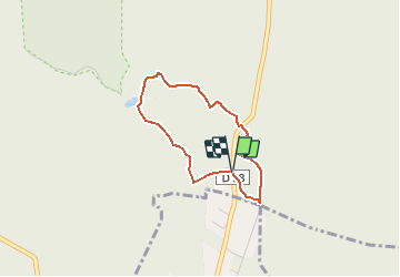
18 km | 22 km-effort
4h 41min
![](https://static1.geolcdn.com/siteimages/upload/files/16400158638029165_repeat_loop_refresh_sync_direction_icon.png)
Ja
![Tocht Te voet Fontainebleau - Boucle 28 km en forêt de Fontainebleau - Photo](https://media.geolcdn.com/t/375/260/21e3a864-d768-407e-8af1-222ee36d7889.jpg&format=jpg&maxdim=2)
![Te voet Te voet](https://static1.geolcdn.com/sitytour/trail-icons/100.png)
Boucle 28 km en forêt de Fontainebleau
Te voet
Medium
(1)
Fontainebleau,
Île-de-France,
Seine-et-Marne,
France
![](/images/other/stat-length.png)
28 km | 34 km-effort
7h 43min
![](https://static1.geolcdn.com/siteimages/upload/files/16400158638029165_repeat_loop_refresh_sync_direction_icon.png)
Ja
![Tocht Stappen Fontainebleau - GLM-150311 - PVerte-Fourceau-Béatrix - Photo](https://media.geolcdn.com/t/375/260/ext.jpg?maxdim=2&url=https%3A%2F%2Fservices.sitytrail.com%2FGeolivesWS%2FDownloadMedia.ashx%3FTrailID%3D394980%26Media%3D3b15c306-0eca-40de-a57d-3cf59ddfeba2.jpg)
![Stappen Stappen](https://static1.geolcdn.com/sitytour/trail-icons/101.png)
GLM-150311 - PVerte-Fourceau-Béatrix
Stappen
Medium
(1)
Fontainebleau,
Île-de-France,
Seine-et-Marne,
France
![](/images/other/stat-length.png)
16,5 km | 20 km-effort
6h 0min
![](https://static1.geolcdn.com/siteimages/upload/files/16400158638029165_repeat_loop_refresh_sync_direction_icon.png)
Ja
![Tocht Stappen Fontainebleau - Boucle 30 km Veni Venelles Vici - Photo](https://media.geolcdn.com/t/375/260/ext.jpg?maxdim=2&url=https%3A%2F%2Fstatic1.geolcdn.com%2Fsiteimages%2Fupload%2Ffiles%2F1553511878bg_sport_marche.png)
![Stappen Stappen](https://static1.geolcdn.com/sitytour/trail-icons/101.png)
Boucle 30 km Veni Venelles Vici
Stappen
Zeer moeilijk
(1)
Fontainebleau,
Île-de-France,
Seine-et-Marne,
France
![](/images/other/stat-length.png)
30 km | 35 km-effort
6h 0min
![](https://static1.geolcdn.com/siteimages/upload/files/16400158638029165_repeat_loop_refresh_sync_direction_icon.png)
Neen
![Tocht Stappen Bourron-Marlotte - Boucle Bourron Marlotte ( reco Didier) - Photo](https://media.geolcdn.com/t/375/260/ext.jpg?maxdim=2&url=https%3A%2F%2Fstatic1.geolcdn.com%2Fsiteimages%2Fupload%2Ffiles%2F1553511878bg_sport_marche.png)
![Stappen Stappen](https://static1.geolcdn.com/sitytour/trail-icons/101.png)
Boucle Bourron Marlotte ( reco Didier)
Stappen
Gemakkelijk
(1)
Bourron-Marlotte,
Île-de-France,
Seine-et-Marne,
France
![](/images/other/stat-length.png)
28 km | 32 km-effort
5h 35min
![](https://static1.geolcdn.com/siteimages/upload/files/16400158638029165_repeat_loop_refresh_sync_direction_icon.png)
Ja
![Tocht Stappen Fontainebleau - Rocher Fourceau-Petit Mont Chauvet SR210523Ve?? fmg - Photo](https://media.geolcdn.com/t/375/260/cabc9437-0e04-4fa0-9f5b-0c9f73ac9000.jpg&format=jpg&maxdim=2)
![Stappen Stappen](https://static1.geolcdn.com/sitytour/trail-icons/101.png)
Rocher Fourceau-Petit Mont Chauvet SR210523Ve?? fmg
Stappen
Zeer moeilijk
(2)
Fontainebleau,
Île-de-France,
Seine-et-Marne,
France
![](/images/other/stat-length.png)
19,5 km | 24 km-effort
5h 27min
![](https://static1.geolcdn.com/siteimages/upload/files/16400158638029165_repeat_loop_refresh_sync_direction_icon.png)
Ja
![Tocht Stappen Fontainebleau - Rando mares aux fees Gilles18 km - Photo](https://media.geolcdn.com/t/375/260/1a2c21e9-241f-4517-a09c-d9710ae3d7d2.jpg&format=jpg&maxdim=2)
![Stappen Stappen](https://static1.geolcdn.com/sitytour/trail-icons/101.png)
Rando mares aux fees Gilles18 km
Stappen
Zeer moeilijk
(1)
Fontainebleau,
Île-de-France,
Seine-et-Marne,
France
![](/images/other/stat-length.png)
17,8 km | 22 km-effort
4h 58min
![](https://static1.geolcdn.com/siteimages/upload/files/16400158638029165_repeat_loop_refresh_sync_direction_icon.png)
Ja
![Tocht Stappen Fontainebleau - viennes carosses - Photo](https://media.geolcdn.com/t/375/260/9b54e644-4214-4411-b7b4-ea5a49e11005.jpg&format=jpg&maxdim=2)
![Stappen Stappen](https://static1.geolcdn.com/sitytour/trail-icons/101.png)
viennes carosses
Stappen
Heel gemakkelijk
(2)
Fontainebleau,
Île-de-France,
Seine-et-Marne,
France
![](/images/other/stat-length.png)
10,8 km | 14 km-effort
2h 50min
![](https://static1.geolcdn.com/siteimages/upload/files/16400158638029165_repeat_loop_refresh_sync_direction_icon.png)
Ja
![Tocht Stappen Fontainebleau - Boucle du Château de Fontainebleau à Thomery 21 km - Photo](https://media.geolcdn.com/t/375/260/22a500a3-91bf-4087-9234-7c012b4b260f.jpg&format=jpg&maxdim=2)
![Stappen Stappen](https://static1.geolcdn.com/sitytour/trail-icons/101.png)
Boucle du Château de Fontainebleau à Thomery 21 km
Stappen
Medium
Fontainebleau,
Île-de-France,
Seine-et-Marne,
France
![](/images/other/stat-length.png)
21 km | 24 km-effort
4h 27min
![](https://static1.geolcdn.com/siteimages/upload/files/16400158638029165_repeat_loop_refresh_sync_direction_icon.png)
Ja