


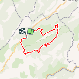

18,4 km | 28 km-effort


Gebruiker


Gratisgps-wandelapplicatie
 SityTrail
IGN / Geografische instituten
SityTrail World
De wereld gaat voor u open
Tocht Stappen van 13,6 km beschikbaar op Occitanië, Hérault, Saint-Guilhem-le-Désert. Deze tocht wordt voorgesteld door ARVIEU.
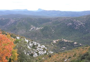
départs des Lavagnes en direction de Cap de Ginestet puis bifurcation par le Puech Bouissou, accès au Roc de la Vigne, retour par la Combe de Loubet
Stappen

Stappen

Stappen
Stappen
Stappen
Stappen

Stappen

Stappen

Stappen