![](/images/other/stat-length.png)
![Tocht Stappen Villaz - Villaz-St-Pierre - La_Foillaz - Rossens - Photo](https://media.geolcdn.com/t/1900/400/ext.pjpeg?maxdim=2&url=https%3A%2F%2Fstatic1.geolcdn.com%2Fsiteimages%2Fupload%2Ffiles%2F1553511878bg_sport_marche.png)
Villaz-St-Pierre - La_Foillaz - Rossens
gpiller
Gebruiker
![Lengte](/images/other/stat-length.png)
Lengte
10,3 km
![Max. hoogte](https://static1.geolcdn.com/siteimages/upload/files/1508320355ic_sort_altitude_max_24dp.png)
Max. hoogte
832 m
![Positief hoogteverschil](https://static1.geolcdn.com/siteimages/upload/files/1508320355ic_sort_den_pos_24dp.png)
Positief hoogteverschil
197 m
![Km-Effort](/images/other/stat-length.png)
Km-Effort
12,9 km
![Min. hoogte](https://static1.geolcdn.com/siteimages/upload/files/1508320355ic_sort_altitude_min_24dp.png)
Min. hoogte
752 m
![Negatief hoogteverschil](https://static1.geolcdn.com/siteimages/upload/files/1508320355ic_sort_den_neg_24dp.png)
Negatief hoogteverschil
189 m
![Boucle](https://static1.geolcdn.com/siteimages/upload/files/16400158638029165_repeat_loop_refresh_sync_direction_icon.png)
Boucle
Ja
Datum van aanmaak :
2019-02-26 08:46:23.386
Laatste wijziging :
2019-02-26 08:46:23.39
![Stappen](https://static1.geolcdn.com/sitytour/trail-icons/101.png)
2h47
Moeilijkheid : Heel gemakkelijk
![Scan deze QR-code om de tocht te openen in de SityTrail-applicatie](https://capi.geolives.com/qq0zvz2zws4bq2lad0pu/sitytour/trails/238804/qr.png?size=200)
Gratisgps-wandelapplicatie
Over ons
Tocht Stappen van 10,3 km beschikbaar op Fribourg/Freiburg, District de la Glâne, Villaz. Deze tocht wordt voorgesteld door gpiller.
Beschrijving
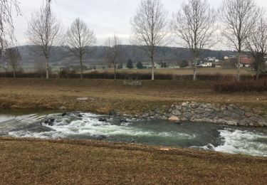
Romont Bicubic - Villaz-St-Pierre, cabane forestière, durée trajet: 12min, 6km, Fr. 2.00 Parcours par temps sec ou gelé. Départ peut aussi se faire au parking de Villarimboud
Peut aussi se faire depuis Villarimboud, parking de l'église
Plaatsbepaling
Land:
Switzerland
Regio :
Fribourg/Freiburg
Departement/Provincie :
District de la Glâne
Gemeente :
Villaz
Locatie:
Unknown
Vertrek:(Dec)
Vertrek:(UTM)
342921 ; 5176699 (32T) N.
Opmerkingen
Wandeltochten in de omgeving
![Tocht Stappen Mézières (FR) - Berlens-La Neirigue - Photo](https://media.geolcdn.com/t/375/260/ext.jpg?maxdim=2&url=https%3A%2F%2Fstatic1.geolcdn.com%2Fsiteimages%2Fupload%2Ffiles%2F1553511878bg_sport_marche.png)
![Stappen Stappen](https://static1.geolcdn.com/sitytour/trail-icons/101.png)
Berlens-La Neirigue
Stappen
Gemakkelijk
(1)
Mézières (FR),
Fribourg/Freiburg,
District de la Glâne,
Switzerland
![](/images/other/stat-length.png)
9,1 km | 11,9 km-effort
2h 36min
![](https://static1.geolcdn.com/siteimages/upload/files/16400158638029165_repeat_loop_refresh_sync_direction_icon.png)
Neen
![Tocht Stappen Valbroye - Sirpierre - Photo](https://media.geolcdn.com/t/375/260/ext.jpg?maxdim=2&url=https%3A%2F%2Fservices.sitytrail.com%2FGeolivesWS%2FDownloadMedia.ashx%3FTrailID%3D877993%26Media%3D20171221154745.jpg)
![Stappen Stappen](https://static1.geolcdn.com/sitytour/trail-icons/101.png)
Sirpierre
Stappen
Heel gemakkelijk
Valbroye,
Waadland,
District de la Broye-Vully,
Switzerland
![](/images/other/stat-length.png)
9,2 km | 12,5 km-effort
2h 36min
![](https://static1.geolcdn.com/siteimages/upload/files/16400158638029165_repeat_loop_refresh_sync_direction_icon.png)
Ja
![Tocht Fiets Mézières (FR) - Berlens - Photo](https://media.geolcdn.com/t/375/260/ext.jpg?maxdim=2&url=https%3A%2F%2Fservices.sitytrail.com%2FGeolivesWS%2FDownloadMedia.ashx%3FTrailID%3D873371%26Media%3D20171207151650.jpg)
![Fiets Fiets](https://static1.geolcdn.com/sitytour/trail-icons/200.png)
Berlens
Fiets
Heel gemakkelijk
Mézières (FR),
Fribourg/Freiburg,
District de la Glâne,
Switzerland
![](/images/other/stat-length.png)
8,5 km | 10,6 km-effort
2h 30min
![](https://static1.geolcdn.com/siteimages/upload/files/16400158638029165_repeat_loop_refresh_sync_direction_icon.png)
Ja
![Tocht Fiets Mézières (FR) - Berlens - Photo](https://media.geolcdn.com/t/375/260/ext.jpg?maxdim=2&url=https%3A%2F%2Fservices.sitytrail.com%2FGeolivesWS%2FDownloadMedia.ashx%3FTrailID%3D872972%26Media%3D20171207151650.jpg)
![Fiets Fiets](https://static1.geolcdn.com/sitytour/trail-icons/200.png)
Berlens
Fiets
Heel gemakkelijk
Mézières (FR),
Fribourg/Freiburg,
District de la Glâne,
Switzerland
![](/images/other/stat-length.png)
8,5 km | 10,6 km-effort
2h 30min
![](https://static1.geolcdn.com/siteimages/upload/files/16400158638029165_repeat_loop_refresh_sync_direction_icon.png)
Ja
![Tocht Fiets Mézières (FR) - Berlens - Photo](https://media.geolcdn.com/t/375/260/ext.jpg?maxdim=2&url=https%3A%2F%2Fservices.sitytrail.com%2FGeolivesWS%2FDownloadMedia.ashx%3FTrailID%3D872964%26Media%3D20171207151650.jpg)
![Fiets Fiets](https://static1.geolcdn.com/sitytour/trail-icons/200.png)
Berlens
Fiets
Heel gemakkelijk
Mézières (FR),
Fribourg/Freiburg,
District de la Glâne,
Switzerland
![](/images/other/stat-length.png)
8,5 km | 10,6 km-effort
2h 30min
![](https://static1.geolcdn.com/siteimages/upload/files/16400158638029165_repeat_loop_refresh_sync_direction_icon.png)
Ja
![Tocht Fiets Valbroye - Granges Le Brit Ménières Sassel Granges - Photo](https://media.geolcdn.com/t/375/260/ext.jpg?maxdim=2&url=https%3A%2F%2Fservices.sitytrail.com%2FGeolivesWS%2FDownloadMedia.ashx%3FTrailID%3D866544%26Media%3D20171123154445.jpg)
![Fiets Fiets](https://static1.geolcdn.com/sitytour/trail-icons/200.png)
Granges Le Brit Ménières Sassel Granges
Fiets
Gemakkelijk
Valbroye,
Waadland,
District de la Broye-Vully,
Switzerland
![](/images/other/stat-length.png)
9,4 km | 11,4 km-effort
2h 44min
![](https://static1.geolcdn.com/siteimages/upload/files/16400158638029165_repeat_loop_refresh_sync_direction_icon.png)
Neen
![Tocht Fiets Valbroye - Granges Le Brit Ménières Sassel Granges - Photo](https://media.geolcdn.com/t/375/260/ext.jpg?maxdim=2&url=https%3A%2F%2Fservices.sitytrail.com%2FGeolivesWS%2FDownloadMedia.ashx%3FTrailID%3D866489%26Media%3D20171123154445.jpg)
![Fiets Fiets](https://static1.geolcdn.com/sitytour/trail-icons/200.png)
Granges Le Brit Ménières Sassel Granges
Fiets
Gemakkelijk
Valbroye,
Waadland,
District de la Broye-Vully,
Switzerland
![](/images/other/stat-length.png)
9,4 km | 11,4 km-effort
2h 44min
![](https://static1.geolcdn.com/siteimages/upload/files/16400158638029165_repeat_loop_refresh_sync_direction_icon.png)
Neen
![Tocht Stappen Valbroye - wa13 - Photo](https://media.geolcdn.com/t/375/260/ext.jpg?maxdim=2&url=https%3A%2F%2Fstatic1.geolcdn.com%2Fsiteimages%2Fupload%2Ffiles%2F1553511878bg_sport_marche.png)
![Stappen Stappen](https://static1.geolcdn.com/sitytour/trail-icons/101.png)
wa13
Stappen
Heel gemakkelijk
Valbroye,
Waadland,
District de la Broye-Vully,
Switzerland
![](/images/other/stat-length.png)
34 km | 45 km-effort
Onbekend
![](https://static1.geolcdn.com/siteimages/upload/files/16400158638029165_repeat_loop_refresh_sync_direction_icon.png)
Neen
![Tocht Stappen La Brillaz - Lentigny - Photo](https://media.geolcdn.com/t/375/260/ext.jpg?maxdim=2&url=https%3A%2F%2Fstatic1.geolcdn.com%2Fsiteimages%2Fupload%2Ffiles%2F1553511878bg_sport_marche.png)
![Stappen Stappen](https://static1.geolcdn.com/sitytour/trail-icons/101.png)
Lentigny
Stappen
La Brillaz,
Fribourg/Freiburg,
District de la Sarine,
Switzerland
![](/images/other/stat-length.png)
7,8 km | 10 km-effort
2h 12min
![](https://static1.geolcdn.com/siteimages/upload/files/16400158638029165_repeat_loop_refresh_sync_direction_icon.png)
Ja