![](/images/other/stat-length.png)
le GR655 dans les Forêts de Laigue et de Compiègne
en forêt de Compiègne
mes randos en forêt
![Lengte](/images/other/stat-length.png)
![Max. hoogte](https://static1.geolcdn.com/siteimages/upload/files/1508320355ic_sort_altitude_max_24dp.png)
![Positief hoogteverschil](https://static1.geolcdn.com/siteimages/upload/files/1508320355ic_sort_den_pos_24dp.png)
![Km-Effort](/images/other/stat-length.png)
![Min. hoogte](https://static1.geolcdn.com/siteimages/upload/files/1508320355ic_sort_altitude_min_24dp.png)
![Negatief hoogteverschil](https://static1.geolcdn.com/siteimages/upload/files/1508320355ic_sort_den_neg_24dp.png)
![Boucle](https://static1.geolcdn.com/siteimages/upload/files/16400158638029165_repeat_loop_refresh_sync_direction_icon.png)
![Te voet](https://static1.geolcdn.com/sitytour/trail-icons/100.png)
--
Moeilijkheid : Zeer moeilijk
![Scan deze QR-code om de tocht te openen in de SityTrail-applicatie](https://capi.geolives.com/qq0zvz2zws4bq2lad0pu/sitytour/trails/2373738/qr.png?size=200)
Gratisgps-wandelapplicatie
Over ons
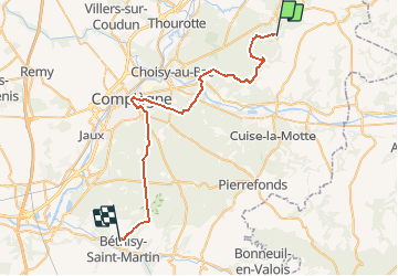
Tocht Te voet van 39 km beschikbaar op Hauts-de-France, Oise, Tracy-le-Mont. Deze tocht wordt voorgesteld door en forêt de Compiègne.
Beschrijving
voir aussi:
http://foret-de-compiegne.over-blog.com/2020/04/le-gr655-dans-les-forets-de-compiegne-et-de-laigue.html
Il traverse la forêt de Laigue (Nord-ESt) et la forêt de Compiègne (Sud-Ouest). J'ai placé le point de départ à Tracy-le-Mont et le point d'arrivée à Béthisy Saint-Pierre sachant que ce GR va bien au-delà de ces points mais je me limite aux 2 forêts.
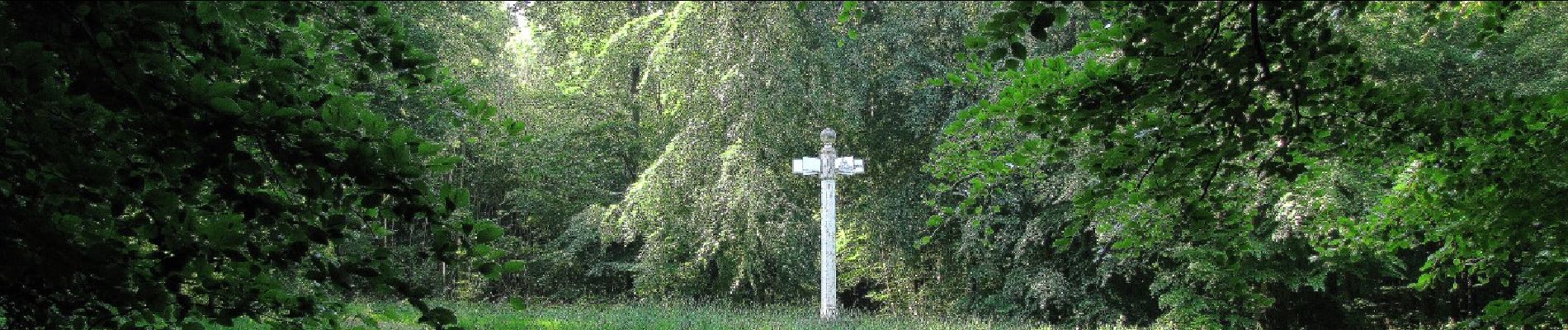
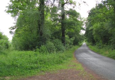
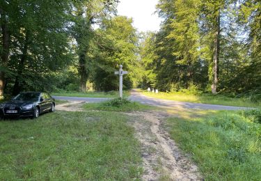
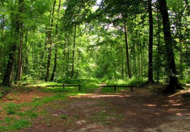
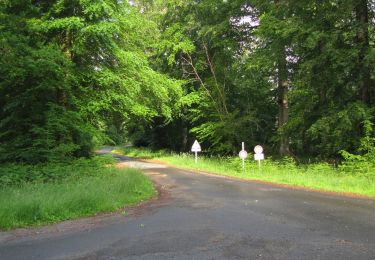
Ce GR traverse quelques km de routes goudronnées, des magnifiques chemins forestiers, un pont qui enjambe l'Aisne, une Allée Impériale et des tous petits sentiers à peine visibles. Le GR655 passe aussi prés d'étangs comme les étangs du domaine d'Offémont et l'étang du Vivier du Grés.
Autre particularité pour la forêt de Laigue: le GR655 chevauche le GR12A jusqu'au carrefour du Précipice de l'Ortille dans la forêt de Compiègne. De même, cet article sera repris dans le blog de la forêt de Compiègne.
Il peut arriver souvent que ce GR porte le nom de routes forestières.
Longueur estimée de cette portion de GR655 : 38,6 km
En théorie, il est faisable en randonnée à pied (pas d'obstacle) mais en une journée? Et c'est pour l'aller ...
Plaatsbepaling
Opmerkingen
Wandeltochten in de omgeving
![Stappen Stappen](https://static1.geolcdn.com/sitytour/trail-icons/101.png)
Stappen
![](/images/other/stat-length.png)
![](https://static1.geolcdn.com/siteimages/upload/files/16400158638029165_repeat_loop_refresh_sync_direction_icon.png)
![Tocht Stappen Carlepont - Carlepont - Photo](https://media.geolcdn.com/t/375/260/ext.jpg?maxdim=2&url=https%3A%2F%2Fstatic1.geolcdn.com%2Fsiteimages%2Fupload%2Ffiles%2F1553511878bg_sport_marche.png)
![Stappen Stappen](https://static1.geolcdn.com/sitytour/trail-icons/101.png)
Stappen
![](/images/other/stat-length.png)
![](https://static1.geolcdn.com/siteimages/upload/files/16400158638029165_repeat_loop_refresh_sync_direction_icon.png)
![Tocht Stappen Rethondes - en forêt de Laigue_15_07_2021_autour du Mont du Fouilleux et du Mont des Singes - Photo](https://media.geolcdn.com/t/375/260/ae49f85a-387f-48a8-bf93-e96ca1fcfc19.jpg&format=jpg&maxdim=2)
![Stappen Stappen](https://static1.geolcdn.com/sitytour/trail-icons/101.png)
Stappen
![](/images/other/stat-length.png)
![](https://static1.geolcdn.com/siteimages/upload/files/16400158638029165_repeat_loop_refresh_sync_direction_icon.png)
![Stappen Stappen](https://static1.geolcdn.com/sitytour/trail-icons/101.png)
Stappen
![](/images/other/stat-length.png)
![](https://static1.geolcdn.com/siteimages/upload/files/16400158638029165_repeat_loop_refresh_sync_direction_icon.png)
![Stappen Stappen](https://static1.geolcdn.com/sitytour/trail-icons/101.png)
Stappen
![](/images/other/stat-length.png)
![](https://static1.geolcdn.com/siteimages/upload/files/16400158638029165_repeat_loop_refresh_sync_direction_icon.png)
![Stappen Stappen](https://static1.geolcdn.com/sitytour/trail-icons/101.png)
Stappen
![](/images/other/stat-length.png)
![](https://static1.geolcdn.com/siteimages/upload/files/16400158638029165_repeat_loop_refresh_sync_direction_icon.png)
![Stappen Stappen](https://static1.geolcdn.com/sitytour/trail-icons/101.png)
Stappen
![](/images/other/stat-length.png)
![](https://static1.geolcdn.com/siteimages/upload/files/16400158638029165_repeat_loop_refresh_sync_direction_icon.png)
![Te voet Te voet](https://static1.geolcdn.com/sitytour/trail-icons/100.png)
Te voet
![](/images/other/stat-length.png)
![](https://static1.geolcdn.com/siteimages/upload/files/16400158638029165_repeat_loop_refresh_sync_direction_icon.png)
![Stappen Stappen](https://static1.geolcdn.com/sitytour/trail-icons/101.png)
Stappen
![](/images/other/stat-length.png)
![](https://static1.geolcdn.com/siteimages/upload/files/16400158638029165_repeat_loop_refresh_sync_direction_icon.png)