
Ajat Bois Nègre

YV24
Gebruiker

Lengte
13 km

Max. hoogte
270 m

Positief hoogteverschil
202 m

Km-Effort
15,7 km

Min. hoogte
176 m

Negatief hoogteverschil
199 m
Boucle
Ja
Datum van aanmaak :
2014-12-10 00:00:00.0
Laatste wijziging :
2014-12-10 00:00:00.0
3h23
Moeilijkheid : Gemakkelijk

Gratisgps-wandelapplicatie
Over ons
Tocht Stappen van 13 km beschikbaar op Nieuw-Aquitanië, Dordogne, Ajat. Deze tocht wordt voorgesteld door YV24.
Beschrijving
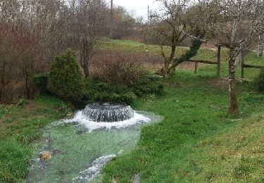
PDIPR bien tracé, balisé panneauté. Du bitume, pas mal de chemin blanc. Circuit varié, praticable en tout temps. Long suivi d'autoroute A89, puis de chemin de fer : inhabituel. Joli village d'Ajat.
Plaatsbepaling
Land:
France
Regio :
Nieuw-Aquitanië
Departement/Provincie :
Dordogne
Gemeente :
Ajat
Locatie:
Unknown
Vertrek:(Dec)
Vertrek:(UTM)
344098 ; 5002158 (31T) N.
Opmerkingen
Wandeltochten in de omgeving

limeyrat


Stappen
Gemakkelijk
Limeyrat,
Nieuw-Aquitanië,
Dordogne,
France

11,1 km | 13,3 km-effort
2h 48min
Ja

reco 3 romain thenon


Mountainbike
Gemakkelijk
Ajat,
Nieuw-Aquitanië,
Dordogne,
France

19,1 km | 23 km-effort
2h 3min
Ja

reco 3 romain thenon


Mountainbike
Gemakkelijk
Ajat,
Nieuw-Aquitanië,
Dordogne,
France

19,1 km | 23 km-effort
2h 3min
Ja

Boucle de la fontaine Marceau ( Montagnac d’ Auberoche)


Stappen
Gemakkelijk
Montagnac-d'Auberoche,
Nieuw-Aquitanië,
Dordogne,
France

6,9 km | 8,6 km-effort
2h 9min
Ja

php Blis & Born


Elektrische fiets
Heel gemakkelijk
Brouchaud,
Nieuw-Aquitanië,
Dordogne,
France

31 km | 37 km-effort
2h 11min
Neen

php Mayac


Wegfiets
Zeer moeilijk
Brouchaud,
Nieuw-Aquitanië,
Dordogne,
France

35 km | 42 km-effort
4h 47min
Ja

Sortie Thenon


Mountainbike
Medium
Thenon,
Nieuw-Aquitanië,
Dordogne,
France

25 km | 30 km-effort
1h 59min
Ja

Beauzens Rozas La Rolfie 12km


Stappen
Gemakkelijk
Ajat,
Nieuw-Aquitanië,
Dordogne,
France

11,7 km | 14,3 km-effort
2h 54min
Ja

Rousselle


Stappen
Heel gemakkelijk
Brouchaud,
Nieuw-Aquitanië,
Dordogne,
France

5,6 km | 7,2 km-effort
1h 35min
Ja


 SityTrail


