![](/images/other/stat-length.png)
![Tocht Stappen Saint-Maximin-la-Sainte-Baume - SAINT MAXIMIN LA SAINTE BAUME - AUTOUR DU DEFENS - Photo](https://media.geolcdn.com/t/1900/400/312380eb-3a4d-4b40-9444-bbc07a6f0962.jpg&format=pjpeg&maxdim=2)
SAINT MAXIMIN LA SAINTE BAUME - AUTOUR DU DEFENS
jean-marie.parachini
Gebruiker
![Lengte](/images/other/stat-length.png)
Lengte
13,6 km
![Max. hoogte](https://static1.geolcdn.com/siteimages/upload/files/1508320355ic_sort_altitude_max_24dp.png)
Max. hoogte
518 m
![Positief hoogteverschil](https://static1.geolcdn.com/siteimages/upload/files/1508320355ic_sort_den_pos_24dp.png)
Positief hoogteverschil
358 m
![Km-Effort](/images/other/stat-length.png)
Km-Effort
18,4 km
![Min. hoogte](https://static1.geolcdn.com/siteimages/upload/files/1508320355ic_sort_altitude_min_24dp.png)
Min. hoogte
292 m
![Negatief hoogteverschil](https://static1.geolcdn.com/siteimages/upload/files/1508320355ic_sort_den_neg_24dp.png)
Negatief hoogteverschil
359 m
![Boucle](https://static1.geolcdn.com/siteimages/upload/files/16400158638029165_repeat_loop_refresh_sync_direction_icon.png)
Boucle
Ja
Datum van aanmaak :
2020-02-23 08:40:11.708
Laatste wijziging :
2020-02-23 18:24:42.265
![Stappen](https://static1.geolcdn.com/sitytour/trail-icons/101.png)
5h23
Moeilijkheid : Gemakkelijk
![Scan deze QR-code om de tocht te openen in de SityTrail-applicatie](https://capi.geolives.com/qq0zvz2zws4bq2lad0pu/sitytour/trails/2344442/qr.png?size=200)
Gratisgps-wandelapplicatie
Over ons
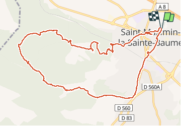
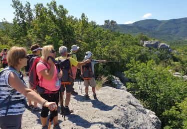
Tocht Stappen van 13,6 km beschikbaar op Provence-Alpes-Côte d'Azur, Var, Saint-Maximin-la-Sainte-Baume. Deze tocht wordt voorgesteld door jean-marie.parachini.
Beschrijving
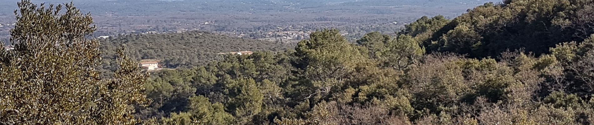
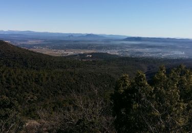
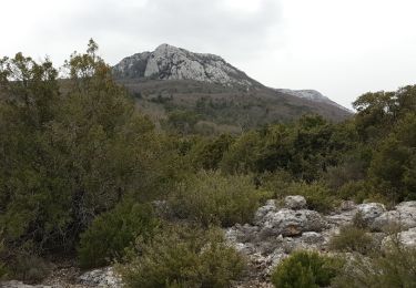
parcours autour de Saint Maximin avec des panoramas vers la ville et la Basilique Sainte Marie Madeleine, les Alpes enneigées, la Sainte Baume, la montagne Sainte Victoire.
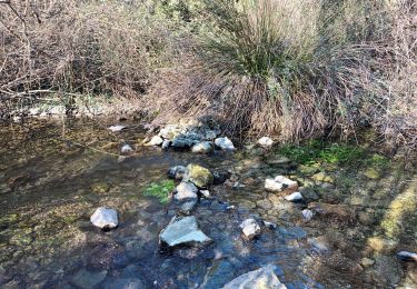
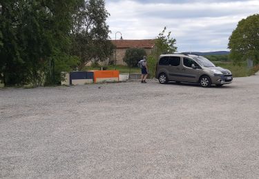
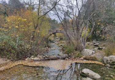
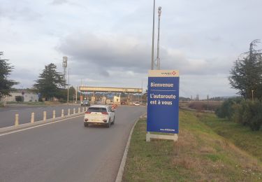
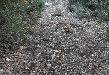
Plaatsbepaling
Land:
France
Regio :
Provence-Alpes-Côte d'Azur
Departement/Provincie :
Var
Gemeente :
Saint-Maximin-la-Sainte-Baume
Locatie:
Unknown
Vertrek:(Dec)
Vertrek:(UTM)
731899 ; 4815255 (31T) N.
Opmerkingen
Wandeltochten in de omgeving
![Tocht Te voet Saint-Maximin-la-Sainte-Baume - Via Aurelia - Le Val - St Maximin - Photo](https://media.geolcdn.com/t/375/260/b94ffd12-9078-42ee-aca4-ef06ddd50861.jpeg&format=jpg&maxdim=2)
![Te voet Te voet](https://static1.geolcdn.com/sitytour/trail-icons/100.png)
Via Aurelia - Le Val - St Maximin
Te voet
Gemakkelijk
Saint-Maximin-la-Sainte-Baume,
Provence-Alpes-Côte d'Azur,
Var,
France
![](/images/other/stat-length.png)
14,2 km | 18,3 km-effort
4h 9min
![](https://static1.geolcdn.com/siteimages/upload/files/16400158638029165_repeat_loop_refresh_sync_direction_icon.png)
Neen
![Tocht Stappen Seillons-Source-d'Argens - Rocher des abeilles-02-02-2022 - Photo](https://media.geolcdn.com/t/375/260/1fa363d5-73a6-4996-a2f2-3a69459e5f76.jpg&format=jpg&maxdim=2)
![Stappen Stappen](https://static1.geolcdn.com/sitytour/trail-icons/101.png)
Rocher des abeilles-02-02-2022
Stappen
Medium
Seillons-Source-d'Argens,
Provence-Alpes-Côte d'Azur,
Var,
France
![](/images/other/stat-length.png)
23 km | 30 km-effort
5h 56min
![](https://static1.geolcdn.com/siteimages/upload/files/16400158638029165_repeat_loop_refresh_sync_direction_icon.png)
Ja
![Tocht Stappen Saint-Maximin-la-Sainte-Baume - M 6 fev mont Aurelien - Photo](https://media.geolcdn.com/t/375/260/52e4e2e1-2fc2-4f02-999d-52b8161f004a.jpg&format=jpg&maxdim=2)
![Stappen Stappen](https://static1.geolcdn.com/sitytour/trail-icons/101.png)
M 6 fev mont Aurelien
Stappen
Medium
Saint-Maximin-la-Sainte-Baume,
Provence-Alpes-Côte d'Azur,
Var,
France
![](/images/other/stat-length.png)
24 km | 34 km-effort
8h 5min
![](https://static1.geolcdn.com/siteimages/upload/files/16400158638029165_repeat_loop_refresh_sync_direction_icon.png)
Ja
![Tocht Stappen Ollières - les anciennes mines a Ollieres - Photo](https://media.geolcdn.com/t/375/260/5cdf6568-7f6e-4fb5-9929-1d1da10c9694.jpg&format=jpg&maxdim=2)
![Stappen Stappen](https://static1.geolcdn.com/sitytour/trail-icons/101.png)
les anciennes mines a Ollieres
Stappen
Medium
Ollières,
Provence-Alpes-Côte d'Azur,
Var,
France
![](/images/other/stat-length.png)
7,4 km | 9,1 km-effort
3h 12min
![](https://static1.geolcdn.com/siteimages/upload/files/16400158638029165_repeat_loop_refresh_sync_direction_icon.png)
Ja
![Tocht Stappen Tourves - Le Caramy - Photo](https://media.geolcdn.com/t/375/260/7f9440e0-36dd-4cce-91df-97f4ebd41cf4.jpg&format=jpg&maxdim=2)
![Stappen Stappen](https://static1.geolcdn.com/sitytour/trail-icons/101.png)
Le Caramy
Stappen
Medium
Tourves,
Provence-Alpes-Côte d'Azur,
Var,
France
![](/images/other/stat-length.png)
13,8 km | 18,8 km-effort
6h 50min
![](https://static1.geolcdn.com/siteimages/upload/files/16400158638029165_repeat_loop_refresh_sync_direction_icon.png)
Ja
![Tocht Stappen Tourves - Tourves-Canfier-Rayol-St Maximin - Photo](https://media.geolcdn.com/t/375/260/f09e9bfb-0592-44ec-b7f9-62316784238c.jpg&format=jpg&maxdim=2)
![Stappen Stappen](https://static1.geolcdn.com/sitytour/trail-icons/101.png)
Tourves-Canfier-Rayol-St Maximin
Stappen
Gemakkelijk
Tourves,
Provence-Alpes-Côte d'Azur,
Var,
France
![](/images/other/stat-length.png)
7,2 km | 8,3 km-effort
1h 19min
![](https://static1.geolcdn.com/siteimages/upload/files/16400158638029165_repeat_loop_refresh_sync_direction_icon.png)
Neen
![Tocht Stappen Tourves - Les Gueules Rouges - Photo](https://media.geolcdn.com/t/375/260/f5def1b9-b75e-4f56-99f7-a33da0c5bba6.jpg&format=jpg&maxdim=2)
![Stappen Stappen](https://static1.geolcdn.com/sitytour/trail-icons/101.png)
Les Gueules Rouges
Stappen
Medium
Tourves,
Provence-Alpes-Côte d'Azur,
Var,
France
![](/images/other/stat-length.png)
18,9 km | 25 km-effort
13h 20min
![](https://static1.geolcdn.com/siteimages/upload/files/16400158638029165_repeat_loop_refresh_sync_direction_icon.png)
Neen
![Tocht Andere activiteiten Tourves - Le pylône de Fontfrège - Photo](https://media.geolcdn.com/t/375/260/ext.jpg?maxdim=2&url=https%3A%2F%2Fservices.sitytrail.com%2FGeolivesWS%2FDownloadMedia.ashx%3FTrailID%3D939197%26Media%3Dfix__20180408165606.jpg)
![Andere activiteiten Andere activiteiten](https://static1.geolcdn.com/sitytour/trail-icons/900.png)
Le pylône de Fontfrège
Andere activiteiten
Heel gemakkelijk
Tourves,
Provence-Alpes-Côte d'Azur,
Var,
France
![](/images/other/stat-length.png)
41 km | 51 km-effort
2h 3min
![](https://static1.geolcdn.com/siteimages/upload/files/16400158638029165_repeat_loop_refresh_sync_direction_icon.png)
Ja
![Tocht Stappen Seillons-Source-d'Argens - seillon - Photo](https://media.geolcdn.com/t/375/260/ext.jpg?maxdim=2&url=https%3A%2F%2Fservices.sitytrail.com%2FGeolivesWS%2FDownloadMedia.ashx%3FTrailID%3D496338%26Media%3Dfix__20151122145605.jpg)
![Stappen Stappen](https://static1.geolcdn.com/sitytour/trail-icons/101.png)
seillon
Stappen
Gemakkelijk
(1)
Seillons-Source-d'Argens,
Provence-Alpes-Côte d'Azur,
Var,
France
![](/images/other/stat-length.png)
15,2 km | 19,2 km-effort
5h 18min
![](https://static1.geolcdn.com/siteimages/upload/files/16400158638029165_repeat_loop_refresh_sync_direction_icon.png)
Ja