![](/images/other/stat-length.png)
![Tocht Stappen Chaponnay - Chaponnay Ecoarees 5.4 a 43 g0.3 - Photo](https://media.geolcdn.com/t/1900/400/ext.pjpeg?maxdim=2&url=https%3A%2F%2Fstatic1.geolcdn.com%2Fsiteimages%2Fupload%2Ffiles%2F1553511878bg_sport_marche.png)
Chaponnay Ecoarees 5.4 a 43 g0.3
jtraverse
Gebruiker
![Lengte](/images/other/stat-length.png)
![Max. hoogte](https://static1.geolcdn.com/siteimages/upload/files/1508320355ic_sort_altitude_max_24dp.png)
![Positief hoogteverschil](https://static1.geolcdn.com/siteimages/upload/files/1508320355ic_sort_den_pos_24dp.png)
![Km-Effort](/images/other/stat-length.png)
![Min. hoogte](https://static1.geolcdn.com/siteimages/upload/files/1508320355ic_sort_altitude_min_24dp.png)
![Negatief hoogteverschil](https://static1.geolcdn.com/siteimages/upload/files/1508320355ic_sort_den_neg_24dp.png)
![Boucle](https://static1.geolcdn.com/siteimages/upload/files/16400158638029165_repeat_loop_refresh_sync_direction_icon.png)
![Stappen](https://static1.geolcdn.com/sitytour/trail-icons/101.png)
1h58
Moeilijkheid : Heel gemakkelijk
![Scan deze QR-code om de tocht te openen in de SityTrail-applicatie](https://capi.geolives.com/qq0zvz2zws4bq2lad0pu/sitytour/trails/2338570/qr.png?size=200)
Gratisgps-wandelapplicatie
Over ons
Tocht Stappen van 5,4 km beschikbaar op Auvergne-Rhône-Alpes, Rhône, Chaponnay. Deze tocht wordt voorgesteld door jtraverse.
Beschrijving
• GPS Pk 45.6377, 4.9283 ou 45°38'15.7"N 4°55'41.9"E
• adresse : 2216 rue Humbert d’Aillon
• ou Centre Sportif Jean Gabin - Rue du stade 69970 Chaponnay.
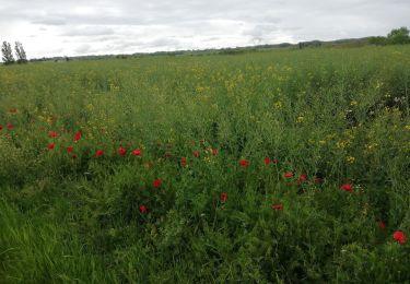
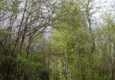
Balade à plat, 5.4km, très peu de goudron dans une zone humide récemment aménagée par la commune.
Vers la fin du parcours, dans le parcours de santé ,
Des bancs un peu partout et des tables de pique-nique.
On peut arrêter les fatigués à l'ombre dans le parc de Chaponnay et emmener les autres pour jusqu'à 1500m de plus sur le parcours de santé avant de rejoindre les voitures - ne pas se fier aux cartes : certains chemins n'existent plus et il y en a plein de nouveaux.
Nombreuses observations possibles dans la zone humide (oiseaux, grenouilles (très bavardes))
Plaatsbepaling
Opmerkingen
Wandeltochten in de omgeving
![Tocht Stappen Marennes - 69 marennes-villette-V2-17km-420m - Photo](https://media.geolcdn.com/t/375/260/25f97240-4655-4bff-897e-e00f442ce49e.jpg&format=jpg&maxdim=2)
![Stappen Stappen](https://static1.geolcdn.com/sitytour/trail-icons/101.png)
Stappen
![](/images/other/stat-length.png)
![](https://static1.geolcdn.com/siteimages/upload/files/16400158638029165_repeat_loop_refresh_sync_direction_icon.png)
![Tocht Mountainbike Chaponnay - Chaponnay - Valencin - Photo](https://media.geolcdn.com/t/375/260/ext.jpg?maxdim=2&url=https%3A%2F%2Fstatic1.geolcdn.com%2Fsiteimages%2Fupload%2Ffiles%2F1524743154velo.jpg)
![Mountainbike Mountainbike](https://static1.geolcdn.com/sitytour/trail-icons/202.png)
Mountainbike
![](/images/other/stat-length.png)
![](https://static1.geolcdn.com/siteimages/upload/files/16400158638029165_repeat_loop_refresh_sync_direction_icon.png)
![Tocht Te voet Feyzin - Sentier des Alouettes - Photo](https://media.geolcdn.com/t/375/260/196abbf9-cf3c-423e-8745-e82f535258da.jpeg&format=jpg&maxdim=2)
![Te voet Te voet](https://static1.geolcdn.com/sitytour/trail-icons/100.png)
Te voet
![](/images/other/stat-length.png)
![](https://static1.geolcdn.com/siteimages/upload/files/16400158638029165_repeat_loop_refresh_sync_direction_icon.png)
![Tocht Stappen Chaponnay - 69-chaponnay-a-luzinay-20KM-430m-sensH-mai21 - Photo](https://media.geolcdn.com/t/375/260/b9109f10-61ca-47fa-8b0f-ffddb86e6f59.jpg&format=jpg&maxdim=2)
![Stappen Stappen](https://static1.geolcdn.com/sitytour/trail-icons/101.png)
Stappen
![](/images/other/stat-length.png)
![](https://static1.geolcdn.com/siteimages/upload/files/16400158638029165_repeat_loop_refresh_sync_direction_icon.png)
![Tocht Mountainbike Corbas - Corbas bois de st jean - Photo](https://media.geolcdn.com/t/375/260/ce84024e-6114-4bc0-bf26-193adabf40f8.jpg&format=jpg&maxdim=2)
![Mountainbike Mountainbike](https://static1.geolcdn.com/sitytour/trail-icons/202.png)
Mountainbike
![](/images/other/stat-length.png)
![](https://static1.geolcdn.com/siteimages/upload/files/16400158638029165_repeat_loop_refresh_sync_direction_icon.png)
![Tocht Stappen Toussieu - 69 Toussieu poypes 2 vallons 21km 420m - Photo](https://media.geolcdn.com/t/375/260/9791a08c-19f2-4a10-84d0-f188f7daef8a.jpg&format=jpg&maxdim=2)
![Stappen Stappen](https://static1.geolcdn.com/sitytour/trail-icons/101.png)
Stappen
![](/images/other/stat-length.png)
![](https://static1.geolcdn.com/siteimages/upload/files/16400158638029165_repeat_loop_refresh_sync_direction_icon.png)
![Tocht Mountainbike Chaponnay - Boucle VTT autour de Chaponnay - Photo](https://media.geolcdn.com/t/375/260/ext.jpg?maxdim=2&url=https%3A%2F%2Fservices.sitytrail.com%2FGeolivesWS%2FDownloadMedia.ashx%3FTrailID%3D316958%26Media%3D16078_6.jpg)
![Mountainbike Mountainbike](https://static1.geolcdn.com/sitytour/trail-icons/202.png)
Mountainbike
![](/images/other/stat-length.png)
![](https://static1.geolcdn.com/siteimages/upload/files/16400158638029165_repeat_loop_refresh_sync_direction_icon.png)
![Tocht Mountainbike Saint-Pierre-de-Chandieu - autour de la ferme de savoye vers luzinay - Photo](https://media.geolcdn.com/t/375/260/ext.jpg?maxdim=2&url=https%3A%2F%2Fservices.sitytrail.com%2FGeolivesWS%2FDownloadMedia.ashx%3FTrailID%3D85531%26Media%3D20110918172032.jpeg)
![Mountainbike Mountainbike](https://static1.geolcdn.com/sitytour/trail-icons/202.png)
Mountainbike
![](/images/other/stat-length.png)
![](https://static1.geolcdn.com/siteimages/upload/files/16400158638029165_repeat_loop_refresh_sync_direction_icon.png)
![Tocht Mountainbike Chaponnay - Chaponnay marennes villette - Photo](https://media.geolcdn.com/t/375/260/ext.jpg?maxdim=2&url=https%3A%2F%2Fstatic1.geolcdn.com%2Fsiteimages%2Fupload%2Ffiles%2F1524743154velo.jpg)
![Mountainbike Mountainbike](https://static1.geolcdn.com/sitytour/trail-icons/202.png)
Mountainbike
![](/images/other/stat-length.png)
![](https://static1.geolcdn.com/siteimages/upload/files/16400158638029165_repeat_loop_refresh_sync_direction_icon.png)