![](/images/other/stat-length.png)
![Tocht Stappen Bergen - Thulin _ Marche Fédéral _ Salle Calva _ Place de Ghlin _ 7011 - GHLIN - Photo](https://media.geolcdn.com/t/1900/400/ext.pjpeg?maxdim=2&url=https%3A%2F%2Fstatic1.geolcdn.com%2Fsiteimages%2Fupload%2Ffiles%2F1553511878bg_sport_marche.png)
Thulin _ Marche Fédéral _ Salle Calva _ Place de Ghlin _ 7011 - GHLIN
jeangulu
Gebruiker
![Lengte](/images/other/stat-length.png)
Lengte
16,8 km
![Max. hoogte](https://static1.geolcdn.com/siteimages/upload/files/1508320355ic_sort_altitude_max_24dp.png)
Max. hoogte
55 m
![Positief hoogteverschil](https://static1.geolcdn.com/siteimages/upload/files/1508320355ic_sort_den_pos_24dp.png)
Positief hoogteverschil
104 m
![Km-Effort](/images/other/stat-length.png)
Km-Effort
18,2 km
![Min. hoogte](https://static1.geolcdn.com/siteimages/upload/files/1508320355ic_sort_altitude_min_24dp.png)
Min. hoogte
28 m
![Negatief hoogteverschil](https://static1.geolcdn.com/siteimages/upload/files/1508320355ic_sort_den_neg_24dp.png)
Negatief hoogteverschil
104 m
![Boucle](https://static1.geolcdn.com/siteimages/upload/files/16400158638029165_repeat_loop_refresh_sync_direction_icon.png)
Boucle
Ja
Datum van aanmaak :
2020-02-16 09:10:46.388
Laatste wijziging :
2020-02-16 13:48:06.254
![Stappen](https://static1.geolcdn.com/sitytour/trail-icons/101.png)
3h57
Moeilijkheid : Gemakkelijk
![Scan deze QR-code om de tocht te openen in de SityTrail-applicatie](https://capi.geolives.com/qq0zvz2zws4bq2lad0pu/sitytour/trails/2336087/qr.png?size=200)
Gratisgps-wandelapplicatie
Over ons
Tocht Stappen van 16,8 km beschikbaar op Wallonië, Henegouwen, Bergen. Deze tocht wordt voorgesteld door jeangulu.
Beschrijving
Les Sans Soucis _ GHLIN _ HT 029
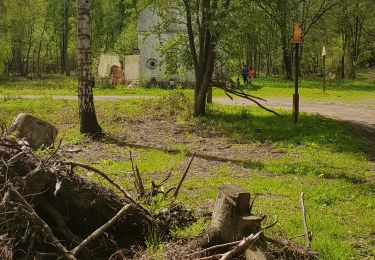
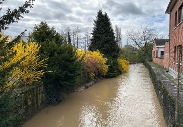
beau parcours sans plus beaucoup de routes et des allées en macadam suite au passage de la tempête il y a eu un changement de parcours à refaire par beau temps
Plaatsbepaling
Land:
Belgium
Regio :
Wallonië
Departement/Provincie :
Henegouwen
Gemeente :
Bergen
Locatie:
Ghlin
Vertrek:(Dec)
Vertrek:(UTM)
564162 ; 5591855 (31U) N.
Opmerkingen
Wandeltochten in de omgeving
![Tocht Stappen Bergen - Nuit du scoutisme - Mons - Photo](https://media.geolcdn.com/t/375/260/87b716aa-c8cf-4b43-af3b-2f8493539c6a.jpg&format=jpg&maxdim=2)
![Stappen Stappen](https://static1.geolcdn.com/sitytour/trail-icons/101.png)
Nuit du scoutisme - Mons
Stappen
Gemakkelijk
(10)
Bergen,
Wallonië,
Henegouwen,
Belgium
![](/images/other/stat-length.png)
4,4 km | 5,2 km-effort
1h 10min
![](https://static1.geolcdn.com/siteimages/upload/files/16400158638029165_repeat_loop_refresh_sync_direction_icon.png)
Ja
![Tocht Stappen Saint-Ghislain - là Ronde maison - Photo](https://media.geolcdn.com/t/375/260/de816312-4de9-443b-a961-c7f1b9cc6a46.jpg&format=jpg&maxdim=2)
![Stappen Stappen](https://static1.geolcdn.com/sitytour/trail-icons/101.png)
là Ronde maison
Stappen
Gemakkelijk
(3)
Saint-Ghislain,
Wallonië,
Henegouwen,
Belgium
![](/images/other/stat-length.png)
6,4 km | 7,2 km-effort
2h 11min
![](https://static1.geolcdn.com/siteimages/upload/files/16400158638029165_repeat_loop_refresh_sync_direction_icon.png)
Ja
![Tocht Noords wandelen Saint-Ghislain - Mielikki marche nordique - Lucioles 2024 - Baudour - Photo](https://media.geolcdn.com/t/375/260/ext.jpg?maxdim=2&url=https%3A%2F%2Fstatic1.geolcdn.com%2Fsiteimages%2Fupload%2Ffiles%2F1545311037marcheuse_200dpi.jpg)
![Noords wandelen Noords wandelen](https://static1.geolcdn.com/sitytour/trail-icons/102.png)
Mielikki marche nordique - Lucioles 2024 - Baudour
Noords wandelen
Gemakkelijk
(2)
Saint-Ghislain,
Wallonië,
Henegouwen,
Belgium
![](/images/other/stat-length.png)
7,4 km | 8,1 km-effort
1h 45min
![](https://static1.geolcdn.com/siteimages/upload/files/16400158638029165_repeat_loop_refresh_sync_direction_icon.png)
Ja
![Tocht Noords wandelen Bergen - Mielikki marche nordique - Ghlin 2 - Photo](https://media.geolcdn.com/t/375/260/ext.jpg?maxdim=2&url=https%3A%2F%2Fstatic1.geolcdn.com%2Fsiteimages%2Fupload%2Ffiles%2F1545311037marcheuse_200dpi.jpg)
![Noords wandelen Noords wandelen](https://static1.geolcdn.com/sitytour/trail-icons/102.png)
Mielikki marche nordique - Ghlin 2
Noords wandelen
Gemakkelijk
(2)
Bergen,
Wallonië,
Henegouwen,
Belgium
![](/images/other/stat-length.png)
8,6 km | 10 km-effort
1h 45min
![](https://static1.geolcdn.com/siteimages/upload/files/16400158638029165_repeat_loop_refresh_sync_direction_icon.png)
Ja
![Tocht Stappen Bergen - petit tour à mons - Photo](https://media.geolcdn.com/t/375/260/d7cbcfa9-b19e-435e-ba25-f17ef2758d9e.jpg&format=jpg&maxdim=2)
![Stappen Stappen](https://static1.geolcdn.com/sitytour/trail-icons/101.png)
petit tour à mons
Stappen
Heel gemakkelijk
Bergen,
Wallonië,
Henegouwen,
Belgium
![](/images/other/stat-length.png)
4,5 km | 5,3 km-effort
1h 38min
![](https://static1.geolcdn.com/siteimages/upload/files/16400158638029165_repeat_loop_refresh_sync_direction_icon.png)
Ja
![Tocht Stappen Jurbeke - Erbisoeul 15 km - Photo](https://media.geolcdn.com/t/375/260/ext.jpg?maxdim=2&url=https%3A%2F%2Fstatic1.geolcdn.com%2Fsiteimages%2Fupload%2Ffiles%2F1553511878bg_sport_marche.png)
![Stappen Stappen](https://static1.geolcdn.com/sitytour/trail-icons/101.png)
Erbisoeul 15 km
Stappen
Heel gemakkelijk
(1)
Jurbeke,
Wallonië,
Henegouwen,
Belgium
![](/images/other/stat-length.png)
14,9 km | 16,6 km-effort
4h 0min
![](https://static1.geolcdn.com/siteimages/upload/files/16400158638029165_repeat_loop_refresh_sync_direction_icon.png)
Ja
![Tocht Noords wandelen Bergen - Ghlin-Erbisoeul - Photo](https://media.geolcdn.com/t/375/260/ext.jpg?maxdim=2&url=https%3A%2F%2Fstatic1.geolcdn.com%2Fsiteimages%2Fupload%2Ffiles%2F1545311037marcheuse_200dpi.jpg)
![Noords wandelen Noords wandelen](https://static1.geolcdn.com/sitytour/trail-icons/102.png)
Ghlin-Erbisoeul
Noords wandelen
Heel gemakkelijk
(1)
Bergen,
Wallonië,
Henegouwen,
Belgium
![](/images/other/stat-length.png)
10,3 km | 11,7 km-effort
2h 30min
![](https://static1.geolcdn.com/siteimages/upload/files/16400158638029165_repeat_loop_refresh_sync_direction_icon.png)
Ja
![Tocht Stappen Bergen - marche 5-06 montpanisel - Photo](https://media.geolcdn.com/t/375/260/ext.jpg?maxdim=2&url=https%3A%2F%2Fstatic1.geolcdn.com%2Fsiteimages%2Fupload%2Ffiles%2F1553511878bg_sport_marche.png)
![Stappen Stappen](https://static1.geolcdn.com/sitytour/trail-icons/101.png)
marche 5-06 montpanisel
Stappen
Heel gemakkelijk
(1)
Bergen,
Wallonië,
Henegouwen,
Belgium
![](/images/other/stat-length.png)
7,1 km | 8,9 km-effort
1h 38min
![](https://static1.geolcdn.com/siteimages/upload/files/16400158638029165_repeat_loop_refresh_sync_direction_icon.png)
Ja
![Tocht Stappen Bergen - Hyon Mons 17,3 km - Photo](https://media.geolcdn.com/t/375/260/c46163c6-2674-4769-b529-d66a48b935d1.jpg&format=jpg&maxdim=2)
![Stappen Stappen](https://static1.geolcdn.com/sitytour/trail-icons/101.png)
Hyon Mons 17,3 km
Stappen
Medium
Bergen,
Wallonië,
Henegouwen,
Belgium
![](/images/other/stat-length.png)
17 km | 19,6 km-effort
4h 27min
![](https://static1.geolcdn.com/siteimages/upload/files/16400158638029165_repeat_loop_refresh_sync_direction_icon.png)
Ja