
Balade de la bataille de Gembloux

Chastre1450
Gebruiker

Lengte
8,7 km

Max. hoogte
166 m

Positief hoogteverschil
63 m

Km-Effort
9,5 km

Min. hoogte
138 m

Negatief hoogteverschil
63 m
Boucle
Ja
Datum van aanmaak :
2014-12-10 00:00:00.0
Laatste wijziging :
2014-12-10 00:00:00.0
2h06
Moeilijkheid : Gemakkelijk

Gratisgps-wandelapplicatie
Over ons
Tocht Stappen van 8,7 km beschikbaar op Wallonië, Waals-Brabant, Chastre. Deze tocht wordt voorgesteld door Chastre1450.
Beschrijving
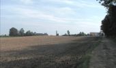
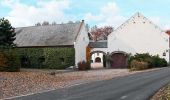
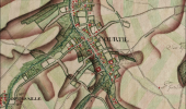
Promenade dans le village et la campagne de Cortil-Noirmont. Tumulus de Penteville et chaussée romaine rappellent l'époque gallo-romaine. Site de la bataille de Gembloux et musée français évoquent l'épisode tragique de la bataille de Gembloux.
POI's
Plaatsbepaling
Land:
Belgium
Regio :
Wallonië
Departement/Provincie :
Waals-Brabant
Gemeente :
Chastre
Locatie:
Cortil-Noirmont
Vertrek:(Dec)
Vertrek:(UTM)
616022 ; 5605018 (31U) N.
Opmerkingen
Wandeltochten in de omgeving
#240223a - Blanmont, Orne, Alvaux, Nil Pierreux***


Stappen
Medium
(1)
Chastre,
Wallonië,
Waals-Brabant,
Belgium

6,6 km | 7,8 km-effort
1h 47min
Ja
#230728 - Gentinnes Kongolo


Stappen
Gemakkelijk
(1)
Chastre,
Wallonië,
Waals-Brabant,
Belgium

5 km | 5,6 km-effort
1h 16min
Ja
Promenade de Villeroux


Stappen
Medium
(1)
Chastre,
Wallonië,
Waals-Brabant,
Belgium

7,6 km | 8,5 km-effort
1h 53min
Ja
Balade récréative de Cortil


Stappen
Gemakkelijk
(4)
Chastre,
Wallonië,
Waals-Brabant,
Belgium

5,9 km | 6,5 km-effort
1h 26min
Ja
Balade de la fontaine Saint Géry à Chastre


Stappen
Medium
(1)
Chastre,
Wallonië,
Waals-Brabant,
Belgium

7,6 km | 8,6 km-effort
1h 53min
Ja
Balade de Gembloux à Corroy-le-Château


Stappen
Moeilijk
Gembloers,
Wallonië,
Namen,
Belgium

13,2 km | 15,3 km-effort
3h 28min
Ja

Saint Gery - Namur - par le GR126


Stappen
Zeer moeilijk
Chastre,
Wallonië,
Waals-Brabant,
Belgium

38 km | 45 km-effort
10h 7min
Neen
SityTrail - Chastre - Perwez GR127


Stappen
Zeer moeilijk
Gembloers,
Wallonië,
Namen,
Belgium

30 km | 33 km-effort
7h 28min
Neen
bgg - ernage bertinchamps gentines chastre perbais


Stappen
Moeilijk
Gembloers,
Wallonië,
Namen,
Belgium

22 km | 24 km-effort
4h 36min
Ja


 SityTrail


