

Le Honteyde et la Coume de Herrere en boucle depuis Poubeau

Rouzier
Gebruiker

Lengte
10,8 km

Max. hoogte
1920 m

Positief hoogteverschil
781 m

Km-Effort
21 km

Min. hoogte
1244 m

Negatief hoogteverschil
826 m
Boucle
Ja
Datum van aanmaak :
2020-02-02 08:38:29.78
Laatste wijziging :
2020-02-07 18:25:29.199
4h57
Moeilijkheid : Medium

Gratisgps-wandelapplicatie
Over ons
Tocht Stappen van 10,8 km beschikbaar op Occitanië, Haute-Garonne, Poubeau. Deze tocht wordt voorgesteld door Rouzier.
Beschrijving
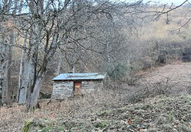
Poubeau, GRP, Sarrat de Gembregasse et de Sacroues, clôt de Legnes,le Honteyde(1912m),pas des portes, Coume de Herrere et sa cabane, GRP, Labach et Poubeau.
Plaatsbepaling
Land:
France
Regio :
Occitanië
Departement/Provincie :
Haute-Garonne
Gemeente :
Poubeau
Locatie:
Unknown
Vertrek:(Dec)
Vertrek:(UTM)
295443 ; 4743214 (31T) N.
Opmerkingen
Wandeltochten in de omgeving
Du Col de Peyresourde au sommet du Pouyaué - Loudervielle


Stappen
Moeilijk
(1)
Portet-de-Luchon,
Occitanië,
Haute-Garonne,
France

9,9 km | 18,4 km-effort
4h 10min
Ja
mail de la pène de Rustier en boucle depuis Mayrègne


Stappen
Medium
Mayrègne,
Occitanië,
Haute-Garonne,
France

11,7 km | 21 km-effort
6h 2min
Ja
Boucle autour d’Oô


Stappen
Gouaux-de-Larboust,
Occitanië,
Haute-Garonne,
France

9 km | 15,6 km-effort
3h 5min
Ja
Cabane de Courreau en boucle depuis St Aventin


Stappen
Medium
Saint-Aventin,
Occitanië,
Haute-Garonne,
France

13,3 km | 24 km-effort
6h 10min
Ja
Cap de Serrède en boucle depuis Mayrègne


Stappen
Medium
Mayrègne,
Occitanië,
Haute-Garonne,
France

6,6 km | 15,2 km-effort
4h 11min
Ja
Peyrasourdes


Stappen
Heel gemakkelijk
Loudervielle,
Occitanië,
Hautes-Pyrénées,
France

4,8 km | 7,7 km-effort
1h 49min
Ja
Agudes


Stappen
Heel gemakkelijk
Gouaux-de-Larboust,
Occitanië,
Haute-Garonne,
France

4,7 km | 8,2 km-effort
1h 42min
Ja
Boucle dans la vallée du Larboust et la Vallée d'Oueil


Te voet
Gemakkelijk
Benque-Dessous-et-Dessus,
Occitanië,
Haute-Garonne,
France

4,9 km | 8,7 km-effort
1h 58min
Neen
Cap des Arjoulents (finalement pas fait !) & Cabane de Turon


Stappen
Gemakkelijk
Oô,
Occitanië,
Haute-Garonne,
France

15,4 km | 25 km-effort
7h 3min
Ja


 SityTrail


