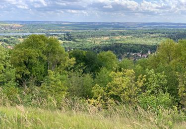
8,8 km | 11,5 km-effort
Les Coteaux de FOURGES_16Km
douneto
Gebruiker
Lengte
15,9 km
Max. hoogte
141 m
Positief hoogteverschil
203 m
Km-Effort
18,6 km
Min. hoogte
22 m
Negatief hoogteverschil
203 m
Boucle
Ja
Datum van aanmaak :
2019-04-30 14:33:14.906
Laatste wijziging :
2019-04-30 14:33:14.941
3h50
Moeilijkheid : Medium
Gratisgps-wandelapplicatie
Over ons
Tocht Stappen van 15,9 km beschikbaar op Île-de-France, Val-d'Oise, Amenucourt. Deze tocht wordt voorgesteld door douneto.
Beschrijving
Rando Avril 2017
Départ du parking du Moulin de Fourges ( vue sur le moulin ...).
Plaatsbepaling
Land:
France
Regio :
Île-de-France
Departement/Provincie :
Val-d'Oise
Gemeente :
Amenucourt
Locatie:
Unknown
Vertrek:(Dec)
Vertrek:(UTM)
401203 ; 5441719 (31U) N.
Opmerkingen
Wandeltochten in de omgeving
La Roche Guyon - Chérence
Stappen
Medium
(2)
La Roche-Guyon,
Île-de-France,
Val-d'Oise,
France
2h 30min
Ja
Chaussy - Villarceaux vers Chaussy
Stappen
Gemakkelijk
(1)
Chaussy,
Île-de-France,
Val-d'Oise,
France
10,4 km | 12,9 km-effort
2h 48min
Ja
Chaussy - Villarceaux - Genainville
Stappen
Gemakkelijk
(1)
Chaussy,
Île-de-France,
Val-d'Oise,
France
11,3 km | 13,7 km-effort
2h 57min
Ja
Rando Douce 1 - Ecos
Stappen
Gemakkelijk
(1)
Vexin-sur-Epte,
Normandië,
Eure,
France
6,5 km | 7,6 km-effort
1h 28min
Ja
Ecos - les trois boucles court
Stappen
Gemakkelijk
(2)
Vexin-sur-Epte,
Normandië,
Eure,
France
11,1 km | 13,1 km-effort
2h 51min
Ja
La Roche-Guyon boucle
Stappen
Gemakkelijk
(1)
La Roche-Guyon,
Île-de-France,
Val-d'Oise,
France
15,5 km | 19,5 km-effort
4h 15min
Ja
La Roche Guyon - Forêt + falaises
Stappen
Medium
(2)
La Roche-Guyon,
Île-de-France,
Val-d'Oise,
France
12,1 km | 15,3 km-effort
3h 22min
Ja
cherence vetheuil
Stappen
Haute-Isle,
Île-de-France,
Val-d'Oise,
France
11,1 km | 14,5 km-effort
3h 21min
Ja
La Roche Guyon
Stappen
Heel gemakkelijk
La Roche-Guyon,
Île-de-France,
Val-d'Oise,
France
8,6 km | 11,4 km-effort
2h 53min
Ja