Tocht Stappen Aubigné-Racan - balade - Photo
 il2larai
il2larai

Gebruiker

© OpenStreetMap contributors
Lengte
Lengte
10,4 km
Max. hoogte
Max. hoogte
101 m
Positief hoogteverschil
142 m
Km-Effort
Km-Effort  
12,3 km
Min. hoogte
Min. hoogte
40 m
Negatief hoogteverschil
143 m
Boucle
Boucle
Ja
Datum van aanmaak :
2020-01-26 13:44:21.196
Laatste wijziging :
2020-01-26 16:06:41.349

(0 Bericht)

Stappen
Stappen
2h21
Moeilijkheid : Heel gemakkelijk

Scan deze QR-code om de tocht te openen in de SityTrail-applicatie

Gratisgps-wandelapplicatie

Logo SityTrail SityTrail

IGN / Geografische instituten

SityTrail uit de App Store downloaden SityTrail uit Google Play downloaden

Logo SityTrail SityTrail World

De wereld gaat voor u open

SityTrail uit de App Store downloaden SityTrail uit Google Play downloaden SityTrail op Huawei AppGallery downloaden

Over ons

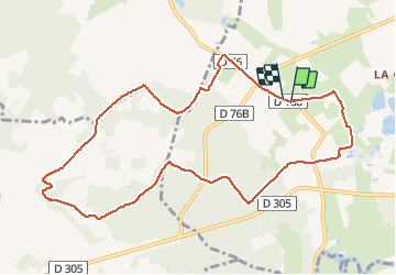
Tocht Stappen van 10,4 km beschikbaar op Pays de la Loire, Sarthe, Aubigné-Racan. Deze tocht wordt voorgesteld door il2larai.

Hoogteprofiel

Plaatsbepaling

Land:
France
Regio :
Pays de la Loire
Departement/Provincie :
Sarthe
Gemeente :
Aubigné-Racan
Locatie:
Unknown
Vertrek:(UTM)
291852 ; 5283583 (31T) N.

Wandeltochten in de omgeving

Tocht Elektrische fiets Le Lude - Le Lude - La Mans-18745742 - Photo
Elektrische fiets
LANDRIEU

Elektrische fiets

Heel gemakkelijk
Le Lude, Pays de la Loire, Sarthe, France
51 km | 57 km-effort
Onbekend
Neen
Tocht Auto La Chapelle-aux-Choux - Modification à faire  - Photo
Auto
anthonyperreau

Auto

La Chapelle-aux-Choux, Pays de la Loire, Sarthe, France
14 km | 16,7 km-effort
35min
Neen
Tocht Wegfiets Le Lude - 2nov - Photo
Wegfiets
anthonyperreau

Wegfiets

Le Lude, Pays de la Loire, Sarthe, France
12,7 km | 14,4 km-effort
20min
Neen


Sluiten
Mijn abonnementen