![](/images/other/stat-length.png)
![Tocht Stappen Turenne - Bois de Turenne - Photo](https://media.geolcdn.com/t/1900/400/ext.pjpeg?maxdim=2&url=https%3A%2F%2Fservices.sitytrail.com%2FGeolivesWS%2FDownloadMedia.ashx%3FTrailID%3D229425%26Media%3Dfix__20131027161423.jpg)
Bois de Turenne
sdroneau
Gebruiker
![Lengte](/images/other/stat-length.png)
Lengte
17,7 km
![Max. hoogte](https://static1.geolcdn.com/siteimages/upload/files/1508320355ic_sort_altitude_max_24dp.png)
Max. hoogte
359 m
![Positief hoogteverschil](https://static1.geolcdn.com/siteimages/upload/files/1508320355ic_sort_den_pos_24dp.png)
Positief hoogteverschil
408 m
![Km-Effort](/images/other/stat-length.png)
Km-Effort
23 km
![Min. hoogte](https://static1.geolcdn.com/siteimages/upload/files/1508320355ic_sort_altitude_min_24dp.png)
Min. hoogte
268 m
![Negatief hoogteverschil](https://static1.geolcdn.com/siteimages/upload/files/1508320355ic_sort_den_neg_24dp.png)
Negatief hoogteverschil
408 m
![Boucle](https://static1.geolcdn.com/siteimages/upload/files/16400158638029165_repeat_loop_refresh_sync_direction_icon.png)
Boucle
Ja
Datum van aanmaak :
2014-12-10 00:00:00.0
Laatste wijziging :
2014-12-10 00:00:00.0
![Stappen](https://static1.geolcdn.com/sitytour/trail-icons/101.png)
4h00
Moeilijkheid : Medium
![Scan deze QR-code om de tocht te openen in de SityTrail-applicatie](https://capi.geolives.com/qq0zvz2zws4bq2lad0pu/sitytour/trails/229425/qr.png?size=200)
Gratisgps-wandelapplicatie
Over ons
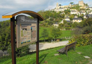
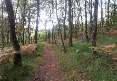
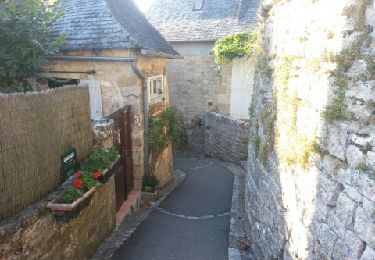
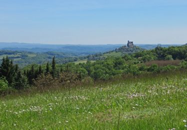
Tocht Stappen van 17,7 km beschikbaar op Nieuw-Aquitanië, Corrèze, Turenne. Deze tocht wordt voorgesteld door sdroneau.
Beschrijving
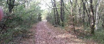
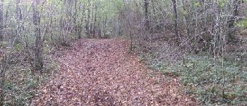
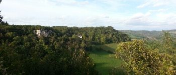
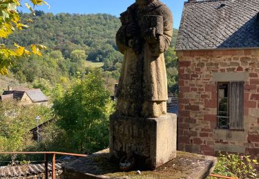
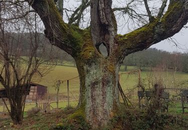
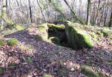
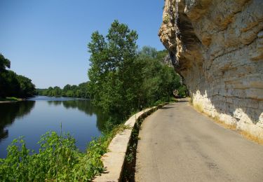
Partez à la découverte de la forêt de Turenne. Au départ du bourg de Turenne, cette balade vous fera découvrir un joli patrimoine bâti, de beaux points de vue et les charmes du causse corrézien!
Plaatsbepaling
Land:
France
Regio :
Nieuw-Aquitanië
Departement/Provincie :
Corrèze
Gemeente :
Turenne
Locatie:
Unknown
Vertrek:(Dec)
Vertrek:(UTM)
388228 ; 4989890 (31T) N.
Opmerkingen
Wandeltochten in de omgeving
![Tocht Mountainbike Ligneyrac - Circuit de la Vicomté de Turenne - Photo](https://media.geolcdn.com/t/375/260/ext.jpg?maxdim=2&url=https%3A%2F%2Fservices.sitytrail.com%2FGeolivesWS%2FDownloadMedia.ashx%3FTrailID%3D398734%26Media%3D412020af-6043-4db5-83f9-0dd0c4c92cfd.JPG)
![Mountainbike Mountainbike](https://static1.geolcdn.com/sitytour/trail-icons/202.png)
Circuit de la Vicomté de Turenne
Mountainbike
Moeilijk
(2)
Ligneyrac,
Nieuw-Aquitanië,
Corrèze,
France
![](/images/other/stat-length.png)
30 km | 43 km-effort
3h 30min
![](https://static1.geolcdn.com/siteimages/upload/files/16400158638029165_repeat_loop_refresh_sync_direction_icon.png)
Ja
![Tocht Stappen Noailhac - Balade autour de Noailhac - Photo](https://media.geolcdn.com/t/375/260/ext.jpg?maxdim=2&url=https%3A%2F%2Fservices.sitytrail.com%2FGeolivesWS%2FDownloadMedia.ashx%3FTrailID%3D149594%26Media%3De96d2a20-66fb-4d49-9d63-44dfab7eae06.jpg)
![Stappen Stappen](https://static1.geolcdn.com/sitytour/trail-icons/101.png)
Balade autour de Noailhac
Stappen
Moeilijk
(2)
Noailhac,
Nieuw-Aquitanië,
Corrèze,
France
![](/images/other/stat-length.png)
14,7 km | 21 km-effort
4h 0min
![](https://static1.geolcdn.com/siteimages/upload/files/16400158638029165_repeat_loop_refresh_sync_direction_icon.png)
Ja
![Tocht Stappen Turenne - le tour de la Vicomté - Photo](https://media.geolcdn.com/t/375/260/ext.jpg?maxdim=2&url=https%3A%2F%2Fservices.sitytrail.com%2FGeolivesWS%2FDownloadMedia.ashx%3FTrailID%3D152771%26Media%3D20120909180748.jpeg)
![Stappen Stappen](https://static1.geolcdn.com/sitytour/trail-icons/101.png)
le tour de la Vicomté
Stappen
Medium
(2)
Turenne,
Nieuw-Aquitanië,
Corrèze,
France
![](/images/other/stat-length.png)
14,1 km | 18,8 km-effort
3h 30min
![](https://static1.geolcdn.com/siteimages/upload/files/16400158638029165_repeat_loop_refresh_sync_direction_icon.png)
Ja
![Tocht Stappen Jugeals-Nazareth - Jugeals-Nazareth ( 8 de la Couze à la Tourmente) - Photo](https://media.geolcdn.com/t/375/260/ext.jpg?maxdim=2&url=https%3A%2F%2Fservices.sitytrail.com%2FGeolivesWS%2FDownloadMedia.ashx%3FTrailID%3D743444%26Media%3D23102de0-5f75-40b9-8fc6-6fa182d7098c.JPG)
![Stappen Stappen](https://static1.geolcdn.com/sitytour/trail-icons/101.png)
Jugeals-Nazareth ( 8 de la Couze à la Tourmente)
Stappen
Medium
Jugeals-Nazareth,
Nieuw-Aquitanië,
Corrèze,
France
![](/images/other/stat-length.png)
8,2 km | 11,3 km-effort
2h 29min
![](https://static1.geolcdn.com/siteimages/upload/files/16400158638029165_repeat_loop_refresh_sync_direction_icon.png)
Ja
![Tocht Stappen Noailhac - noailhac - Photo](https://media.geolcdn.com/t/375/260/ext.jpg?maxdim=2&url=https%3A%2F%2Fstatic1.geolcdn.com%2Fsiteimages%2Fupload%2Ffiles%2F1553511878bg_sport_marche.png)
![Stappen Stappen](https://static1.geolcdn.com/sitytour/trail-icons/101.png)
noailhac
Stappen
Medium
(1)
Noailhac,
Nieuw-Aquitanië,
Corrèze,
France
![](/images/other/stat-length.png)
13,8 km | 19,6 km-effort
4h 9min
![](https://static1.geolcdn.com/siteimages/upload/files/16400158638029165_repeat_loop_refresh_sync_direction_icon.png)
Ja
![Tocht Stappen Noailhac - Noailhac - Photo](https://media.geolcdn.com/t/375/260/b0b8d16f-875a-4884-8e5c-a708c4a97ecd.jpg&format=jpg&maxdim=2)
![Stappen Stappen](https://static1.geolcdn.com/sitytour/trail-icons/101.png)
Noailhac
Stappen
Medium
Noailhac,
Nieuw-Aquitanië,
Corrèze,
France
![](/images/other/stat-length.png)
13,8 km | 19,6 km-effort
4h 38min
![](https://static1.geolcdn.com/siteimages/upload/files/16400158638029165_repeat_loop_refresh_sync_direction_icon.png)
Ja
![Tocht Stappen Cressensac-Sarrazac - Sarrazac - Photo](https://media.geolcdn.com/t/375/260/20ea6751-876f-4fc5-becb-f8d816d523f6.jpg&format=jpg&maxdim=2)
![Stappen Stappen](https://static1.geolcdn.com/sitytour/trail-icons/101.png)
Sarrazac
Stappen
Medium
Cressensac-Sarrazac,
Occitanië,
Lot,
France
![](/images/other/stat-length.png)
6,3 km | 9 km-effort
1h 46min
![](https://static1.geolcdn.com/siteimages/upload/files/16400158638029165_repeat_loop_refresh_sync_direction_icon.png)
Ja
![Stappen Stappen](https://static1.geolcdn.com/sitytour/trail-icons/101.png)
Noailhac- Dolmen et pierre gravée (départ de Noailhac)
Stappen
Medium
Noailhac,
Nieuw-Aquitanië,
Corrèze,
France
![](/images/other/stat-length.png)
6,6 km | 10,4 km-effort
2h 2min
![](https://static1.geolcdn.com/siteimages/upload/files/16400158638029165_repeat_loop_refresh_sync_direction_icon.png)
Ja
![Motorfiets Motorfiets](https://static1.geolcdn.com/sitytour/trail-icons/402.png)
Turenne-Martel-Lacave-Rocamadour-Souillac
Motorfiets
Gemakkelijk
Turenne,
Nieuw-Aquitanië,
Corrèze,
France
![](/images/other/stat-length.png)
87 km | 107 km-effort
3h 0min
![](https://static1.geolcdn.com/siteimages/upload/files/16400158638029165_repeat_loop_refresh_sync_direction_icon.png)
Neen