![](/images/other/stat-length.png)
![Tocht Te voet Ouzous - SityTrail - Ouzous Cabane d'Ayzi-fait - Photo](https://media.geolcdn.com/t/1900/400/ext.pjpeg?maxdim=2&url=https%3A%2F%2Fstatic1.geolcdn.com%2Fsiteimages%2Fupload%2Ffiles%2F1545311037marcheuse_200dpi.jpg)
SityTrail - Ouzous Cabane d'Ayzi-fait
marmotte65
Gebruiker GUIDE
![Lengte](/images/other/stat-length.png)
Lengte
9,7 km
![Max. hoogte](https://static1.geolcdn.com/siteimages/upload/files/1508320355ic_sort_altitude_max_24dp.png)
Max. hoogte
1251 m
![Positief hoogteverschil](https://static1.geolcdn.com/siteimages/upload/files/1508320355ic_sort_den_pos_24dp.png)
Positief hoogteverschil
696 m
![Km-Effort](/images/other/stat-length.png)
Km-Effort
19 km
![Min. hoogte](https://static1.geolcdn.com/siteimages/upload/files/1508320355ic_sort_altitude_min_24dp.png)
Min. hoogte
578 m
![Negatief hoogteverschil](https://static1.geolcdn.com/siteimages/upload/files/1508320355ic_sort_den_neg_24dp.png)
Negatief hoogteverschil
697 m
![Boucle](https://static1.geolcdn.com/siteimages/upload/files/16400158638029165_repeat_loop_refresh_sync_direction_icon.png)
Boucle
Ja
Datum van aanmaak :
2019-12-31 13:43:41.082
Laatste wijziging :
2019-12-31 13:57:16.558
![Te voet](https://static1.geolcdn.com/sitytour/trail-icons/100.png)
--
Moeilijkheid : Medium
![Scan deze QR-code om de tocht te openen in de SityTrail-applicatie](https://capi.geolives.com/qq0zvz2zws4bq2lad0pu/sitytour/trails/2293973/qr.png?size=200)
Gratisgps-wandelapplicatie
Over ons
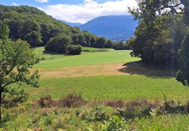
Tocht Te voet van 9,7 km beschikbaar op Occitanië, Hautes-Pyrénées, Ouzous. Deze tocht wordt voorgesteld door marmotte65.
Beschrijving
Superbe rando pour tous surtout pour celles et ceux qui ne connaissaient pas le secteur.
les chiffres du G3 ont ete un peu depassés
Plaatsbepaling
Land:
France
Regio :
Occitanië
Departement/Provincie :
Hautes-Pyrénées
Gemeente :
Ouzous
Locatie:
Unknown
Vertrek:(Dec)
Vertrek:(UTM)
735639 ; 4768193 (30T) N.
Opmerkingen
Wandeltochten in de omgeving
![Tocht Stappen Argelès-Gazost - Le Mont de Gez en circuit - Argelès Gazost - Photo](https://media.geolcdn.com/t/375/260/ext.jpg?maxdim=2&url=https%3A%2F%2Fservices.sitytrail.com%2FGeolivesWS%2FDownloadMedia.ashx%3FTrailID%3D172309%26Media%3D13627_4.jpg)
![Stappen Stappen](https://static1.geolcdn.com/sitytour/trail-icons/101.png)
Le Mont de Gez en circuit - Argelès Gazost
Stappen
Medium
(1)
Argelès-Gazost,
Occitanië,
Hautes-Pyrénées,
France
![](/images/other/stat-length.png)
11,8 km | 20 km-effort
4h 30min
![](https://static1.geolcdn.com/siteimages/upload/files/16400158638029165_repeat_loop_refresh_sync_direction_icon.png)
Ja
![Tocht Stappen Ségus - col du pré du roi par segus reconnu - Photo](https://media.geolcdn.com/t/375/260/8a292310-c3a3-4003-ab0e-617cb49dc561.jpg&format=jpg&maxdim=2)
![Stappen Stappen](https://static1.geolcdn.com/sitytour/trail-icons/101.png)
col du pré du roi par segus reconnu
Stappen
Moeilijk
(1)
Ségus,
Occitanië,
Hautes-Pyrénées,
France
![](/images/other/stat-length.png)
10,4 km | 16,8 km-effort
3h 49min
![](https://static1.geolcdn.com/siteimages/upload/files/16400158638029165_repeat_loop_refresh_sync_direction_icon.png)
Ja
![Tocht Elektrische fiets Argelès-Gazost - CABALIROS 30 JUIN 2023 - Photo](https://media.geolcdn.com/t/375/260/d00efa13-e401-495e-87f8-f59eb1442703.jpg&format=jpg&maxdim=2)
![Elektrische fiets Elektrische fiets](https://static1.geolcdn.com/sitytour/trail-icons/205.png)
CABALIROS 30 JUIN 2023
Elektrische fiets
Medium
Argelès-Gazost,
Occitanië,
Hautes-Pyrénées,
France
![](/images/other/stat-length.png)
39 km | 57 km-effort
4h 47min
![](https://static1.geolcdn.com/siteimages/upload/files/16400158638029165_repeat_loop_refresh_sync_direction_icon.png)
Ja
![Tocht Stappen Argelès-Gazost - ARGELES La boucle de l arrieulat - Photo](https://media.geolcdn.com/t/375/260/cee8eb17-b22b-4615-9318-bf7446bdbe22.jpg&format=jpg&maxdim=2)
![Stappen Stappen](https://static1.geolcdn.com/sitytour/trail-icons/101.png)
ARGELES La boucle de l arrieulat
Stappen
Moeilijk
Argelès-Gazost,
Occitanië,
Hautes-Pyrénées,
France
![](/images/other/stat-length.png)
10,3 km | 14,6 km-effort
3h 4min
![](https://static1.geolcdn.com/siteimages/upload/files/16400158638029165_repeat_loop_refresh_sync_direction_icon.png)
Ja
![Tocht Stappen Argelès-Gazost - ARGELES Mont de Gez G3 fait - Photo](https://media.geolcdn.com/t/375/260/653c1198-5439-4c4b-acf2-a53537be36e4.jpg&format=jpg&maxdim=2)
![Stappen Stappen](https://static1.geolcdn.com/sitytour/trail-icons/101.png)
ARGELES Mont de Gez G3 fait
Stappen
Medium
Argelès-Gazost,
Occitanië,
Hautes-Pyrénées,
France
![](/images/other/stat-length.png)
10,2 km | 18,3 km-effort
5h 39min
![](https://static1.geolcdn.com/siteimages/upload/files/16400158638029165_repeat_loop_refresh_sync_direction_icon.png)
Ja
![Tocht Stappen Ouzous - Ouzous pibeste-fait - Photo](https://media.geolcdn.com/t/375/260/ext.jpg?maxdim=2&url=https%3A%2F%2Fstatic1.geolcdn.com%2Fsiteimages%2Fupload%2Ffiles%2F1553511878bg_sport_marche.png)
![Stappen Stappen](https://static1.geolcdn.com/sitytour/trail-icons/101.png)
Ouzous pibeste-fait
Stappen
Medium
(1)
Ouzous,
Occitanië,
Hautes-Pyrénées,
France
![](/images/other/stat-length.png)
11,3 km | 22 km-effort
4h 29min
![](https://static1.geolcdn.com/siteimages/upload/files/16400158638029165_repeat_loop_refresh_sync_direction_icon.png)
Ja
![Tocht Stappen Ouzous - Pic du Pibeste - Photo](https://media.geolcdn.com/t/375/260/ext.jpg?maxdim=2&url=https%3A%2F%2Fstatic1.geolcdn.com%2Fsiteimages%2Fupload%2Ffiles%2F1553511878bg_sport_marche.png)
![Stappen Stappen](https://static1.geolcdn.com/sitytour/trail-icons/101.png)
Pic du Pibeste
Stappen
Medium
(1)
Ouzous,
Occitanië,
Hautes-Pyrénées,
France
![](/images/other/stat-length.png)
13 km | 25 km-effort
6h 9min
![](https://static1.geolcdn.com/siteimages/upload/files/16400158638029165_repeat_loop_refresh_sync_direction_icon.png)
Ja
![Tocht Stappen Salles - Escala du Prat du Rey - Photo](https://media.geolcdn.com/t/375/260/ext.jpg?maxdim=2&url=https%3A%2F%2Fstatic1.geolcdn.com%2Fsiteimages%2Fupload%2Ffiles%2F1553511878bg_sport_marche.png)
![Stappen Stappen](https://static1.geolcdn.com/sitytour/trail-icons/101.png)
Escala du Prat du Rey
Stappen
Medium
(1)
Salles,
Occitanië,
Hautes-Pyrénées,
France
![](/images/other/stat-length.png)
11,3 km | 22 km-effort
4h 24min
![](https://static1.geolcdn.com/siteimages/upload/files/16400158638029165_repeat_loop_refresh_sync_direction_icon.png)
Ja
![Tocht Stappen Ouzous - Pyrénées 2023 Jour 3 - Pic du Pibeste - Photo](https://media.geolcdn.com/t/375/260/fb027cac-9587-44ce-a7ce-c65dbfe35a1e.jpg&format=jpg&maxdim=2)
![Stappen Stappen](https://static1.geolcdn.com/sitytour/trail-icons/101.png)
Pyrénées 2023 Jour 3 - Pic du Pibeste
Stappen
Medium
Ouzous,
Occitanië,
Hautes-Pyrénées,
France
![](/images/other/stat-length.png)
11,5 km | 24 km-effort
7h 29min
![](https://static1.geolcdn.com/siteimages/upload/files/16400158638029165_repeat_loop_refresh_sync_direction_icon.png)
Ja