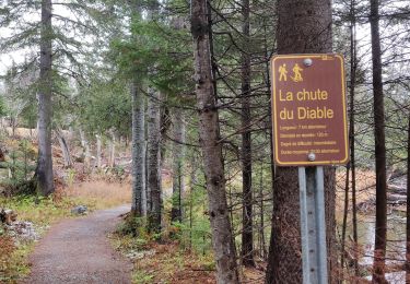
4,5 km | 7 km-effort
Mt Ernest Laforce Parc de Gaspésie
TRIMAILLE
Gebruiker
Lengte
5 km
Max. hoogte
830 m
Positief hoogteverschil
184 m
Km-Effort
7,5 km
Min. hoogte
651 m
Negatief hoogteverschil
180 m
Boucle
Ja
Datum van aanmaak :
2019-12-01 09:40:43.76
Laatste wijziging :
2019-12-01 09:41:55.862
1h33
Moeilijkheid : Gemakkelijk
Gratisgps-wandelapplicatie
Over ons
Tocht Stappen van 5 km beschikbaar op Quebec, La Haute-Gaspésie, Mont-Albert. Deze tocht wordt voorgesteld door TRIMAILLE.
Plaatsbepaling
Land:
Canada
Regio :
Quebec
Departement/Provincie :
La Haute-Gaspésie
Gemeente :
Mont-Albert
Locatie:
Unknown
Vertrek:(Dec)
Vertrek:(UTM)
715153 ; 5423245 (19U) N.
Opmerkingen
Wandeltochten in de omgeving
2014-08-10 18:36:31
Stappen
Gemakkelijk
(1)
Mont-Albert,
Quebec,
La Haute-Gaspésie,
Canada
1h 50min
Ja
Chutes du diable - sentier du Mont Albert
Stappen
Medium
Mont-Albert,
Quebec,
La Haute-Gaspésie,
Canada
6,9 km | 8,6 km-effort
1h 48min
Ja
2014-08-11 15:45:09
Stappen
Zeer moeilijk
Mont-Albert,
Quebec,
La Haute-Gaspésie,
Canada
16,8 km | 29 km-effort
7h 0min
Ja
Wikiloc - Parc National de la Gaspésie - Sentier du Mont Richardson - Aller-r...
Stappen
Zeer moeilijk
Mont-Albert,
Quebec,
La Haute-Gaspésie,
Canada
11,6 km | 22 km-effort
4h 26min
Ja
Wikiloc - Mont xalibu
Stappen
Moeilijk
Mont-Albert,
Quebec,
La Haute-Gaspésie,
Canada
12,3 km | 19,9 km-effort
4h 5min
Ja
Wikiloc - Mont Olivine
Stappen
Medium
Mont-Albert,
Quebec,
La Haute-Gaspésie,
Canada
8 km | 12,1 km-effort
2h 27min
Neen
Wikiloc - Mont Olivine et Abri de la Serpentine
Stappen
Zeer moeilijk
Mont-Albert,
Quebec,
La Haute-Gaspésie,
Canada
17 km | 26 km-effort
5h 19min
Ja
Wikiloc - Chute du diable
Stappen
Medium
Mont-Albert,
Quebec,
La Haute-Gaspésie,
Canada
7,1 km | 9,1 km-effort
1h 56min
Ja
Wikiloc - Parc National de la Gaspésie - Mont Ernest Laforce
Stappen
Medium
Mont-Albert,
Quebec,
La Haute-Gaspésie,
Canada
5,5 km | 8,6 km-effort
1h 46min
Ja