![](/images/other/stat-length.png)
![Tocht Andere activiteiten Yverdon-les-Bains - Yverdon-Bru - Photo](https://media.geolcdn.com/t/1900/400/ext.pjpeg?maxdim=2&url=https%3A%2F%2Fstatic1.geolcdn.com%2Fsiteimages%2Fupload%2Ffiles%2F1545311037marcheuse_200dpi.jpg)
Yverdon-Bru
pittnuss
Gebruiker
![Lengte](/images/other/stat-length.png)
Lengte
12,6 km
![Max. hoogte](https://static1.geolcdn.com/siteimages/upload/files/1508320355ic_sort_altitude_max_24dp.png)
Max. hoogte
463 m
![Positief hoogteverschil](https://static1.geolcdn.com/siteimages/upload/files/1508320355ic_sort_den_pos_24dp.png)
Positief hoogteverschil
82 m
![Km-Effort](/images/other/stat-length.png)
Km-Effort
13,7 km
![Min. hoogte](https://static1.geolcdn.com/siteimages/upload/files/1508320355ic_sort_altitude_min_24dp.png)
Min. hoogte
430 m
![Negatief hoogteverschil](https://static1.geolcdn.com/siteimages/upload/files/1508320355ic_sort_den_neg_24dp.png)
Negatief hoogteverschil
82 m
![Boucle](https://static1.geolcdn.com/siteimages/upload/files/16400158638029165_repeat_loop_refresh_sync_direction_icon.png)
Boucle
Ja
Datum van aanmaak :
2014-12-11 00:00:00.0
Laatste wijziging :
2014-12-11 00:00:00.0
![Andere activiteiten](https://static1.geolcdn.com/sitytour/trail-icons/900.png)
--
Moeilijkheid : Onbekend
![Scan deze QR-code om de tocht te openen in de SityTrail-applicatie](https://capi.geolives.com/qq0zvz2zws4bq2lad0pu/sitytour/trails/22704/qr.png?size=200)
Gratisgps-wandelapplicatie
Over ons
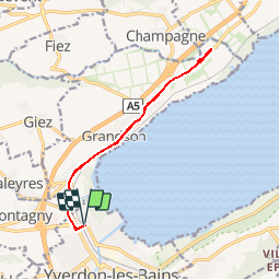
Tocht Andere activiteiten van 12,6 km beschikbaar op Waadland, District du Jura-Nord vaudois, Yverdon-les-Bains. Deze tocht wordt voorgesteld door pittnuss.
Beschrijving
Excursion sur 2 jours avec la nuit à la cabane Demecre - 19 et 20.08.2006
Plaatsbepaling
Land:
Switzerland
Regio :
Waadland
Departement/Provincie :
District du Jura-Nord vaudois
Gemeente :
Yverdon-les-Bains
Locatie:
Yverdon-les-Bains
Vertrek:(Dec)
Vertrek:(UTM)
319333 ; 5184493 (32T) N.
Opmerkingen
Wandeltochten in de omgeving
![Tocht Stappen Yverdon-les-Bains - mtb07 - Photo](https://media.geolcdn.com/t/375/260/ext.jpg?maxdim=2&url=https%3A%2F%2Fstatic1.geolcdn.com%2Fsiteimages%2Fupload%2Ffiles%2F1553511878bg_sport_marche.png)
![Stappen Stappen](https://static1.geolcdn.com/sitytour/trail-icons/101.png)
mtb07
Stappen
Heel gemakkelijk
Yverdon-les-Bains,
Waadland,
District du Jura-Nord vaudois,
Switzerland
![](/images/other/stat-length.png)
49 km | 70 km-effort
Onbekend
![](https://static1.geolcdn.com/siteimages/upload/files/16400158638029165_repeat_loop_refresh_sync_direction_icon.png)
Ja
![Tocht Stappen Yverdon-les-Bains - Champ-Pittet: Moorpfad - Photo](https://media.geolcdn.com/t/375/260/ext.jpg?maxdim=2&url=https%3A%2F%2Fstatic1.geolcdn.com%2Fsiteimages%2Fupload%2Ffiles%2F1553511878bg_sport_marche.png)
![Stappen Stappen](https://static1.geolcdn.com/sitytour/trail-icons/101.png)
Champ-Pittet: Moorpfad
Stappen
Heel gemakkelijk
Yverdon-les-Bains,
Waadland,
District du Jura-Nord vaudois,
Switzerland
![](/images/other/stat-length.png)
10,8 km | 12,8 km-effort
Onbekend
![](https://static1.geolcdn.com/siteimages/upload/files/16400158638029165_repeat_loop_refresh_sync_direction_icon.png)
Neen
![Tocht Te voet Yverdon-les-Bains - Between nature reserves and the shore - Photo](https://media.geolcdn.com/t/375/260/ext.jpg?maxdim=2&url=https%3A%2F%2Fstatic1.geolcdn.com%2Fsiteimages%2Fupload%2Ffiles%2F1545311037marcheuse_200dpi.jpg)
![Te voet Te voet](https://static1.geolcdn.com/sitytour/trail-icons/100.png)
Between nature reserves and the shore
Te voet
Gemakkelijk
Yverdon-les-Bains,
Waadland,
District du Jura-Nord vaudois,
Switzerland
![](/images/other/stat-length.png)
8,9 km | 10,7 km-effort
2h 26min
![](https://static1.geolcdn.com/siteimages/upload/files/16400158638029165_repeat_loop_refresh_sync_direction_icon.png)
Neen
![Tocht Andere activiteiten Giez - Giez vaumarcus Giez - Photo](https://media.geolcdn.com/t/375/260/ext.jpg?maxdim=2&url=https%3A%2F%2Fstatic1.geolcdn.com%2Fsiteimages%2Fupload%2Ffiles%2F1545311037marcheuse_200dpi.jpg)
![Andere activiteiten Andere activiteiten](https://static1.geolcdn.com/sitytour/trail-icons/900.png)
Giez vaumarcus Giez
Andere activiteiten
Heel gemakkelijk
Giez,
Waadland,
District du Jura-Nord vaudois,
Switzerland
![](/images/other/stat-length.png)
34 km | 40 km-effort
4h 36min
![](https://static1.geolcdn.com/siteimages/upload/files/16400158638029165_repeat_loop_refresh_sync_direction_icon.png)
Ja
![Tocht Andere activiteiten Yverdon-les-Bains - Yverdon-les-Bains tour hiver - Photo](https://media.geolcdn.com/t/375/260/ext.jpg?maxdim=2&url=https%3A%2F%2Fstatic1.geolcdn.com%2Fsiteimages%2Fupload%2Ffiles%2F1545311037marcheuse_200dpi.jpg)
![Andere activiteiten Andere activiteiten](https://static1.geolcdn.com/sitytour/trail-icons/900.png)
Yverdon-les-Bains tour hiver
Andere activiteiten
Heel gemakkelijk
Yverdon-les-Bains,
Waadland,
District du Jura-Nord vaudois,
Switzerland
![](/images/other/stat-length.png)
13,1 km | 15,8 km-effort
Onbekend
![](https://static1.geolcdn.com/siteimages/upload/files/16400158638029165_repeat_loop_refresh_sync_direction_icon.png)
Ja
![Tocht Wintersport Grandson - Jura-Tour ab Yverdon - Photo](https://media.geolcdn.com/t/375/260/ext.jpg?maxdim=2&url=https%3A%2F%2Fstatic1.geolcdn.com%2Fsiteimages%2Fupload%2Ffiles%2F1524743153ski.jpg)
![Wintersport Wintersport](https://static1.geolcdn.com/sitytour/trail-icons/500.png)
Jura-Tour ab Yverdon
Wintersport
Heel gemakkelijk
Grandson,
Waadland,
District du Jura-Nord vaudois,
Switzerland
![](/images/other/stat-length.png)
54 km | 81 km-effort
Onbekend
![](https://static1.geolcdn.com/siteimages/upload/files/16400158638029165_repeat_loop_refresh_sync_direction_icon.png)
Neen
![Tocht Stappen Giez - Giez refuge petit - Photo](https://media.geolcdn.com/t/375/260/ext.jpg?maxdim=2&url=https%3A%2F%2Fstatic1.geolcdn.com%2Fsiteimages%2Fupload%2Ffiles%2F1553511878bg_sport_marche.png)
![Stappen Stappen](https://static1.geolcdn.com/sitytour/trail-icons/101.png)
Giez refuge petit
Stappen
Gemakkelijk
Giez,
Waadland,
District du Jura-Nord vaudois,
Switzerland
![](/images/other/stat-length.png)
1,5 km | 1,8 km-effort
25min
![](https://static1.geolcdn.com/siteimages/upload/files/16400158638029165_repeat_loop_refresh_sync_direction_icon.png)
Ja
![Tocht Stappen Giez - Grand refuge Giez - Photo](https://media.geolcdn.com/t/375/260/ext.jpg?maxdim=2&url=https%3A%2F%2Fstatic1.geolcdn.com%2Fsiteimages%2Fupload%2Ffiles%2F1553511878bg_sport_marche.png)
![Stappen Stappen](https://static1.geolcdn.com/sitytour/trail-icons/101.png)
Grand refuge Giez
Stappen
Gemakkelijk
Giez,
Waadland,
District du Jura-Nord vaudois,
Switzerland
![](/images/other/stat-length.png)
3,6 km | 4,5 km-effort
1h 1min
![](https://static1.geolcdn.com/siteimages/upload/files/16400158638029165_repeat_loop_refresh_sync_direction_icon.png)
Ja
![Tocht Fietstoerisme Grandson - lac de Neuchâtel - Photo](https://media.geolcdn.com/t/375/260/ext.jpg?maxdim=2&url=https%3A%2F%2Fstatic1.geolcdn.com%2Fsiteimages%2Fupload%2Ffiles%2F1524743154velo.jpg)
![Fietstoerisme Fietstoerisme](https://static1.geolcdn.com/sitytour/trail-icons/204.png)
lac de Neuchâtel
Fietstoerisme
Heel gemakkelijk
Grandson,
Waadland,
District du Jura-Nord vaudois,
Switzerland
![](/images/other/stat-length.png)
5,9 km | 6,5 km-effort
40min
![](https://static1.geolcdn.com/siteimages/upload/files/16400158638029165_repeat_loop_refresh_sync_direction_icon.png)
Ja