Tocht Noords wandelen Camiers - La Baie de la Canche depuis Camiers - Photo

La Baie de la Canche depuis Camiers

 denissculier
denissculier

Gebruiker

© OpenStreetMap contributors
Lengte
Lengte
6,2 km
Max. hoogte
Max. hoogte
68 m
Positief hoogteverschil
96 m
Km-Effort
Km-Effort  
7,4 km
Min. hoogte
Min. hoogte
4 m
Negatief hoogteverschil
99 m
Boucle
Boucle
Ja
Datum van aanmaak :
2019-11-14 16:28:53.794
Laatste wijziging :
2021-09-30 10:45:39.543

(1 Bericht)

Noords wandelen
Noords wandelen
1h35
Moeilijkheid : Gemakkelijk

Scan deze QR-code om de tocht te openen in de SityTrail-applicatie

Gratisgps-wandelapplicatie

Logo SityTrail SityTrail

IGN / Geografische instituten

SityTrail uit de App Store downloaden SityTrail uit Google Play downloaden

Logo SityTrail SityTrail World

De wereld gaat voor u open

SityTrail uit de App Store downloaden SityTrail uit Google Play downloaden SityTrail op Huawei AppGallery downloaden

Over ons

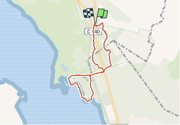
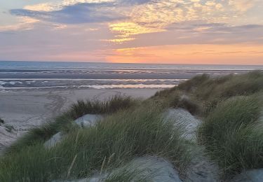
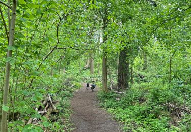
Tocht Noords wandelen van 6,2 km beschikbaar op Hauts-de-France, Pas-de-Calais, Camiers. Deze tocht wordt voorgesteld door denissculier.

Beschrijving

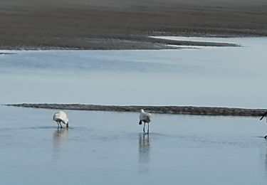
Attention, consulter les marées

Hoogteprofiel

Plaatsbepaling

Land:
France
Regio :
Hauts-de-France
Departement/Provincie :
Pas-de-Calais
Gemeente :
Camiers
Locatie:
Unknown
Vertrek:(UTM)
402179 ; 5600881 (31U) N.

Opmerkingen

Gelieve in te loggen om een commentaar of een beoordeling achter te laten


Wandeltochten in de omgeving

Tocht Fiets Étaples - Les Garnoulles - Etaples - Photo
Fiets
tracegps

Fiets

Medium
(2)
Étaples, Hauts-de-France, Pas-de-Calais, France
34 km | 38 km-effort
2h 45min
Ja
Tocht Stappen Étaples - Le sentier du Rombly - Etaples - Photo
Stappen
tracegps

Stappen

Moeilijk
(3)
Étaples, Hauts-de-France, Pas-de-Calais, France
14,1 km | 17,3 km-effort
3h 30min
Ja
Tocht Te voet Étaples - Sentier de Rombly - Photo
Te voet
GUIDE+

Te voet

Medium
Étaples, Hauts-de-France, Pas-de-Calais, France
17,2 km | 21 km-effort
4h 48min
Ja
Tocht Noords wandelen Le Touquet-Paris-Plage - Marche nordique : Boucle 12 km Le Touquet - Merlimont - Photo
Noords wandelen
GUIDE
chessyca

Noords wandelen

Heel gemakkelijk
Le Touquet-Paris-Plage, Hauts-de-France, Pas-de-Calais, France
12,3 km | 12,5 km-effort
1h 59min
Ja
Tocht Stappen Le Touquet-Paris-Plage - Sur la route du musée - Photo
Stappen
GUIDE
chessyca

Stappen

Le Touquet-Paris-Plage, Hauts-de-France, Pas-de-Calais, France
8,4 km | 9 km-effort
1h 55min
Ja
Tocht Stappen Le Touquet-Paris-Plage - Balade dans la baie de Canche - Photo
Stappen
GUIDE
chessyca

Stappen

Heel gemakkelijk
Le Touquet-Paris-Plage, Hauts-de-France, Pas-de-Calais, France
7,3 km | 7,8 km-effort
1h 24min
Neen
Tocht Stappen Camiers - ballade  - Photo
Stappen
gregcamb

Stappen

Gemakkelijk
(1)
Camiers, Hauts-de-France, Pas-de-Calais, France
7,8 km | 8,3 km-effort
1h 51min
Neen
Tocht Stappen Dannes - Le Mont Saint Frieux - Photo
Stappen
tracegps

Stappen

Gemakkelijk
(1)
Dannes, Hauts-de-France, Pas-de-Calais, France
6,1 km | 7,8 km-effort
2h 0min
Ja
Tocht Stappen Étaples - Étaples - La forestière  - Photo
Stappen
alfreson

Stappen

Gemakkelijk
Étaples, Hauts-de-France, Pas-de-Calais, France
4,4 km | 5,5 km-effort
1h 26min
Ja


Sluiten
Mijn abonnementen