

M012-Durban Corbières

Polo-31
Gebruiker

Lengte
12,1 km

Max. hoogte
372 m

Positief hoogteverschil
475 m

Km-Effort
18,5 km

Min. hoogte
93 m

Negatief hoogteverschil
477 m
Boucle
Ja
Datum van aanmaak :
2014-12-10 00:00:00.0
Laatste wijziging :
2014-12-10 00:00:00.0
3h49
Moeilijkheid : Medium

Gratisgps-wandelapplicatie
Over ons
Tocht Stappen van 12,1 km beschikbaar op Occitanië, Aude, Durban-Corbières. Deze tocht wordt voorgesteld door Polo-31.
Beschrijving
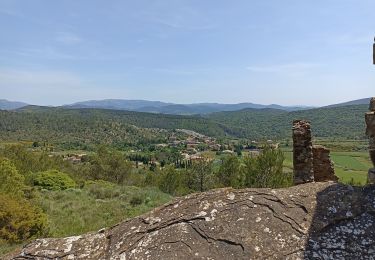
Depuis Durban, Mont Marquié, La Berrière, Pech Bedel, Les Cremades, puis chemin cathare vers Ste Raphine (376m) et retour Durban par le chemin Cathare.
Plaatsbepaling
Land:
France
Regio :
Occitanië
Departement/Provincie :
Aude
Gemeente :
Durban-Corbières
Locatie:
Unknown
Vertrek:(Dec)
Vertrek:(UTM)
485073 ; 4760427 (31T) N.
Opmerkingen
Wandeltochten in de omgeving
La Récaoufa ou Ste Raphine


Stappen
Medium
(1)
Villeneuve-les-Corbières,
Occitanië,
Aude,
France

19 km | 27 km-effort
5h 37min
Ja
La Source de la Berre - Cascastel des Corbières


Stappen
Medium
(1)
Cascastel-des-Corbières,
Occitanië,
Aude,
France

16 km | 21 km-effort
4h 30min
Ja
Cathare 2 de Durban à Tuchan


Ezelwandeling
Medium
Durban-Corbières,
Occitanië,
Aude,
France

28 km | 39 km-effort
6h 50min
Neen
M020-Durban Corbières


Stappen
Medium
Durban-Corbières,
Occitanië,
Aude,
France

19,7 km | 28 km-effort
5h 50min
Ja
M014-Durban Corbières


Stappen
Medium
Durban-Corbières,
Occitanië,
Aude,
France

13,4 km | 18,1 km-effort
3h 48min
Ja
29-01


Stappen
Zeer moeilijk
Cascastel-des-Corbières,
Occitanië,
Aude,
France

16,7 km | 23 km-effort
4h 3min
Ja
Villeneuve des corbières


Stappen
Medium
Villeneuve-les-Corbières,
Occitanië,
Aude,
France

19,9 km | 29 km-effort
5h 28min
Ja
M014-Durban Corbières


Stappen
Medium
Durban-Corbières,
Occitanië,
Aude,
France

13,4 km | 18,1 km-effort
3h 48min
Ja
durban1 2022


Elektrische fiets
Moeilijk
Durban-Corbières,
Occitanië,
Aude,
France

40 km | 51 km-effort
6h 29min
Ja


 SityTrail


Très beau parcours mais dommage que le sentier soit presque complètement obstrué par endroit entre le km 3 et le km 4 mais on peut l'éviter en prenant la piste par la cote 185 puis 280 et 282, il en est de même au Km 5 où nous n'avons pas trouvé le chemin sur la droite, nous avons alors rejoint le km 6 en passant par montaut, très joli sentier également