![](/images/other/stat-length.png)
![Tocht Stappen Sixt-Fer-à-Cheval - YHH144 Le Lignon - Brèche du Dérochoir - Photo](https://media.geolcdn.com/t/1900/400/ext.pjpeg?maxdim=2&url=https%3A%2F%2Fstatic1.geolcdn.com%2Fsiteimages%2Fupload%2Ffiles%2F1553511878bg_sport_marche.png)
YHH144 Le Lignon - Brèche du Dérochoir
yveshumbert
Gebruiker
![Lengte](/images/other/stat-length.png)
![Max. hoogte](https://static1.geolcdn.com/siteimages/upload/files/1508320355ic_sort_altitude_max_24dp.png)
![Positief hoogteverschil](https://static1.geolcdn.com/siteimages/upload/files/1508320355ic_sort_den_pos_24dp.png)
![Km-Effort](/images/other/stat-length.png)
![Min. hoogte](https://static1.geolcdn.com/siteimages/upload/files/1508320355ic_sort_altitude_min_24dp.png)
![Negatief hoogteverschil](https://static1.geolcdn.com/siteimages/upload/files/1508320355ic_sort_den_neg_24dp.png)
![Boucle](https://static1.geolcdn.com/siteimages/upload/files/16400158638029165_repeat_loop_refresh_sync_direction_icon.png)
![Stappen](https://static1.geolcdn.com/sitytour/trail-icons/101.png)
3h58
Moeilijkheid : Moeilijk
![Scan deze QR-code om de tocht te openen in de SityTrail-applicatie](https://capi.geolives.com/qq0zvz2zws4bq2lad0pu/sitytour/trails/222236/qr.png?size=200)
Gratisgps-wandelapplicatie
Over ons
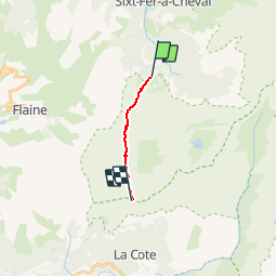
Tocht Stappen van 7,4 km beschikbaar op Auvergne-Rhône-Alpes, Haute-Savoie, Sixt-Fer-à-Cheval. Deze tocht wordt voorgesteld door yveshumbert.
Beschrijving
Rando d' une journée en boucle au Départ du parking Le Lignon.
Une première montée avec quelques cascades vous amménera jusqu' aux chalets de Sales, où vous pourrez vous restaurer. Puis le chemin est assez plat pouir un moment avant de recommencer à monter pour vous rendre à la Brèche du Dérochoir
Plaatsbepaling
Opmerkingen
Wandeltochten in de omgeving
![Tocht Stappen Sixt-Fer-à-Cheval - Lac d'Anterne - Photo](https://media.geolcdn.com/t/375/260/ext.jpg?maxdim=2&url=https%3A%2F%2Fservices.sitytrail.com%2FGeolivesWS%2FDownloadMedia.ashx%3FTrailID%3D219373%26Media%3Dfix__20130905155735.jpg)
![Stappen Stappen](https://static1.geolcdn.com/sitytour/trail-icons/101.png)
Stappen
![](/images/other/stat-length.png)
![](https://static1.geolcdn.com/siteimages/upload/files/16400158638029165_repeat_loop_refresh_sync_direction_icon.png)
![Tocht Stappen Samoëns - Lac de Gers - Photo](https://media.geolcdn.com/t/375/260/4f8c7a90-c8a6-4a64-bc22-de3fbc680b52.jpg&format=jpg&maxdim=2)
![Stappen Stappen](https://static1.geolcdn.com/sitytour/trail-icons/101.png)
Stappen
![](/images/other/stat-length.png)
![](https://static1.geolcdn.com/siteimages/upload/files/16400158638029165_repeat_loop_refresh_sync_direction_icon.png)
![Tocht Stappen Sixt-Fer-à-Cheval - Gorges des Tines - Gers - Samoens - Photo](https://media.geolcdn.com/t/375/260/62d4f53d-e161-4e86-b37e-5afda26819a6.jpg&format=jpg&maxdim=2)
![Stappen Stappen](https://static1.geolcdn.com/sitytour/trail-icons/101.png)
Stappen
![](/images/other/stat-length.png)
![](https://static1.geolcdn.com/siteimages/upload/files/16400158638029165_repeat_loop_refresh_sync_direction_icon.png)
![Tocht Stappen Sixt-Fer-à-Cheval - 2020-08-15 Marche Refuge Grenairon Le Mont Buet Les Fonts Salvagny - Photo](https://media.geolcdn.com/t/375/260/e7db8eb5-0ce5-4100-b4bb-95b4993ccdfd.jpg&format=jpg&maxdim=2)
![Stappen Stappen](https://static1.geolcdn.com/sitytour/trail-icons/101.png)
Stappen
![](/images/other/stat-length.png)
![](https://static1.geolcdn.com/siteimages/upload/files/16400158638029165_repeat_loop_refresh_sync_direction_icon.png)
![Tocht Stappen Sixt-Fer-à-Cheval - Le tour des Fiz : J3 - Photo](https://media.geolcdn.com/t/375/260/9c7228c0-b1d1-422d-97b7-6cc678ab62a3.jpg&format=jpg&maxdim=2)
![Stappen Stappen](https://static1.geolcdn.com/sitytour/trail-icons/101.png)
Stappen
![](/images/other/stat-length.png)
![](https://static1.geolcdn.com/siteimages/upload/files/16400158638029165_repeat_loop_refresh_sync_direction_icon.png)
![Tocht Stappen Passy - Le tour des Fiz : J2 - Photo](https://media.geolcdn.com/t/375/260/939b6d9f-8ec5-49fa-ac5f-683b426f45bd.jpg&format=jpg&maxdim=2)
![Stappen Stappen](https://static1.geolcdn.com/sitytour/trail-icons/101.png)
Stappen
![](/images/other/stat-length.png)
![](https://static1.geolcdn.com/siteimages/upload/files/16400158638029165_repeat_loop_refresh_sync_direction_icon.png)
![Tocht Stappen Sixt-Fer-à-Cheval - J9GR5Nord - Photo](https://media.geolcdn.com/t/375/260/425bb134-0523-4921-89e1-6ba98a367abc.jpg&format=jpg&maxdim=2)
![Stappen Stappen](https://static1.geolcdn.com/sitytour/trail-icons/101.png)
Stappen
![](/images/other/stat-length.png)
![](https://static1.geolcdn.com/siteimages/upload/files/16400158638029165_repeat_loop_refresh_sync_direction_icon.png)
![Tocht Stappen Sixt-Fer-à-Cheval - SIXT PASSY RESERVE: CHALETS DE SALES 2 - Photo](https://media.geolcdn.com/t/375/260/8dd95f56-4f3c-4299-950f-2399bed8a605.jpg&format=jpg&maxdim=2)
![Stappen Stappen](https://static1.geolcdn.com/sitytour/trail-icons/101.png)
Stappen
![](/images/other/stat-length.png)
![](https://static1.geolcdn.com/siteimages/upload/files/16400158638029165_repeat_loop_refresh_sync_direction_icon.png)
![Tocht Stappen Sixt-Fer-à-Cheval - SIXT PASSY RESERVE: LE BUET MONTEE VIA GRENAIRON - RETOUR PAR LES FONDS - Photo](https://media.geolcdn.com/t/375/260/37ee0cc7-a301-4565-b950-3c9eefd63255.jpg&format=jpg&maxdim=2)
![Stappen Stappen](https://static1.geolcdn.com/sitytour/trail-icons/101.png)
Stappen
![](/images/other/stat-length.png)
![](https://static1.geolcdn.com/siteimages/upload/files/16400158638029165_repeat_loop_refresh_sync_direction_icon.png)