![](/images/other/stat-length.png)
![Tocht Te voet Soccia - Lac de CRENA et Chapelle St Eliseo - Photo](https://media.geolcdn.com/t/1900/400/eb8f6c32-2d15-454a-82a0-f0390d86d1f8.jpg&format=pjpeg&maxdim=2)
Lac de CRENA et Chapelle St Eliseo
cathymac20
Gebruiker
![Lengte](/images/other/stat-length.png)
![Max. hoogte](https://static1.geolcdn.com/siteimages/upload/files/1508320355ic_sort_altitude_max_24dp.png)
![Positief hoogteverschil](https://static1.geolcdn.com/siteimages/upload/files/1508320355ic_sort_den_pos_24dp.png)
![Km-Effort](/images/other/stat-length.png)
![Min. hoogte](https://static1.geolcdn.com/siteimages/upload/files/1508320355ic_sort_altitude_min_24dp.png)
![Negatief hoogteverschil](https://static1.geolcdn.com/siteimages/upload/files/1508320355ic_sort_den_neg_24dp.png)
![Boucle](https://static1.geolcdn.com/siteimages/upload/files/16400158638029165_repeat_loop_refresh_sync_direction_icon.png)
![Te voet](https://static1.geolcdn.com/sitytour/trail-icons/100.png)
--
Moeilijkheid : Gemakkelijk
![Scan deze QR-code om de tocht te openen in de SityTrail-applicatie](https://capi.geolives.com/qq0zvz2zws4bq2lad0pu/sitytour/trails/2208625/qr.png?size=200)
Gratisgps-wandelapplicatie
Over ons
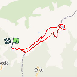
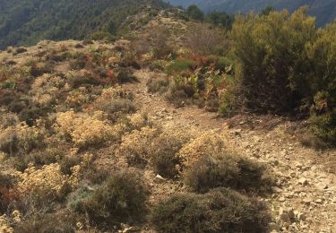
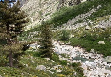
Tocht Te voet van 8,1 km beschikbaar op Corsica, Corse-du-Sud, Soccia. Deze tocht wordt voorgesteld door cathymac20.
Beschrijving
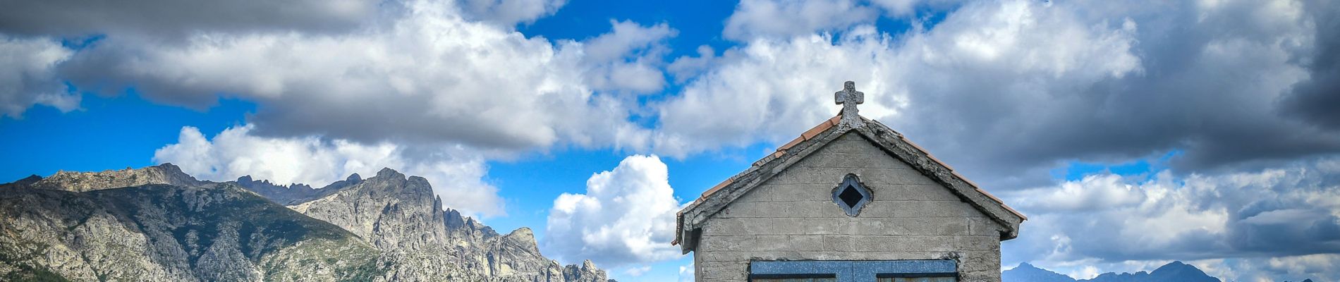
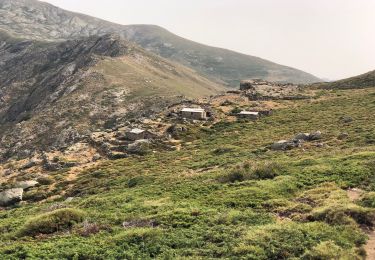
Pour compliquer et rallonger le lac de Crena je vous conseille le détour vers la chapelle st Eliseo qui est magnifique, une belle grimpette, mais ça vaut le coup, on peut également redescendre par le Zoico en prenant la direction du refuge de Manganu et bifurquer à gauche avant la passerelle, cela fait faire une boucle beaucoup plus intéressante je pense pour une journée plus longue...
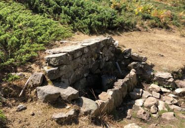
Le tracé a été fait manuellement sur le site, ce jour là Sity trail avait prévenu qu ils avaient un souci, le tracé était fou! lol la montée vers la chapelle n est pas le parcours exact mais le départ se fait derrière la maison du gardien du Lac et le chemin est bien cairné, pour le reste le chemin est bien indiqué sur l ign.... :)
Plaatsbepaling
Opmerkingen
Wandeltochten in de omgeving
![Tocht Stappen Soccia - lac de creno - Photo](https://media.geolcdn.com/t/375/260/ext.jpg?maxdim=2&url=https%3A%2F%2Fstatic1.geolcdn.com%2Fsiteimages%2Fupload%2Ffiles%2F1553511878bg_sport_marche.png)
![Stappen Stappen](https://static1.geolcdn.com/sitytour/trail-icons/101.png)
Stappen
![](/images/other/stat-length.png)
![](https://static1.geolcdn.com/siteimages/upload/files/16400158638029165_repeat_loop_refresh_sync_direction_icon.png)
![Tocht Stappen Soccia - Lac de Creno - Photo](https://media.geolcdn.com/t/375/260/ext.jpg?maxdim=2&url=https%3A%2F%2Fstatic1.geolcdn.com%2Fsiteimages%2Fupload%2Ffiles%2F1553511878bg_sport_marche.png)
![Stappen Stappen](https://static1.geolcdn.com/sitytour/trail-icons/101.png)
Stappen
![](/images/other/stat-length.png)
![](https://static1.geolcdn.com/siteimages/upload/files/16400158638029165_repeat_loop_refresh_sync_direction_icon.png)
![Tocht Stappen Soccia - Lac de Creno depuis Soccia - Photo](https://media.geolcdn.com/t/375/260/d33ee31a-2418-4668-9b10-fc06e03e2f9b.jpg&format=jpg&maxdim=2)
![Stappen Stappen](https://static1.geolcdn.com/sitytour/trail-icons/101.png)
Stappen
![](/images/other/stat-length.png)
![](https://static1.geolcdn.com/siteimages/upload/files/16400158638029165_repeat_loop_refresh_sync_direction_icon.png)
![Tocht Stappen Soccia - Lac de Goria - Photo](https://media.geolcdn.com/t/375/260/6c4d20a7-4a11-40fc-ab38-4d19571b2772.jpg&format=jpg&maxdim=2)
![Stappen Stappen](https://static1.geolcdn.com/sitytour/trail-icons/101.png)
Stappen
![](/images/other/stat-length.png)
![](https://static1.geolcdn.com/siteimages/upload/files/16400158638029165_repeat_loop_refresh_sync_direction_icon.png)
![Tocht Stappen Soccia - Soccia lac de creno monte santelisea - Photo](https://media.geolcdn.com/t/375/260/e96f9911-d811-4b64-89ac-acc7b371493a.jpg&format=jpg&maxdim=2)
![Stappen Stappen](https://static1.geolcdn.com/sitytour/trail-icons/101.png)
Stappen
![](/images/other/stat-length.png)
![](https://static1.geolcdn.com/siteimages/upload/files/16400158638029165_repeat_loop_refresh_sync_direction_icon.png)
![Tocht Stappen Poggiolo - Monte Ciarbellu - Photo](https://media.geolcdn.com/t/375/260/c06ffb1c-0d80-4711-8d2f-967568f3cb90.jpg&format=jpg&maxdim=2)
![Stappen Stappen](https://static1.geolcdn.com/sitytour/trail-icons/101.png)
Stappen
![](/images/other/stat-length.png)
![](https://static1.geolcdn.com/siteimages/upload/files/16400158638029165_repeat_loop_refresh_sync_direction_icon.png)
![Tocht Stappen Soccia - À Cimatella - Photo](https://media.geolcdn.com/t/375/260/9ed08440-b00c-4ec3-af46-a86f83e8c4f3.jpg&format=jpg&maxdim=2)
![Stappen Stappen](https://static1.geolcdn.com/sitytour/trail-icons/101.png)
Stappen
![](/images/other/stat-length.png)
![](https://static1.geolcdn.com/siteimages/upload/files/16400158638029165_repeat_loop_refresh_sync_direction_icon.png)
![Tocht Stappen Soccia - LAC DE CRENO - Photo](https://media.geolcdn.com/t/375/260/baa822e7-7544-4373-a928-bf8342301d52.jpg&format=jpg&maxdim=2)
![Stappen Stappen](https://static1.geolcdn.com/sitytour/trail-icons/101.png)
Stappen
![](/images/other/stat-length.png)
![](https://static1.geolcdn.com/siteimages/upload/files/16400158638029165_repeat_loop_refresh_sync_direction_icon.png)
![Tocht Stappen Corte - GR20 bergerie de Vaccaghja - Grotelles - Photo](https://media.geolcdn.com/t/375/260/e38dc38f-04d2-41e4-9b96-5e2a48d123af.jpg&format=jpg&maxdim=2)
![Stappen Stappen](https://static1.geolcdn.com/sitytour/trail-icons/101.png)
Stappen
![](/images/other/stat-length.png)
![](https://static1.geolcdn.com/siteimages/upload/files/16400158638029165_repeat_loop_refresh_sync_direction_icon.png)
Magnifiques photos, bravo et merci !