


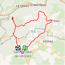

10,1 km | 18,8 km-effort


Gebruiker


Gratisgps-wandelapplicatie
 SityTrail
IGN / Geografische instituten
SityTrail World
De wereld gaat voor u open
Tocht Stappen van 19,2 km beschikbaar op Occitanië, Aveyron, Saint-André-de-Vézines. Deze tocht wordt voorgesteld door pipette12.
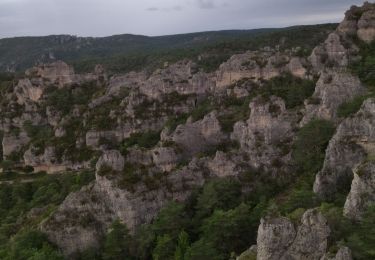
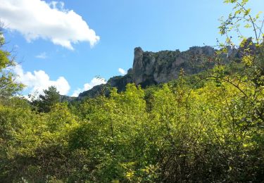
C'EST DES TRÉS JOLI COIN POUR EFFECTUER DES RANDONNÉES

Stappen

Stappen
Stappen

Stappen

Stappen
Stappen

Stappen
Stappen
Stappen