![](/images/other/stat-length.png)
![Tocht Stappen Onbekend - 2015-01-03 13:00:50 - Photo](https://media.geolcdn.com/t/1900/400/ext.pjpeg?maxdim=2&url=https%3A%2F%2Fstatic1.geolcdn.com%2Fsiteimages%2Fupload%2Ffiles%2F1553511878bg_sport_marche.png)
2015-01-03 13:00:50
Alizée.pee
Gebruiker GUIDE
![Lengte](/images/other/stat-length.png)
![Max. hoogte](https://static1.geolcdn.com/siteimages/upload/files/1508320355ic_sort_altitude_max_24dp.png)
![Positief hoogteverschil](https://static1.geolcdn.com/siteimages/upload/files/1508320355ic_sort_den_pos_24dp.png)
![Km-Effort](/images/other/stat-length.png)
![Min. hoogte](https://static1.geolcdn.com/siteimages/upload/files/1508320355ic_sort_altitude_min_24dp.png)
![Negatief hoogteverschil](https://static1.geolcdn.com/siteimages/upload/files/1508320355ic_sort_den_neg_24dp.png)
![Boucle](https://static1.geolcdn.com/siteimages/upload/files/16400158638029165_repeat_loop_refresh_sync_direction_icon.png)
![Stappen](https://static1.geolcdn.com/sitytour/trail-icons/101.png)
5h30
Moeilijkheid : Medium
![Scan deze QR-code om de tocht te openen in de SityTrail-applicatie](https://capi.geolives.com/qq0zvz2zws4bq2lad0pu/sitytour/trails/2191373/qr.png?size=200)
Gratisgps-wandelapplicatie
Over ons
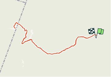
Tocht Stappen van 12 km beschikbaar op Vermont, Washington County, Onbekend. Deze tocht wordt voorgesteld door Alizée.pee.
Beschrijving
Le Mont Camel’s Hump est la troisième montagne la plus haute du Vermont et offre une vue exceptionnelle sur les alentours. Du sommet, il vous sera possible d’observer le magnifique Lac Champlain, ainsi que de distinguer divers autres sommets. Pour rejoindre celui-ci, de nombreux sentiers existent. Cette randonnée suit la boucle de l’Est, qui est selon plusieurs, le plus beau sentier qu’offre cette montagne. Malgré la longueur de cette randonnée, elle n’est pas si compliquée que cela. En tout cas, les paysages sont de la partie !
Plaatsbepaling
Opmerkingen
Wandeltochten in de omgeving
![Tocht Stappen Onbekend - 11-NOV-12 - Photo](https://media.geolcdn.com/t/375/260/ext.jpg?maxdim=2&url=https%3A%2F%2Fstatic1.geolcdn.com%2Fsiteimages%2Fupload%2Ffiles%2F1553511878bg_sport_marche.png)
![Stappen Stappen](https://static1.geolcdn.com/sitytour/trail-icons/101.png)
Stappen
![](/images/other/stat-length.png)
![](https://static1.geolcdn.com/siteimages/upload/files/16400158638029165_repeat_loop_refresh_sync_direction_icon.png)
![Tocht Stappen Onbekend - ACTIVE LOG095154 - Photo](https://media.geolcdn.com/t/375/260/ext.jpg?maxdim=2&url=https%3A%2F%2Fstatic1.geolcdn.com%2Fsiteimages%2Fupload%2Ffiles%2F1553511878bg_sport_marche.png)
![Stappen Stappen](https://static1.geolcdn.com/sitytour/trail-icons/101.png)
Stappen
![](/images/other/stat-length.png)
![](https://static1.geolcdn.com/siteimages/upload/files/16400158638029165_repeat_loop_refresh_sync_direction_icon.png)
Merci pour ce partage !