Tocht Mountainbike Azay-sur-Cher - azay-cher-montrichard et retour - Photo

azay-cher-montrichard et retour

 dporcher
dporcher

Gebruiker

© OpenStreetMap contributors
Lengte
Lengte
56 km
Max. hoogte
Max. hoogte
77 m
Positief hoogteverschil
393 m
Km-Effort
Km-Effort  
61 km
Min. hoogte
Min. hoogte
47 m
Negatief hoogteverschil
392 m
Boucle
Boucle
Ja
Datum van aanmaak :
2014-12-10 00:00:00.0
Laatste wijziging :
2014-12-10 00:00:00.0

(0 Bericht)

Mountainbike
Mountainbike
3h23
Moeilijkheid : Heel gemakkelijk

Scan deze QR-code om de tocht te openen in de SityTrail-applicatie

Gratisgps-wandelapplicatie

Logo SityTrail SityTrail

IGN / Geografische instituten

SityTrail uit de App Store downloaden SityTrail uit Google Play downloaden

Logo SityTrail SityTrail World

De wereld gaat voor u open

SityTrail uit de App Store downloaden SityTrail uit Google Play downloaden SityTrail op Huawei AppGallery downloaden

Over ons

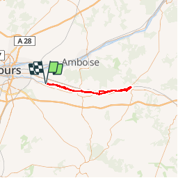
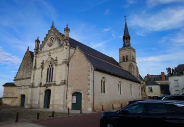
Tocht Mountainbike van 56 km beschikbaar op Centre-Val de Loire, Indre-et-Loire, Azay-sur-Cher. Deze tocht wordt voorgesteld door dporcher.

Beschrijving

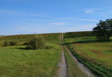
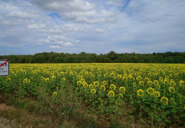
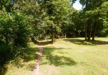
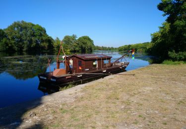
Plat sur chemins roulants. A faire de préférence hors période touristique pour qui vous voulez éviter la foule aux abords de Chenonceaux.  Un passage sympathique de 2km peu après Bléré, un autre avant Chenonceaux.

Hoogteprofiel

Foto's

Plaatsbepaling

Land:
France
Regio :
Centre-Val de Loire
Departement/Provincie :
Indre-et-Loire
Gemeente :
Azay-sur-Cher
Locatie:
Unknown
Vertrek:(Dec)
Vertrek:(UTM)
337599 ; 5246462 (31T) N.

Wandeltochten in de omgeving

Tocht Stappen Véretz - Véretz - PR Sentier de Bacchus - 14.9km 90m 3h00 - 2023 11 25 - Photo
Stappen
GUIDE
Orcal37

Stappen

Gemakkelijk
Véretz, Centre-Val de Loire, Indre-et-Loire, France
14,9 km | 16,1 km-effort
3h 0min
Ja
Tocht Stappen Montlouis-sur-Loire - Montlouis-sur-Loire - gare GR41 Veretz Azay-sur-Cher - 13km 85m 2h45 - 2023 10 07 - Photo
Stappen
GUIDE
Orcal37

Stappen

Gemakkelijk
Montlouis-sur-Loire, Centre-Val de Loire, Indre-et-Loire, France
13 km | 14,2 km-effort
2h 45min
Ja
Tocht Stappen Saint-Martin-le-Beau - Saint-Martin-le-Beau - PR Entre Vignes et Forêts - 11.8km 120m 2h45 (45mn) - 2023 10 07 - Photo
Stappen
GUIDE
Orcal37

Stappen

Medium
Saint-Martin-le-Beau, Centre-Val de Loire, Indre-et-Loire, France
11,8 km | 13,4 km-effort
2h 45min
Ja
Tocht Stappen Saint-Martin-le-Beau - Saint-Martin-le-Beau - Nitray GR41 Azay-sur-Cher - 23.2km 185m 5h15 (40mn) - 2023 10 04 - Photo
Stappen
GUIDE
Orcal37

Stappen

Gemakkelijk
Saint-Martin-le-Beau, Centre-Val de Loire, Indre-et-Loire, France
23 km | 26 km-effort
5h 15min
Ja
Tocht Stappen Azay-sur-Cher - Azay-sur-Cher - le Grais - 13.1km 100m 2h55 - 2023 07 12 - Photo
Stappen
GUIDE
Orcal37

Stappen

Gemakkelijk
Azay-sur-Cher, Centre-Val de Loire, Indre-et-Loire, France
13,1 km | 14,5 km-effort
2h 55min
Ja
Tocht Stappen Montlouis-sur-Loire - Montlouis-sur-Loire - PR Sur les pas de Gabrielle d'Estrées - 9.5km 100m 2h20 - 2023 07 08 - Photo
Stappen
GUIDE
Orcal37

Stappen

Gemakkelijk
Montlouis-sur-Loire, Centre-Val de Loire, Indre-et-Loire, France
9,5 km | 10,9 km-effort
2h 20min
Ja
Tocht Fietstoerisme Montlouis-sur-Loire - De Montlouis sur Loire à Villandry  - Photo
Fietstoerisme
GUIDE
nadd73

Fietstoerisme

Medium
Montlouis-sur-Loire, Centre-Val de Loire, Indre-et-Loire, France
78 km | 85 km-effort
5h 18min
Neen
Tocht Stappen Montlouis-sur-Loire - Montlouis-sur-Loire - Entre Loire et vignes GR3 GR655est - 17.4km 190m 3h55 - 2022 10 16 - Photo
Stappen
GUIDE
Orcal37

Stappen

Gemakkelijk
Montlouis-sur-Loire, Centre-Val de Loire, Indre-et-Loire, France
17,4 km | 19,9 km-effort
3h 55min
Ja
Tocht Stappen Athée-sur-Cher - Athée-sur-Cher - Port Chandon - 18km 140m 4h05 - 2022 07 24 - Photo
Stappen
GUIDE
Orcal37

Stappen

Gemakkelijk
Athée-sur-Cher, Centre-Val de Loire, Indre-et-Loire, France
18 km | 19,8 km-effort
4h 5min
Ja


Sluiten
Mijn abonnementen