![](/images/other/stat-length.png)
![Tocht Stappen Larrau - SityTrail - Pic d,' Orhy en boucle - Photo](https://media.geolcdn.com/t/1900/400/ext.pjpeg?maxdim=2&url=https%3A%2F%2Fstatic1.geolcdn.com%2Fsiteimages%2Fupload%2Ffiles%2F1553511878bg_sport_marche.png)
SityTrail - Pic d,' Orhy en boucle
benat40
Gebruiker
![Lengte](/images/other/stat-length.png)
Lengte
6,1 km
![Max. hoogte](https://static1.geolcdn.com/siteimages/upload/files/1508320355ic_sort_altitude_max_24dp.png)
Max. hoogte
2011 m
![Positief hoogteverschil](https://static1.geolcdn.com/siteimages/upload/files/1508320355ic_sort_den_pos_24dp.png)
Positief hoogteverschil
662 m
![Km-Effort](/images/other/stat-length.png)
Km-Effort
14,9 km
![Min. hoogte](https://static1.geolcdn.com/siteimages/upload/files/1508320355ic_sort_altitude_min_24dp.png)
Min. hoogte
1356 m
![Negatief hoogteverschil](https://static1.geolcdn.com/siteimages/upload/files/1508320355ic_sort_den_neg_24dp.png)
Negatief hoogteverschil
661 m
![Boucle](https://static1.geolcdn.com/siteimages/upload/files/16400158638029165_repeat_loop_refresh_sync_direction_icon.png)
Boucle
Ja
Datum van aanmaak :
2019-08-25 08:23:10.282
Laatste wijziging :
2019-08-25 10:13:13.528
![Stappen](https://static1.geolcdn.com/sitytour/trail-icons/101.png)
2h53
Moeilijkheid : Moeilijk
![Scan deze QR-code om de tocht te openen in de SityTrail-applicatie](https://capi.geolives.com/qq0zvz2zws4bq2lad0pu/sitytour/trails/2182113/qr.png?size=200)
Gratisgps-wandelapplicatie
Over ons
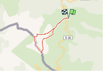
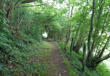
Tocht Stappen van 6,1 km beschikbaar op Nieuw-Aquitanië, Pyrénées-Atlantiques, Larrau. Deze tocht wordt voorgesteld door benat40.
Beschrijving
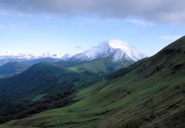
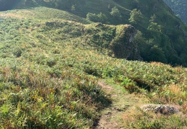
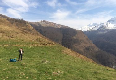
Randonnée très agréable avec une mise en jambes rapide et pentue. Très belle vue au sommet du pic surtout par beau temps.
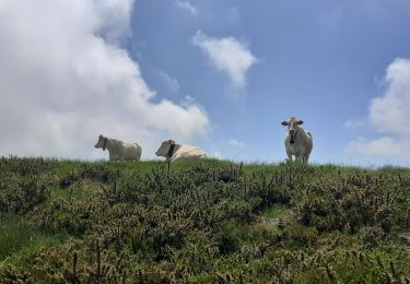
La deuxième partie à partir des crêtes s'est effectuée sur un chemin crée par les moutons et recèle quelques passages délicats
Plaatsbepaling
Land:
France
Regio :
Nieuw-Aquitanië
Departement/Provincie :
Pyrénées-Atlantiques
Gemeente :
Larrau
Locatie:
Unknown
Vertrek:(Dec)
Vertrek:(UTM)
664201 ; 4762504 (30T) N.
Opmerkingen
Wandeltochten in de omgeving
![Tocht Stappen Larrau - Gorges d'Olhadubi et passerelle d'Holzarté - Photo](https://media.geolcdn.com/t/375/260/ext.jpg?maxdim=2&url=https%3A%2F%2Fservices.sitytrail.com%2FGeolivesWS%2FDownloadMedia.ashx%3FTrailID%3D102557%26Media%3D3440_2.jpg)
![Stappen Stappen](https://static1.geolcdn.com/sitytour/trail-icons/101.png)
Gorges d'Olhadubi et passerelle d'Holzarté
Stappen
Moeilijk
(3)
Larrau,
Nieuw-Aquitanië,
Pyrénées-Atlantiques,
France
![](/images/other/stat-length.png)
12 km | 21 km-effort
4h 0min
![](https://static1.geolcdn.com/siteimages/upload/files/16400158638029165_repeat_loop_refresh_sync_direction_icon.png)
Ja
![Tocht Stappen Larrau - IRATY le pic des escaliers sans monter au pic 408M+ 2948308 - Photo](https://media.geolcdn.com/t/375/260/1725c3fb-51a3-4e7e-9d48-19cb60baeea0.jpg&format=jpg&maxdim=2)
![Stappen Stappen](https://static1.geolcdn.com/sitytour/trail-icons/101.png)
IRATY le pic des escaliers sans monter au pic 408M+ 2948308
Stappen
Moeilijk
Larrau,
Nieuw-Aquitanië,
Pyrénées-Atlantiques,
France
![](/images/other/stat-length.png)
7,9 km | 13,4 km-effort
3h 2min
![](https://static1.geolcdn.com/siteimages/upload/files/16400158638029165_repeat_loop_refresh_sync_direction_icon.png)
Ja
![Tocht Stappen Larrau - Holzarte/Oladubi - Photo](https://media.geolcdn.com/t/375/260/ext.jpg?maxdim=2&url=https%3A%2F%2Fstatic1.geolcdn.com%2Fsiteimages%2Fupload%2Ffiles%2F1553511878bg_sport_marche.png)
![Stappen Stappen](https://static1.geolcdn.com/sitytour/trail-icons/101.png)
Holzarte/Oladubi
Stappen
Medium
(3)
Larrau,
Nieuw-Aquitanië,
Pyrénées-Atlantiques,
France
![](/images/other/stat-length.png)
14 km | 24 km-effort
5h 28min
![](https://static1.geolcdn.com/siteimages/upload/files/16400158638029165_repeat_loop_refresh_sync_direction_icon.png)
Ja
![Tocht Stappen Larrau - Le Pic d'Orhy par le Port de Larrau - Photo](https://media.geolcdn.com/t/375/260/ext.jpg?maxdim=2&url=https%3A%2F%2Fservices.sitytrail.com%2FGeolivesWS%2FDownloadMedia.ashx%3FTrailID%3D112249%26Media%3D10194_1.jpg)
![Stappen Stappen](https://static1.geolcdn.com/sitytour/trail-icons/101.png)
Le Pic d'Orhy par le Port de Larrau
Stappen
Moeilijk
(2)
Larrau,
Nieuw-Aquitanië,
Pyrénées-Atlantiques,
France
![](/images/other/stat-length.png)
2,3 km | 6,6 km-effort
2h 0min
![](https://static1.geolcdn.com/siteimages/upload/files/16400158638029165_repeat_loop_refresh_sync_direction_icon.png)
Neen
![Tocht Stappen Larrau - LARRAU Rebalisage Jaureguyberry](https://media.geolcdn.com/t/375/260/6831e79f-63c1-4c52-868e-338486f61218.jpg&format=jpg&maxdim=2)
![Stappen Stappen](https://static1.geolcdn.com/sitytour/trail-icons/101.png)
LARRAU Rebalisage Jaureguyberry "3732641"
Stappen
Moeilijk
Larrau,
Nieuw-Aquitanië,
Pyrénées-Atlantiques,
France
![](/images/other/stat-length.png)
9,3 km | 14,1 km-effort
3h 12min
![](https://static1.geolcdn.com/siteimages/upload/files/16400158638029165_repeat_loop_refresh_sync_direction_icon.png)
Ja
![Tocht Stappen Larrau - Iraty cabane ZINGOLATZE - Photo](https://media.geolcdn.com/t/375/260/44ee5c4f-fb20-4eee-9c16-d8a5e8350ada.jpg&format=jpg&maxdim=2)
![Stappen Stappen](https://static1.geolcdn.com/sitytour/trail-icons/101.png)
Iraty cabane ZINGOLATZE
Stappen
Heel gemakkelijk
Larrau,
Nieuw-Aquitanië,
Pyrénées-Atlantiques,
France
![](/images/other/stat-length.png)
6,8 km | 9,7 km-effort
3h 29min
![](https://static1.geolcdn.com/siteimages/upload/files/16400158638029165_repeat_loop_refresh_sync_direction_icon.png)
Ja
![Tocht Stappen Larrau - GR 10 - 10ème étape : Logibar - plateau d’Ardakhotchia - Sainte Engrâce - Photo](https://media.geolcdn.com/t/375/260/64b081df-84b5-4646-ab58-d6aa6b8cc8c7.jpg&format=jpg&maxdim=2)
![Stappen Stappen](https://static1.geolcdn.com/sitytour/trail-icons/101.png)
GR 10 - 10ème étape : Logibar - plateau d’Ardakhotchia - Sainte Engrâce
Stappen
Moeilijk
Larrau,
Nieuw-Aquitanië,
Pyrénées-Atlantiques,
France
![](/images/other/stat-length.png)
25 km | 42 km-effort
6h 8min
![](https://static1.geolcdn.com/siteimages/upload/files/16400158638029165_repeat_loop_refresh_sync_direction_icon.png)
Neen
![Tocht Stappen Larrau - le Pic des Escalier - Photo](https://media.geolcdn.com/t/375/260/25a58932-02ea-4249-a083-fd59fc4e847e.jpg&format=jpg&maxdim=2)
![Stappen Stappen](https://static1.geolcdn.com/sitytour/trail-icons/101.png)
le Pic des Escalier
Stappen
Medium
Larrau,
Nieuw-Aquitanië,
Pyrénées-Atlantiques,
France
![](/images/other/stat-length.png)
10,4 km | 16,7 km-effort
3h 8min
![](https://static1.geolcdn.com/siteimages/upload/files/16400158638029165_repeat_loop_refresh_sync_direction_icon.png)
Ja
![Tocht Stappen Larrau - Holzarte sans passerelle - Photo](https://media.geolcdn.com/t/375/260/a74e795e-179b-4cd5-bf53-10c5691fc8a6.jpg&format=jpg&maxdim=2)
![Stappen Stappen](https://static1.geolcdn.com/sitytour/trail-icons/101.png)
Holzarte sans passerelle
Stappen
Moeilijk
Larrau,
Nieuw-Aquitanië,
Pyrénées-Atlantiques,
France
![](/images/other/stat-length.png)
23 km | 34 km-effort
6h 26min
![](https://static1.geolcdn.com/siteimages/upload/files/16400158638029165_repeat_loop_refresh_sync_direction_icon.png)
Neen