![](/images/other/stat-length.png)
![Tocht Stappen La Haye - La Haye - Chemin n* 15 - La Verrerie. - Photo](https://media.geolcdn.com/t/1900/400/976b26bd-b1c8-4348-8eef-d5ae2afe0800.jpg&format=pjpeg&maxdim=2)
La Haye - Chemin n* 15 - La Verrerie.
MichelRando7656
Gebruiker
![Lengte](/images/other/stat-length.png)
Lengte
8,2 km
![Max. hoogte](https://static1.geolcdn.com/siteimages/upload/files/1508320355ic_sort_altitude_max_24dp.png)
Max. hoogte
182 m
![Positief hoogteverschil](https://static1.geolcdn.com/siteimages/upload/files/1508320355ic_sort_den_pos_24dp.png)
Positief hoogteverschil
106 m
![Km-Effort](/images/other/stat-length.png)
Km-Effort
9,6 km
![Min. hoogte](https://static1.geolcdn.com/siteimages/upload/files/1508320355ic_sort_altitude_min_24dp.png)
Min. hoogte
146 m
![Negatief hoogteverschil](https://static1.geolcdn.com/siteimages/upload/files/1508320355ic_sort_den_neg_24dp.png)
Negatief hoogteverschil
95 m
![Boucle](https://static1.geolcdn.com/siteimages/upload/files/16400158638029165_repeat_loop_refresh_sync_direction_icon.png)
Boucle
Neen
Datum van aanmaak :
2019-08-22 12:11:17.923
Laatste wijziging :
2019-08-22 15:06:10.292
![Stappen](https://static1.geolcdn.com/sitytour/trail-icons/101.png)
2h54
Moeilijkheid : Heel gemakkelijk
![Scan deze QR-code om de tocht te openen in de SityTrail-applicatie](https://capi.geolives.com/qq0zvz2zws4bq2lad0pu/sitytour/trails/2179409/qr.png?size=200)
Gratisgps-wandelapplicatie
Over ons
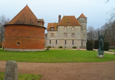
Tocht Stappen van 8,2 km beschikbaar op Normandië, Seine-Maritime, La Haye. Deze tocht wordt voorgesteld door MichelRando7656.
Beschrijving
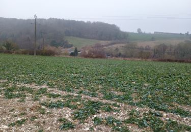
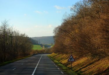
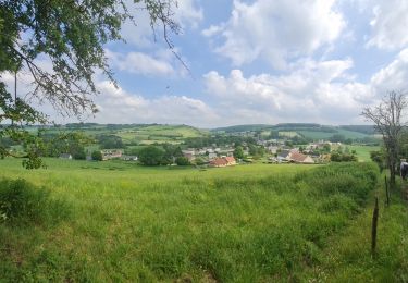
Chemins de campagne et forestiers superbes.
Attention ne pas faire les jours de chasse.
Pique-nique possible au point de départ.
Plaatsbepaling
Land:
France
Regio :
Normandië
Departement/Provincie :
Seine-Maritime
Gemeente :
La Haye
Locatie:
Unknown
Vertrek:(Dec)
Vertrek:(UTM)
387282 ; 5479921 (31U) N.
Opmerkingen
Wandeltochten in de omgeving
![Tocht Stappen La Haye - La Haye (76) - Les Landez (Le Tronquay) - Photo](https://media.geolcdn.com/t/375/260/ext.jpg?maxdim=2&url=https%3A%2F%2Fstatic1.geolcdn.com%2Fsiteimages%2Fupload%2Ffiles%2F1553511878bg_sport_marche.png)
![Stappen Stappen](https://static1.geolcdn.com/sitytour/trail-icons/101.png)
La Haye (76) - Les Landez (Le Tronquay)
Stappen
Heel gemakkelijk
(1)
La Haye,
Normandië,
Seine-Maritime,
France
![](/images/other/stat-length.png)
8,1 km | 10,4 km-effort
2h 15min
![](https://static1.geolcdn.com/siteimages/upload/files/16400158638029165_repeat_loop_refresh_sync_direction_icon.png)
Ja
![Tocht Stappen Nolléval - Nolléval - le Boulay - Photo](https://media.geolcdn.com/t/375/260/ext.jpg?maxdim=2&url=https%3A%2F%2Fstatic1.geolcdn.com%2Fsiteimages%2Fupload%2Ffiles%2F1553511878bg_sport_marche.png)
![Stappen Stappen](https://static1.geolcdn.com/sitytour/trail-icons/101.png)
Nolléval - le Boulay
Stappen
Medium
(2)
Nolléval,
Normandië,
Seine-Maritime,
France
![](/images/other/stat-length.png)
10,1 km | 14,1 km-effort
2h 56min
![](https://static1.geolcdn.com/siteimages/upload/files/16400158638029165_repeat_loop_refresh_sync_direction_icon.png)
Ja
![Tocht Stappen Le Héron - Rebets par l'Héronchelles - Photo](https://media.geolcdn.com/t/375/260/d3f3818d-0528-4506-9a5b-801bed775619.jpg&format=jpg&maxdim=2)
![Stappen Stappen](https://static1.geolcdn.com/sitytour/trail-icons/101.png)
Rebets par l'Héronchelles
Stappen
Moeilijk
Le Héron,
Normandië,
Seine-Maritime,
France
![](/images/other/stat-length.png)
11,2 km | 15,2 km-effort
3h 7min
![](https://static1.geolcdn.com/siteimages/upload/files/16400158638029165_repeat_loop_refresh_sync_direction_icon.png)
Ja
![Stappen Stappen](https://static1.geolcdn.com/sitytour/trail-icons/101.png)
20231207-Vascoeuil
Stappen
Medium
Vascœuil,
Normandië,
Eure,
France
![](/images/other/stat-length.png)
10,9 km | 14,1 km-effort
3h 6min
![](https://static1.geolcdn.com/siteimages/upload/files/16400158638029165_repeat_loop_refresh_sync_direction_icon.png)
Ja
![Stappen Stappen](https://static1.geolcdn.com/sitytour/trail-icons/101.png)
20220823-Elbeuf sur Andelle
Stappen
Medium
Elbeuf-sur-Andelle,
Normandië,
Seine-Maritime,
France
![](/images/other/stat-length.png)
12,6 km | 15,9 km-effort
3h 23min
![](https://static1.geolcdn.com/siteimages/upload/files/16400158638029165_repeat_loop_refresh_sync_direction_icon.png)
Ja
![Tocht Te voet La Feuillie - Les Orchidées - Photo](https://media.geolcdn.com/t/375/260/56ec95b6-9ea1-40dd-91ba-a3a4e9ec6cc7.jpeg&format=jpg&maxdim=2)
![Te voet Te voet](https://static1.geolcdn.com/sitytour/trail-icons/100.png)
Les Orchidées
Te voet
Gemakkelijk
La Feuillie,
Normandië,
Seine-Maritime,
France
![](/images/other/stat-length.png)
9,3 km | 11,1 km-effort
2h 31min
![](https://static1.geolcdn.com/siteimages/upload/files/16400158638029165_repeat_loop_refresh_sync_direction_icon.png)
Ja
![Tocht Stappen Nolléval - 20210603-Nolléval - Photo](https://media.geolcdn.com/t/375/260/629e1398-d0c9-446f-bcbe-1d9a731ba8d8.jpg&format=jpg&maxdim=2)
![Stappen Stappen](https://static1.geolcdn.com/sitytour/trail-icons/101.png)
20210603-Nolléval
Stappen
Medium
Nolléval,
Normandië,
Seine-Maritime,
France
![](/images/other/stat-length.png)
20 km | 26 km-effort
6h 2min
![](https://static1.geolcdn.com/siteimages/upload/files/16400158638029165_repeat_loop_refresh_sync_direction_icon.png)
Ja
![Stappen Stappen](https://static1.geolcdn.com/sitytour/trail-icons/101.png)
20200804-Vascoeuil
Stappen
Medium
Vascœuil,
Normandië,
Eure,
France
![](/images/other/stat-length.png)
13,9 km | 17,7 km-effort
3h 47min
![](https://static1.geolcdn.com/siteimages/upload/files/16400158638029165_repeat_loop_refresh_sync_direction_icon.png)
Ja
![Stappen Stappen](https://static1.geolcdn.com/sitytour/trail-icons/101.png)
20191022-Le Héron-Elbeuf sur Andelle
Stappen
Medium
Elbeuf-sur-Andelle,
Normandië,
Seine-Maritime,
France
![](/images/other/stat-length.png)
11,9 km | 15,1 km-effort
3h 13min
![](https://static1.geolcdn.com/siteimages/upload/files/16400158638029165_repeat_loop_refresh_sync_direction_icon.png)
Ja