


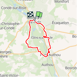

9,9 km | 11,7 km-effort


Gebruiker


Gratisgps-wandelapplicatie
 SityTrail
IGN / Geografische instituten
SityTrail World
De wereld gaat voor u open
Tocht Stappen van 21 km beschikbaar op Normandië, Eure, Montfort-sur-Risle. Deze tocht wordt voorgesteld door MichelRando7656.
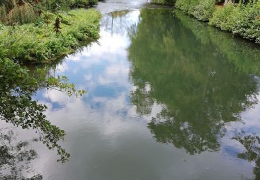
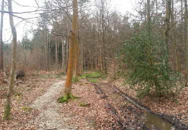
Beau parcours de 20 km. Nombreux sentiers forestiers et campagnards. Très peu de route. Bel endroit au bord de la Risle pour le pique-nique du midi.
Parking près la poste.


Stappen

Stappen
Stappen
Paardrijden
Paardrijden

Stappen
Stappen

Stappen
Stappen